MyTopo
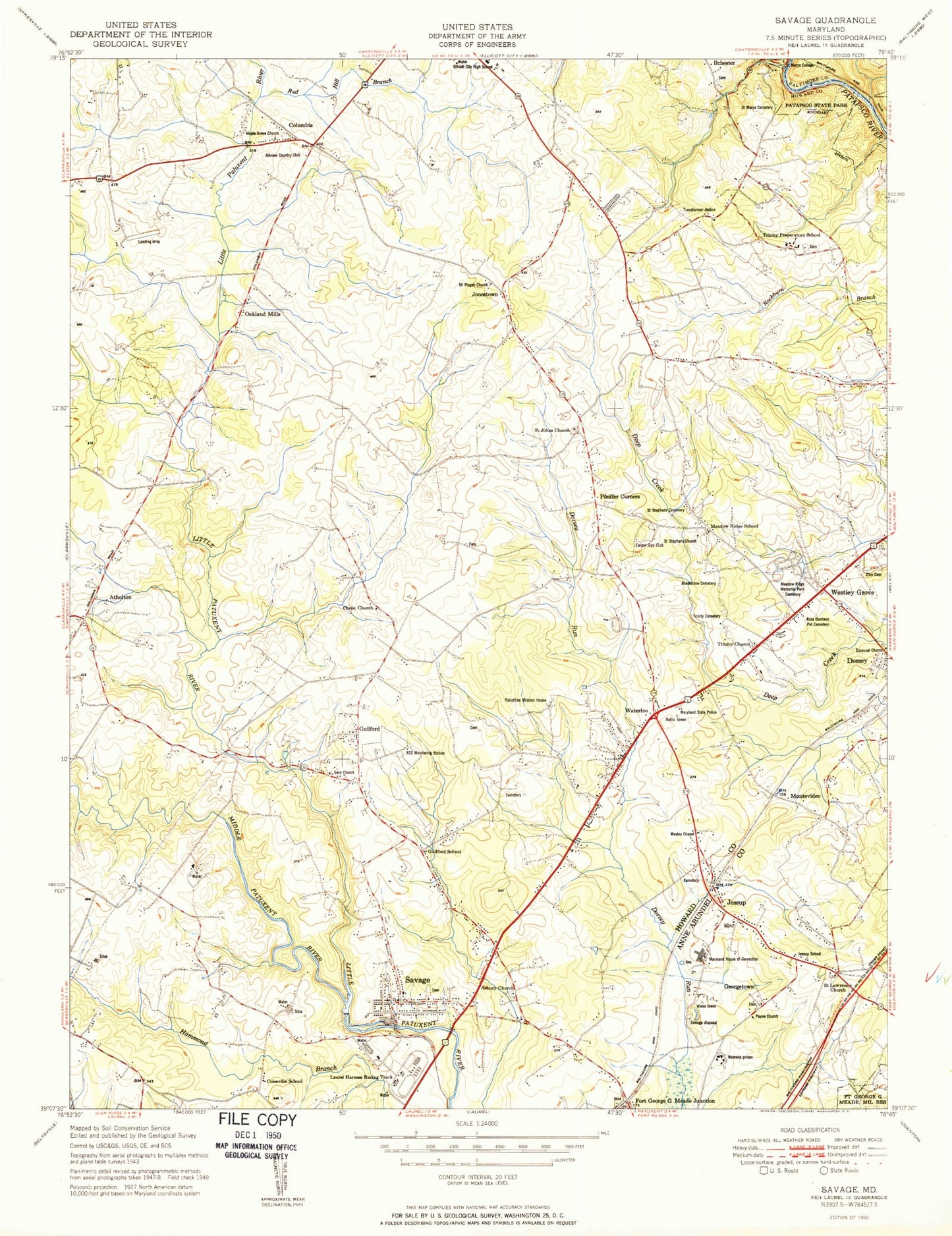
Classic USGS Savage Maryland 7.5'x7.5' Topo Map
Couldn't load pickup availability
Historical USGS topographic quad map of Savage in the state of Maryland. Typical map scale is 1:24,000, but may vary for certain years, if available. Print size: 24" x 27"
This quadrangle is in the following counties: Anne Arundel, Baltimore, Howard.
The map contains contour lines, roads, rivers, towns, and lakes. Printed on high-quality waterproof paper with UV fade-resistant inks, and shipped rolled.
Contains the following named places: Asbury United Methodist Church, Blackstone Cemetery, Cavey Cemetery, Cedar Knoll Elementary School, Christ Church, Dorsey - Owings - Waters Cemetery, Ellicott Mills Middle School, Gardner Cemetery, Glenmar United Methodist Church, Grace Cemetery, Guilford Road Church, Kings Apostle Church, Maple Grove Church, Meadow Ridge Memorial Park Cemetery, Meadow Ridge School, Middle Patuxent River, Montevideo, Old Guilford School, Patuxent Institution, Payne Church, Plumtree Branch, Red Hill Branch, Rosa Bonheur Pet Cemetery, Rose of Sharon Baptist Church, Saint Johns Evangelical Lutheran Cemetery, Saint Johns Church, Saint Mary's Cemetery, Saint Stephens Cemetery, Saint Stephens Methodist Church, Trinity Cemetery, Trinity Chapel Cemetery, Trinity School, Deep Run Elementary School, Wesley Chapel United Methodist Church, White Cemetery (historical), Zion Cemetery, Fort George G Mead Junction, Columbia, Georgetown, Guilford, Jessup, Jonestown, Oakland Mills, Pfeiffer Corners, Savage, Waterloo, Wesley Grove, Allview Golf Course, Laurel Harness Racing Track, Rocky Gorge Dam, Wilde Lake, General Electric Retention Pond, Lake Elkhorn Dam, Lake Elkhorn, Lake Kittamaqundi Dam, Bloede Dam, Patapsco River Reservoir, Aerospace Tech Center Heliport, Allview Country Club, Allview Estates, Annapolis Junction Post Office, Arrowhead, Atholton Elementary School, Atholton Park, Atholton Seventh Day Adventist Church, Atholton Shopping Center, Atholton Swim Club, Bryant Woods, Bryant Woods Elementary School, Cardinal Forest, Carriage Hills, Centennial Lake, Centennial Park, Chase Eden, Christ Memorial Presbyterian Church, Church of the Living Word, Clemens Crossing Elementary School, Colesville School (historical), Columbia Hills, Columbia 100 Office Research Park, Corridor Industrial Park, Dasher Green, Dasher Green Village Shopping Center, Dickinson, Dickinson Park, Donleigh, Epiphany Lutheran Church, Evemar Mobile Home Park, First Presbyterian Church of Howard County, Glenmont, Gorman Park, Governor Century Plaza Shopping Center, Guilford Downs, Guilford Industrial Center, Hammond High School, Hammonds Promise, Harvester Baptist Church, Hillcroft Executive Park, Howard County Central Library, Howard High School, Huntington, Huntington East, Kings Contrivance Park, Kings Contrivance Village Shopping Center, Kings Meade, Lake Kittamaqundi, Lakeview, Lillys Addition, Locust Park, Long Reach, MacGills Common, Martin Road Park, Merriweather Post Pavilion, Montessori School of Columbia, Oakland Mills High School, Oakland Mills Middle School, Oakland Mills Post Office, Oakland Mills Shopping Center, Oakland Mills Uniting Church, Oakland Ridge Industrial Center, Owen Brown, Lake Elkhorn Middle School, Owen Brown Village Shopping Center, Phelps Luck, Phelps Luck Elementary School, Pleasant Grove, Rivers Corporate Center, Rivers Corporate Park, Rivers Ninty Five Industrial Park, Rivers Technical Park, Robinsons Promise, Rosemont, Running Brook, Running Brook Elementary School, Savage Dam, Savage Park, Savage Post Office, Sebring, Simpsonville Post Office, Stevens Forest, Stevens Forest Elementary School, Stonebrook, Talbott Springs, Talbott Springs Elementary School, The Birches, Columbia Mall Shopping Center, The Pines, Thunder Hill, Thunder Hill Elementary School, Twin Knolls Business Park, Vantage Point, Village of Dorseys Search, Wardens Landing, Warfields Range, Wellington Estates, Wild Lake Village Green Shopping Center, Wilde Lake High School, Wilde Lake Interfaith Center, Wilde Lake Park, Woodleigh, Woodvalley, Aladdin Village Trailer Park, Annetta Gardens, Asbury Woods, Aspenwood, Autumn Woods, Baltimore-Washington Industrial Park, Barrington Woods, Bethel Assembly of God Church, Bollman Bridge Elementary School, Bollman Suspension and Trussed Bridge, Bonnie Acres, Bonnie Brae, Brampton Hills, Brightfield, Brookdale Industrial Park, Camp Ilchester, Campbell, Cedars, Cedars Baptist Church, Cedar-Villa Heights Park, Clifton T Perkins Hospital Center, Columbia Post Office, Corridor North, Crowder, Deep Run Park, Dobbin Center Shopping Center, Dorsey Business Center, Elkhorn, Elkridge Independent Methodist Church, Falcon Gun Club, First Baptist Church of Guilford, First Baptist Church of Guilford Cemetery, Font Hill, Garrian Orchards, Glen Court, Glen Oaks, Glenmar, Glenshire Towne, Grace Church, Guilford Elementary School, Guilford Gardens, Guilford Park, Guilford Square, Guilford United Methodist Church, Heritage Woods, Hopewell, Hopewell Park, Howard Hills, Hunt Country Estates, Jeffers Hill Elementary School, Jeffers Hill, Kings Church of God, Knollview, Lennox Park, Locust Manor, Long Reach Park, Long Reach Shopping Center, Magnolia (historical), Maple Trailer Park, Marshalee Estates, Maryland School for the Deaf, Maryland Wholesale Food Center, Mayfield Manor, Mission Heights, Montgomery Knolls, Montgomery Run, Mount Pisgah Methodist Church, Nordeau, Oak View Village, Orange Grove (historical), Pallottine Mission Home (historical), Dorsey Run Industrial Park, Patuxent Valley Middle School, Peter Harmond Acres, Pleasant View