MyTopo
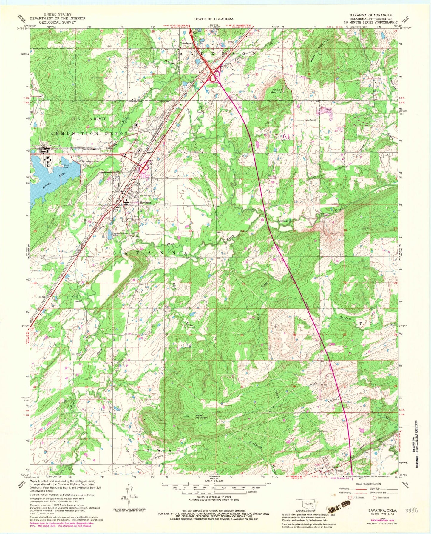
Classic USGS Savanna Oklahoma 7.5'x7.5' Topo Map
Couldn't load pickup availability
Historical USGS topographic quad map of Savanna in the state of Oklahoma. Map scale may vary for some years, but is generally around 1:24,000. Print size is approximately 24" x 27"
This quadrangle is in the following counties: Pittsburg.
The map contains contour lines, roads, rivers, towns, and lakes. Printed on high-quality waterproof paper with UV fade-resistant inks, and shipped rolled.
Contains the following named places: Blanco, Blanco Cemetery, Blanco Census Designated Place, Blanco Fire Department, Blanco Post Office, Brewer, Brown Lake Dam, Brushy Peaceable Creek Site 31 Dam, Brushy Peaceable Creek Site 32 Dam, Brushy Peaceable Creek Site 32 Reservoir, Brushy Peaceable Creek Site 33 Dam, Brushy Peaceable Creek Site 33 Reservoir, Bull Creek, Burshy Peaceable Creek Site 31 Reservoir, Chambers, Chambers Cemetery, Chun Creek, Dancing Rabbit Creek, Halley, McAlester Army Ammo Plant Fire Department, Piney Branch, Piney Mountain, Rock Creek, Savanna, Savanna Cemetery, Savanna Elementary School, Savanna Fire Department, Savanna High School, Savanna Post Office, Shoat Mountain, Town of Savanna, Township of Savanna, Wade Mountain, ZIP Code: 74565