MyTopo
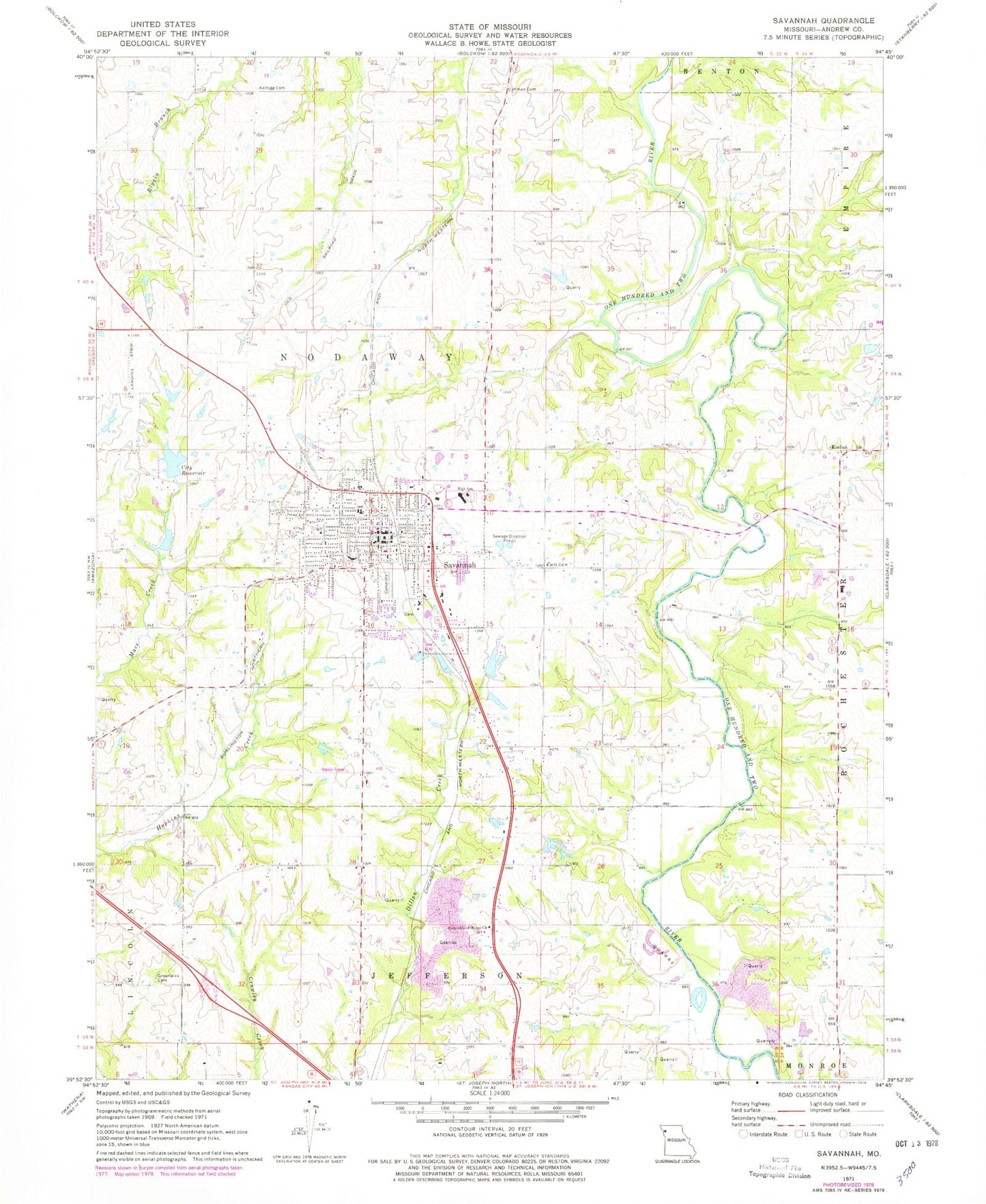
Classic USGS Savannah Missouri 7.5'x7.5' Topo Map
Couldn't load pickup availability
Historical USGS topographic quad map of Savannah in the state of Missouri. Map scale may vary for some years, but is generally around 1:24,000. Print size is approximately 24" x 27"
This quadrangle is in the following counties: Andrew.
The map contains contour lines, roads, rivers, towns, and lakes. Printed on high-quality waterproof paper with UV fade-resistant inks, and shipped rolled.
Contains the following named places: Andrew County, Andrew County Lake, Andrew County Lake Dam, Andrew County Sheriff's Office, Barr School, Bedford Chapel, City of Savannah, City Reservoir, Coffman Cemetery, Coffman School, County Farm, Cumberland Ridge Church, Dakin School, Dewitt School, Earls Cemetery, Ford Lake, Ford Lake Dam, Greenwick Cemetery, Howard School, Kelley Lake, Kelley Lake Dam, Kellogg Cemetery, Kodiak, Minnie Cline Elementary School, Mount Pleasant School, Republican School, Salem School, Savannah, Savannah Cemetery, Savannah City Reservoir Dam, Savannah Fire Department, Savannah High School, Savannah Middle School, Savannah Post Office, Savannah Rural Fire District, Schuster, Township of Nodaway, Washington School, Woodlawn School, Worth Airport, ZIP Code: 64485