
MyTopo
Classic USGS Sawbill Camp Minnesota 7.5'x7.5' Topo Map
Couldn't load pickup availability
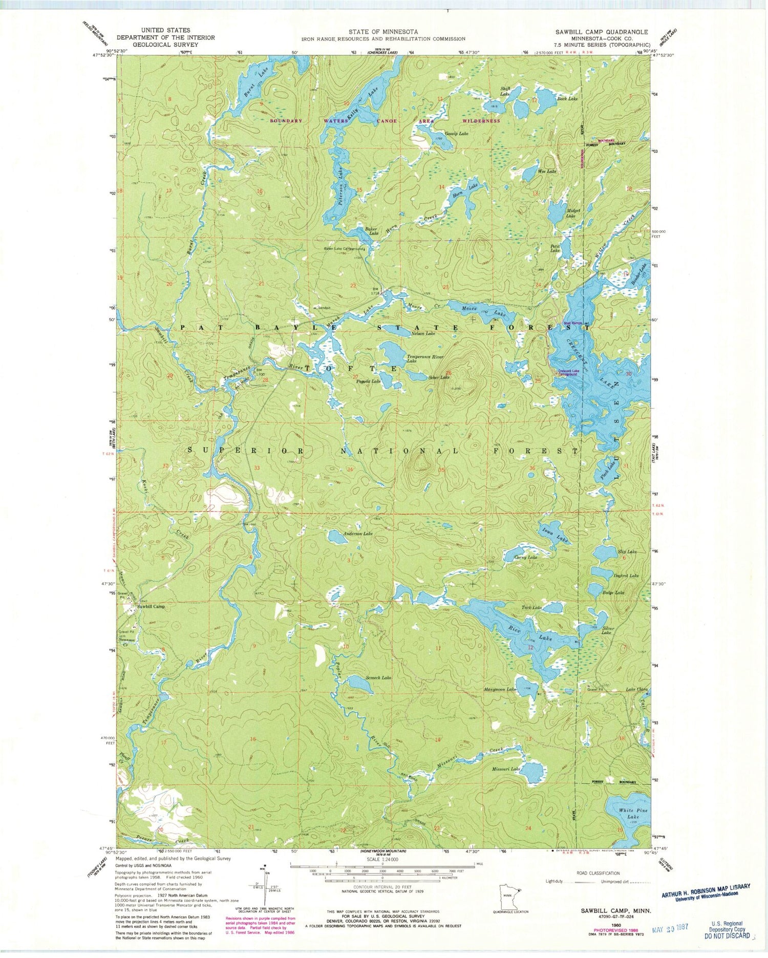
Historical USGS topographic quad map of Sawbill Camp in the state of Minnesota. Map scale may vary for some years, but is generally around 1:24,000. Print size is approximately 24" x 27"
This quadrangle is in the following counties: Cook.
The map contains contour lines, roads, rivers, towns, and lakes. Printed on high-quality waterproof paper with UV fade-resistant inks, and shipped rolled.
Contains the following named places: Anderson Lake, Back Lake, Baker Lake, Baker Lake Campground, Bulge Lake, Burnt Creek, Corny Lake, Crescent Lake, Crescent Lake Campground, Dogtrot Lake, Fleck Lake, Gossip Lake, Horn Creek, Horn Lake, Iowa Lake, Kelly Lake, Koski Creek, Manymoon Lake, Marsh Lake, Midget Lake, Missouri Creek, Missouri Lake, Moore Creek, Moore Lake, Nelson Lake, Pagoda Lake, Peterson Lake, Petit Lake, Plouff Creek, Rice Lake, Sawbill Camp, Sawbill Creek, Screech Lake, Shift Lake, Silver Lake, Slip Lake, Sober Lake, Swanson Creek, Tack Lake, Temperance River Lake, Township of Tofte, Wee Lake, Willow Creek


