MyTopo
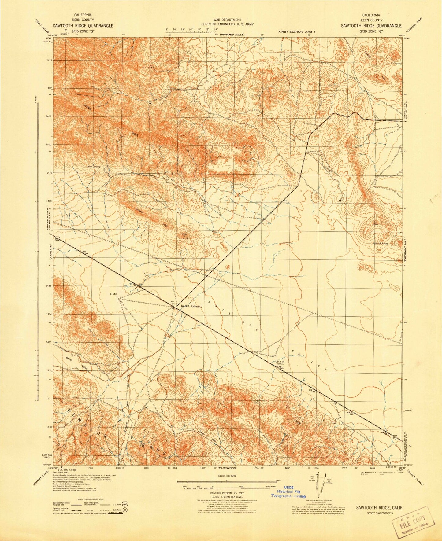
Classic USGS Sawtooth Ridge California 7.5'x7.5' Topo Map
Regular price
$16.95
Regular price
Sale price
$16.95
Unit price
per
Couldn't load pickup availability
Historical USGS topographic quad map of Sawtooth Ridge in the state of California. Map scale may vary for some years, but is generally around 1:24,000. Print size is approximately 24" x 27"
This quadrangle is in the following counties: Kern.
The map contains contour lines, roads, rivers, towns, and lakes. Printed on high-quality waterproof paper with UV fade-resistant inks, and shipped rolled.
Contains the following named places: Aido Spring, Barrel Valley, Berrenda Mesa 1051 Dam, Blackwell Land Company Inc Airport, Devils Den, Franciscan Creek, Hilbrich Grade, Kecks Corner, Kilmer Spring, Packwood Creek, Point of Rocks, Raven Pass, Sawtooth Ridge, White City Canyon