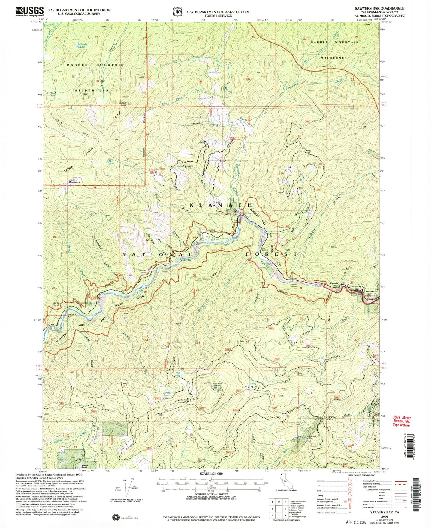
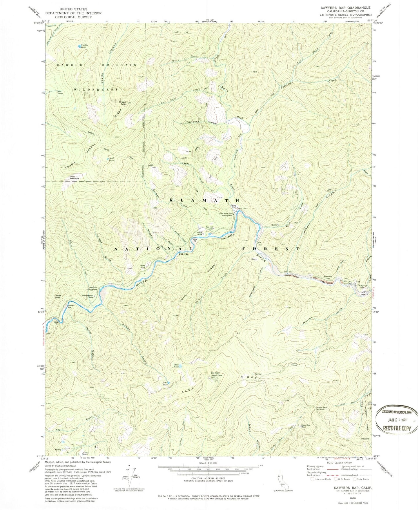
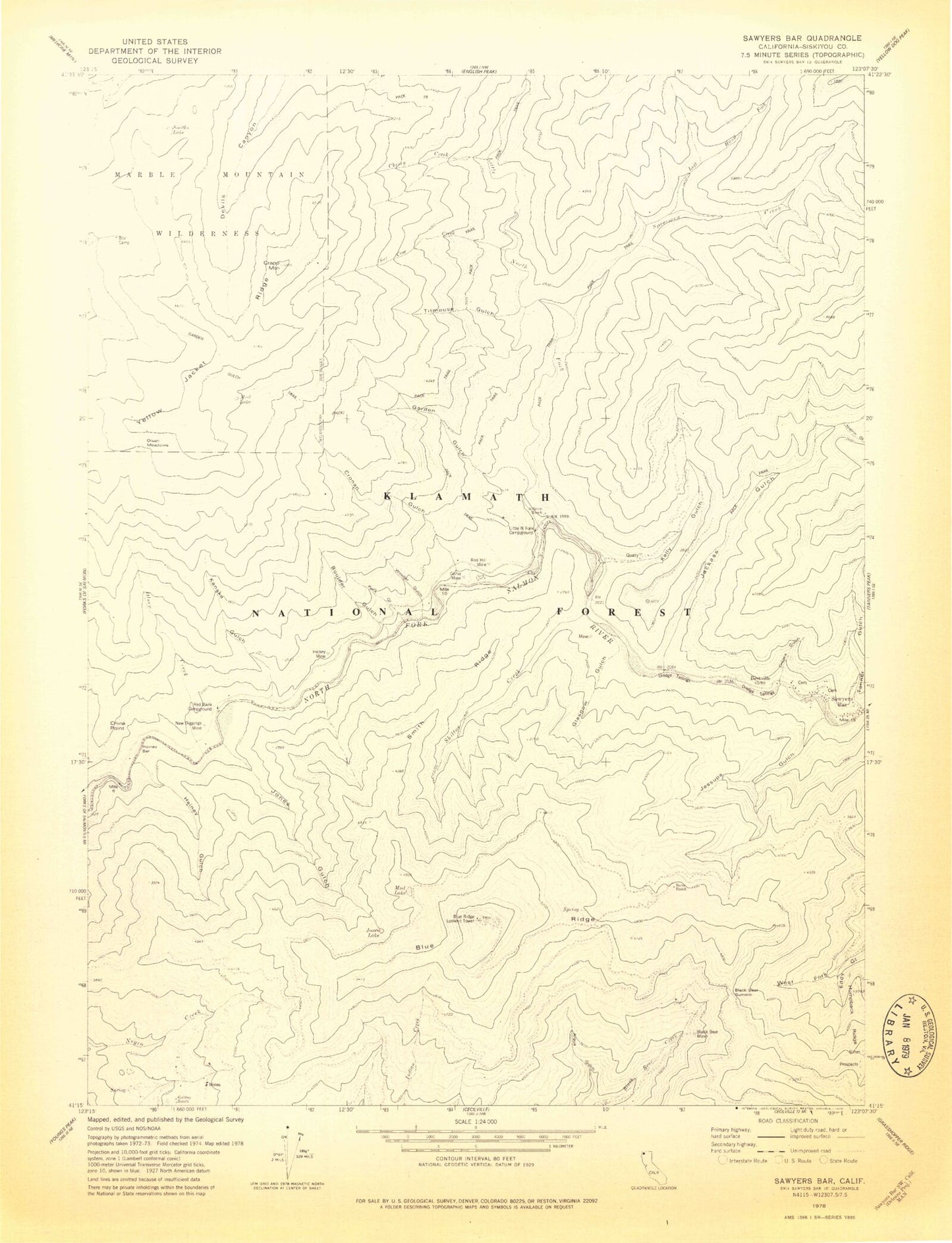
MyTopo
Classic USGS Sawyers Bar California 7.5'x7.5' Topo Map
Couldn't load pickup availability
Historical USGS topographic quad map of Sawyers Bar in the state of California. Map scale may vary for some years, but is generally around 1:24,000. Print size is approximately 24" x 27"
This quadrangle is in the following counties: Siskiyou.
The map contains contour lines, roads, rivers, towns, and lakes. Printed on high-quality waterproof paper with UV fade-resistant inks, and shipped rolled.
Contains the following named places: Ahlgren Cabin, Ahlgren Ranch, Bestville, Black Bear Mine, Black Bear Summit, Blue Ridge, Blue Ridge Lookout Tower, Boulder Gulch, Box Camp, Burns Ranch, Cherry Creek, China Point, Crapo Mountain, Croaks Gulch, Cronan Gulch, Gallia Mine, Garden Gulch, Garden Gulch Trail, Glasgow Gulch, Godfrey Ranch, Heiney Bar, Heiney Gulch, Hickey Mine, Humpback Ridge, Jackass Gulch, Jessups Gulch, Jones Gulch, Jones Lake, Kanaka Gulch, Kelly Gulch, Left Hand Fork Specimen Creek, Little North Fork Campground, Little North Fork Salmon River, Mud Lake, New Diggings Mine, Nielon Gulch, Olsen Creek, Olsen Meadows, Peck Gulch, Red Bank Campground, Red Hill Mine, Russianville School, Salmon River Ranger Office, Sawyers Bar, Sawyers Bar Catholic Cemetery, Sawyers Bar Cemetery, Sawyers Bar Elementary School, Sawyers Bar Work Center, Shiltos Creek, Smith Ridge, Smiths Lake, Specimen Creek, Sur Cree Creek, Tanner Gulch, Titmouse Gulch, West Fork Eddy Gulch, Windler Gulch, Yellow Jacket Ridge