MyTopo
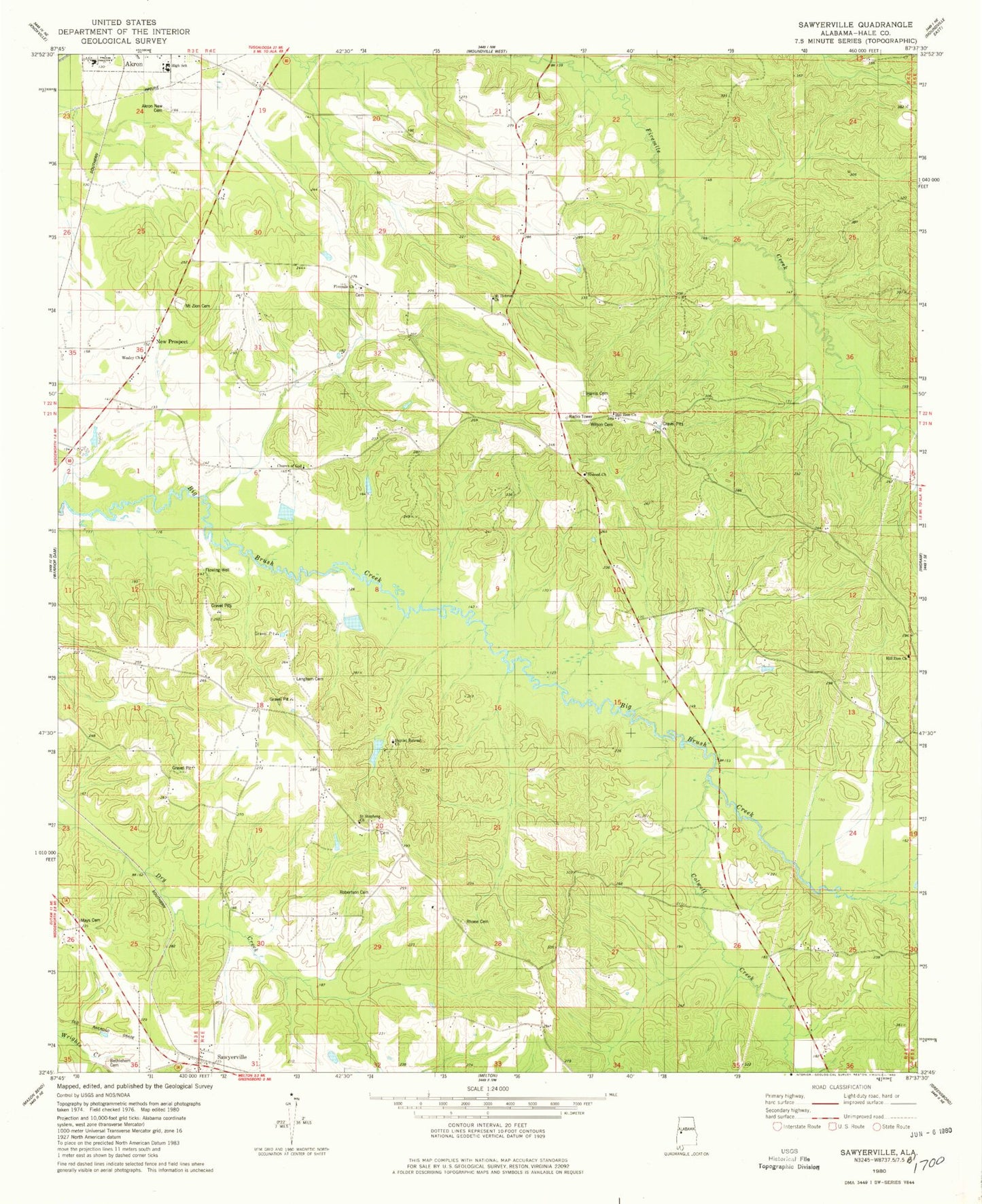
Classic USGS Sawyerville Alabama 7.5'x7.5' Topo Map
Couldn't load pickup availability
Historical USGS topographic quad map of Sawyerville in the state of Alabama. Map scale may vary for some years, but is generally around 1:24,000. Print size is approximately 24" x 27"
This quadrangle is in the following counties: Hale.
The map contains contour lines, roads, rivers, towns, and lakes. Printed on high-quality waterproof paper with UV fade-resistant inks, and shipped rolled.
Contains the following named places: Akron Community School, Akron High School, Akron New Cemetery, Baptist Retreat Church, Bethlehem Cemetery, Chalaybeate Spring, Church of God, Colwell Creek, Ellis School, Elwood Church, Elwood School, Estes School, Far View Plantation, Five Mile Cemetery, Five Mile Church, Fivemile Church, Greene Springs Academy, Hale County, Harris Cemetery, Hill Zion Church, Hobson School, Langham Cemetery, Long Cemetery, Mays Cemetery, McCrarys Branch, Mount Hebron Cemetery, Mount Hebron Church, Mount Zion Cemetery, Mount Zion Church, New Prospect, Rams Field, Rhone Cemetery, Robertson Cemetery, Saint Stephens Church, Sawyerville, Sawyerville Post Office, Sawyerville Volunteer Fire Department, Stewart-Akron Division, Strickland/Smalley Field, Tanglewood University of Alabama Biological Station, Wesley Church, Williams Cemetery, Wilson Cemetery