
MyTopo
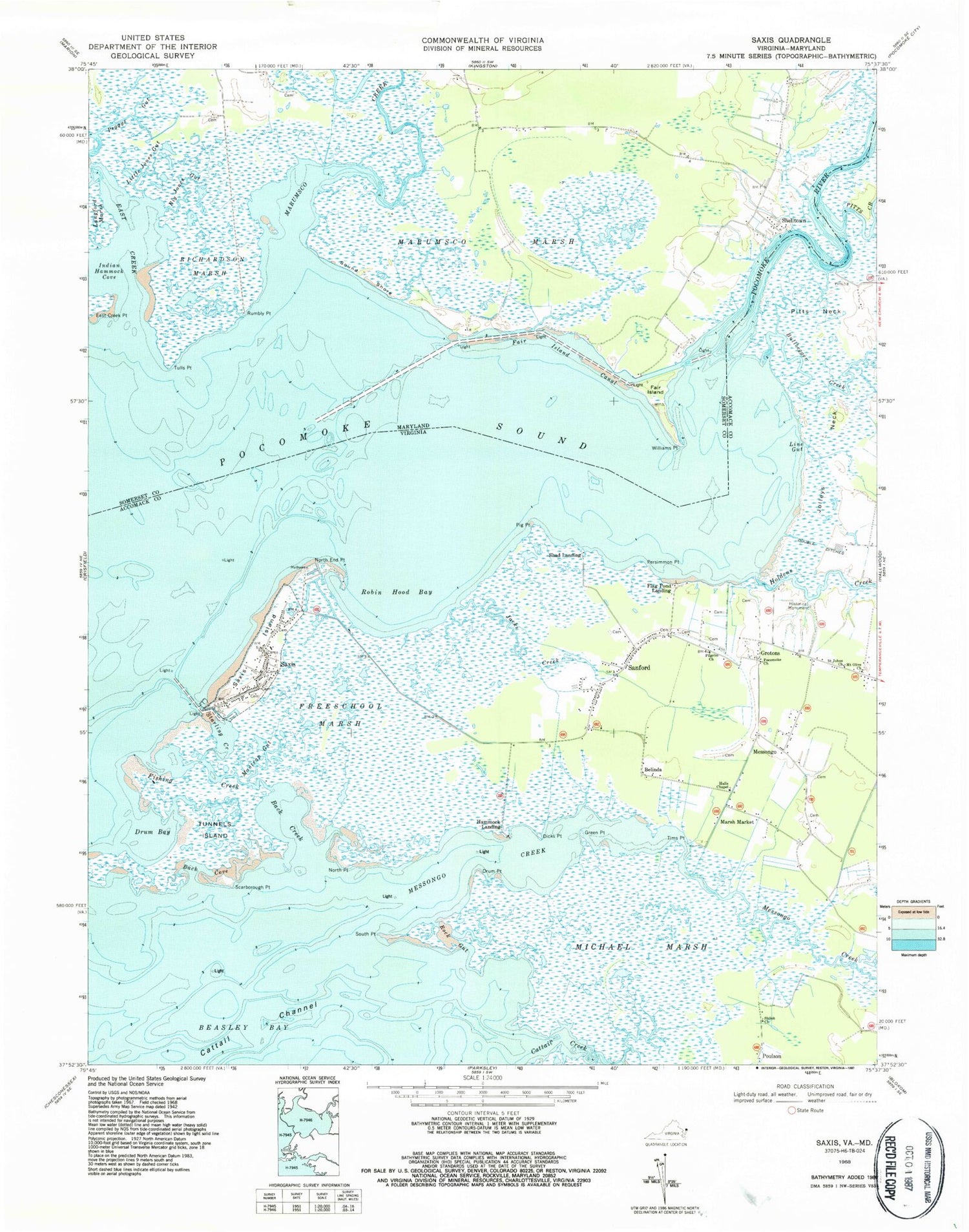
Classic USGS Saxis Virginia 7.5'x7.5' Topo Map
Couldn't load pickup availability
Historical USGS topographic quad map of Saxis in the states of Virginia, Maryland. Map scale may vary for some years, but is generally around 1:24,000. Print size is approximately 24" x 27"
This quadrangle is in the following counties: Accomack, Somerset.
The map contains contour lines, roads, rivers, towns, and lakes. Printed on high-quality waterproof paper with UV fade-resistant inks, and shipped rolled.
Contains the following named places: Back Cove, Back Creek, Baptist Churchyard Cemetery, Belinda, Big Jones Gut, Bullbegger Creek, Cattail Creek, Cliftons Creek, Dicks Point, Double Ditches, Drum Bay, Drum Point, East Creek, East Creek Point, Fair Island, Fair Island Canal, Fishing Creek, Flag Pond Landing, Freeschool Marsh, Green Point, Grotons, Halls Chapel, Hammock Landing, Holdens Creek, Indian Hammock Cove, Jacks Creek, Jolleys Neck, Line Gut, Little Jones Gut, Makitts Creek, Mantrap Gut, Marsh Market, Marumsco Creek, Marumsco Marsh, Messongo, Messongo Creek, Michael Marsh, Mount Olive Church, North End Point, North Point, Peggys Gut, Persimmon Point, Pig Point, Pilgrim Church, Pitts Creek, Pitts Neck, Pocomoke Church, Pocomoke River, Poulson, Richardson Marsh, Robin Hood Bay, Rock Gut, Rumbly Point, Saint Johns Church, Sanford, Sanford Census Designated Place, Sanford Post Office, Saxis, Saxis Island, Saxis Marsh Waterfowl Management Area and Refuge, Saxis Post Office, Saxis Volunteer Fire Company, Scarborough Point, Shad Landing, Shelltown, Shiloh Church, Sound Shore, South Point, Starling Creek, The Irish Grove, The Muds, Tims Point, Town of Saxis, Tulls Point, Tunnels Island, Williams Point, ZIP Codes: 23409, 23426, 23427


