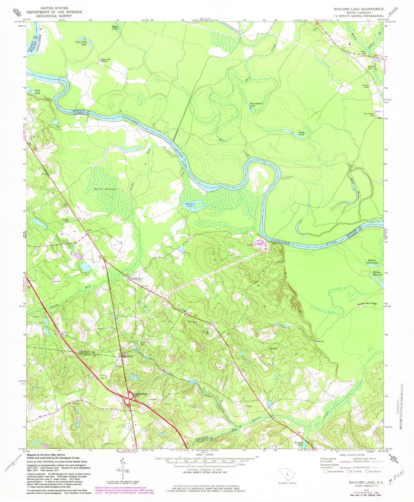
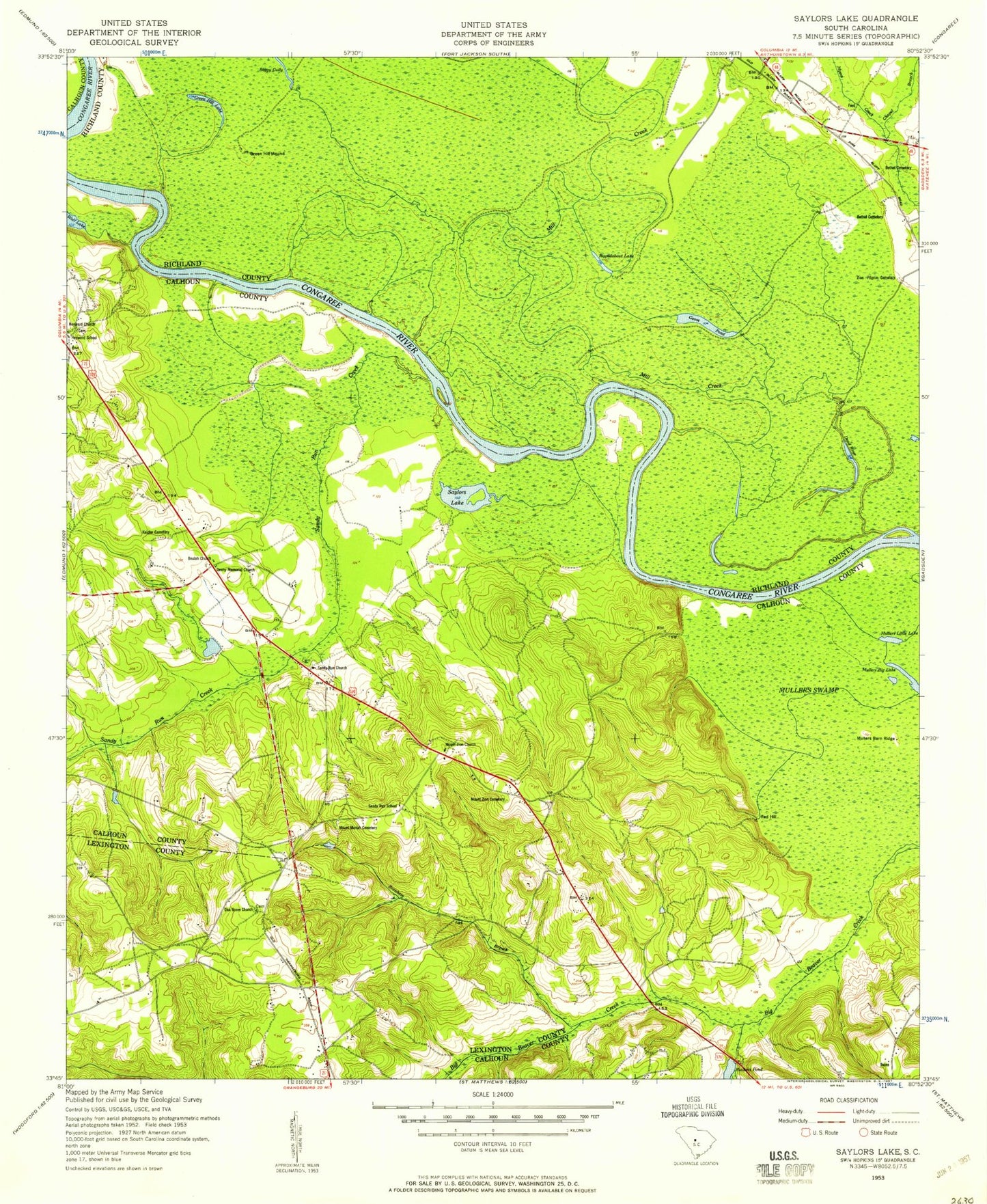
MyTopo
Classic USGS Saylors Lake South Carolina 7.5'x7.5' Topo Map
Couldn't load pickup availability
Historical USGS topographic quad map of Saylors Lake in the state of South Carolina. Map scale may vary for some years, but is generally around 1:24,000. Print size is approximately 24" x 27"
This quadrangle is in the following counties: Calhoun, Lexington, Richland.
The map contains contour lines, roads, rivers, towns, and lakes. Printed on high-quality waterproof paper with UV fade-resistant inks, and shipped rolled.
Contains the following named places: Bell Hall Neck, Bethel Cemetery, Beulah Church, Boggy Gully, Branham Branch, Cabin Branch, Culler School, Dead River, Denny Memorial Church, Devils Orchard, Goose Pond, Green Hill Lake, Green Hill Mound, Hagood Church, Haigs Hill, Heyward Church, Heyward School, Jamison Pond, Kaigler Cemetery, Little Beaver Creek, Mill Creek, Mount Moriah Cemetery, Mount Moriah Church, Mount Moriah School, Mount Zion Cemetery, Mount Zion Church, Mullers Barn Ridge, Mullers Little Lake, Mullers Swamp, Myers Cemetery, New Bethel Church, Oak Grove, Oak Grove Cemetery, Oak Grove Church, Red Hill, Roundabout Lake, Ruckers Pond, Sandy Run, Sandy Run Calhoun Fire Department, Sandy Run Lutheran Church, Sandy Run School, Savany Hunt Creek, Saylors Lake, South Carolina Noname 09034 D-2649 Dam, South Carolina Noname 09035 D-2650 Dam, South Carolina Noname 09036 D-2651 Dam, South Carolina Noname 09037 D-2652 Dam, Struckman Pond, Struckman Pond Dam D-2926, Taylors House Pond, Taylors Upper Pond, Weeping Mary Church, Wolf Lake, WRLX-FM (Orangeburg), Zion Church, Zion Pilgrim Cemetery