MyTopo
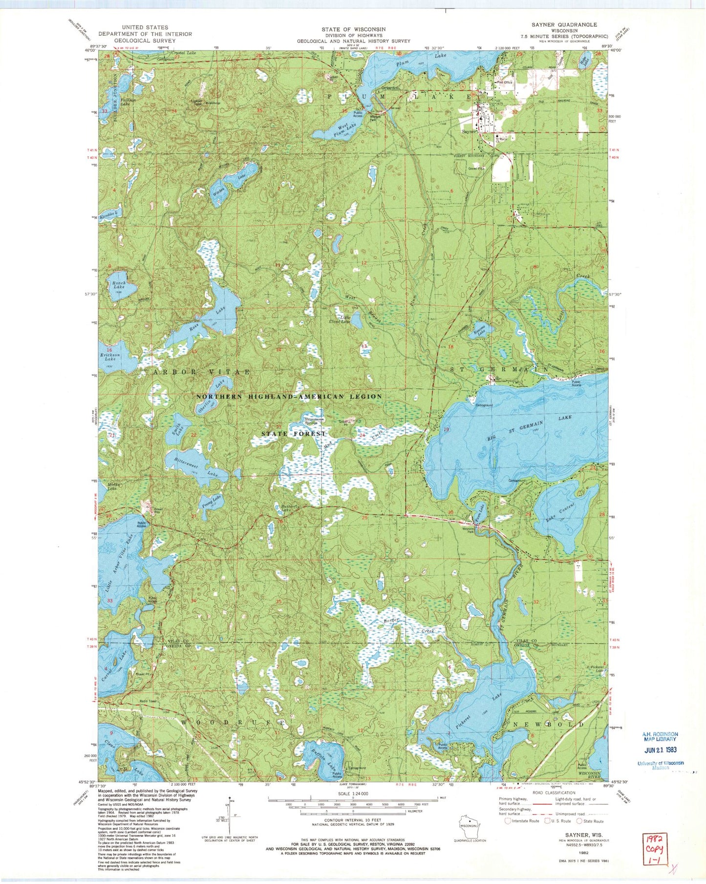
Classic USGS Sayner Wisconsin 7.5'x7.5' Topo Map
Couldn't load pickup availability
Historical USGS topographic quad map of Sayner in the state of Wisconsin. Typical map scale is 1:24,000, but may vary for certain years, if available. Print size: 24" x 27"
This quadrangle is in the following counties: Oneida, Vilas.
The map contains contour lines, roads, rivers, towns, and lakes. Printed on high-quality waterproof paper with UV fade-resistant inks, and shipped rolled.
Contains the following named places: Big Saint Germain Lake, Bittersweet Lake, Border Creek, Buffalo Lake, Lake Content, Erickson Lake, Fawn Lake, Hobo Lake, Kasomo Lake, Klondike Lake, Little Arbor Vitae Lake, Little Cloud Lake, Lost Creek, Mud Creek, Oberlin Lake, Pickerel Lake, Plum Creek, Prong Lake, Roach Lake, Ross Lake, Saint Germain River, Sayner, Smith Lake, West Branch Plum Creek, Witches Lake, Northern Highland-American Legion State Forest, Muskellunge Lookout Tower, Big Saint Germain 1909C361 Dam, Butterfly Lake, Hermanson Springs, Saint Marys Catholic Church, Sayner Post Office, Shepherd of the Lakes Lutheran Church, West Plum Lake, Plum Lake Golf Course, Bittersweet Lakes State Natural Area, Sayner Census Designated Place, Plum Lake Township Volunteer Fire Department Station 1, Plum Lake Ambulance Service