
MyTopo
Classic USGS Scales Mound West Illinois 7.5'x7.5' Topo Map
Couldn't load pickup availability
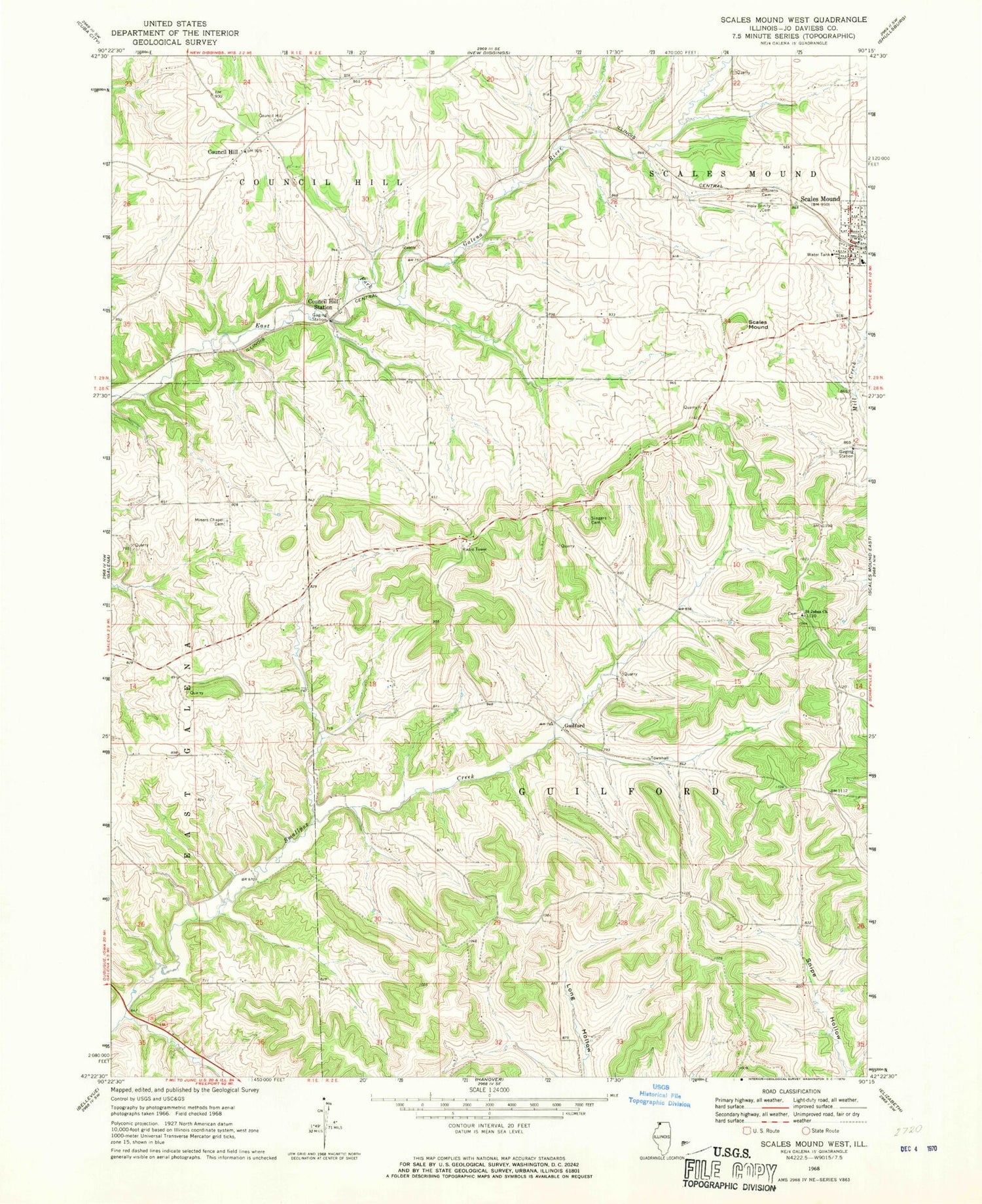
Historical USGS topographic quad map of Scales Mound West in the state of Illinois. Map scale may vary for some years, but is generally around 1:24,000. Print size is approximately 24" x 27"
This quadrangle is in the following counties: Jo Daviess.
The map contains contour lines, roads, rivers, towns, and lakes. Printed on high-quality waterproof paper with UV fade-resistant inks, and shipped rolled.
Contains the following named places: Belden School, Citzens Cemetery, Council Hill, Council Hill Cemetery, Council Hill Station, First Presbyterian Church, Ford School, Galena Lake, Glen Hollow School, Guilford, Holy Trinity Cemetery, Independence School, Lake Quarry, Miners Chapel Cemetery, Miners School, Mount Zion School, Saint Johns Church, Scales Mound, Scales Mound Fire Department Galena Territory Station, Scales Mound Fire Department Scales Mound Station, Scales Mound High School, Scales Mound Historic District, Scales Mound Post Office, Schoenhard School, Singers Catholic Cemetery, Smallpox Creek Dam, Stienstra Quarry, Taylor School, The Galena Territory Census Designated Place, Township of Council Hill, Township of Guilford, Travis School, Village of Scales Mound, ZIP Code: 61075


