MyTopo
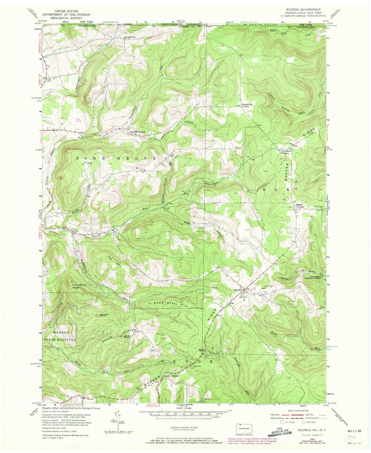
Classic USGS Scandia Pennsylvania 7.5'x7.5' Topo Map
Couldn't load pickup availability
Historical USGS topographic quad map of Scandia in the state of Pennsylvania. Typical map scale is 1:24,000, but may vary for certain years, if available. Print size: 24" x 27"
This quadrangle is in the following counties: Cattaraugus, Chautauqua, Warren.
The map contains contour lines, roads, rivers, towns, and lakes. Printed on high-quality waterproof paper with UV fade-resistant inks, and shipped rolled.
Contains the following named places: Bone Steel Hill, Cable Hollow, Cable Hollow, Clendening Corners, Cole Hill, Fox Hill, Gardners Rocks, Goose Heaven Hill, Gouldtown, Hale Cemetery, Lounsbury Corners, Macks Corners, Pine Grove Glade, Priest Hollow, Quaker Ridge, Reynolds Run, Scandia, Seven Dolors Cemetery, Smith Cemetery, Smith Corners, South Rocks, Sulphur Spring Run, Vanarsdale Run, Warren Rocks, Widdlefield Run, Wolcott Run, Scandia Air Park, Clendenning School (historical), Reynolds School (historical), Priest Hollow School (historical), Hale School, Smith School, Cable Hollow Golf Course, Blueberry Hill Golf Course, Township of Pine Grove, Scandia Volunteer Fire Department