MyTopo
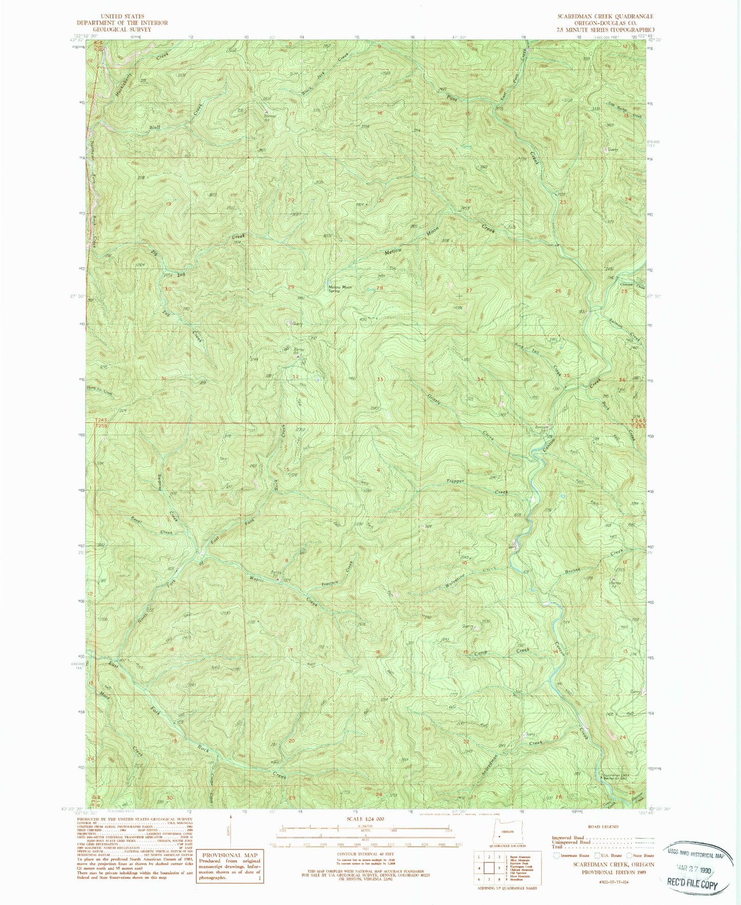
Classic USGS Scaredman Creek Oregon 7.5'x7.5' Topo Map
Couldn't load pickup availability
Historical USGS topographic quad map of Scaredman Creek in the state of Oregon. Map scale may vary for some years, but is generally around 1:24,000. Print size is approximately 24" x 27"
This quadrangle is in the following counties: Douglas.
The map contains contour lines, roads, rivers, towns, and lakes. Printed on high-quality waterproof paper with UV fade-resistant inks, and shipped rolled.
Contains the following named places: Black Jack Creek, Bluff Creek, Brouse Creek, Buck Creek, Call Creek, Camp Creek, Canton Shelter, Chilcoot Creek, Coon Creek, Cougar Creek, East Pass Creek, Fracture Creek, Grizzly Creek, Hipower Creek, Leach Camp Trail, Mace Creek, Mellow Moon Creek, Mellow Moon Spring, No Man Shelter, North Fork East Fork Rock Creek, Pass Creek, Pass Creek Shelter, Ravel Creek, Ring Tail Creek, Salmon Creek, Scaredman Camp, Scaredman Creek, Scaredman Creek Recreation Site, Surprise Creek, Trapper Creek, Trapper Shelter, Wapiti Creek, West Pass Creek Way, Wolverine Creek, Zag Creek, Zig Zag Creek