MyTopo
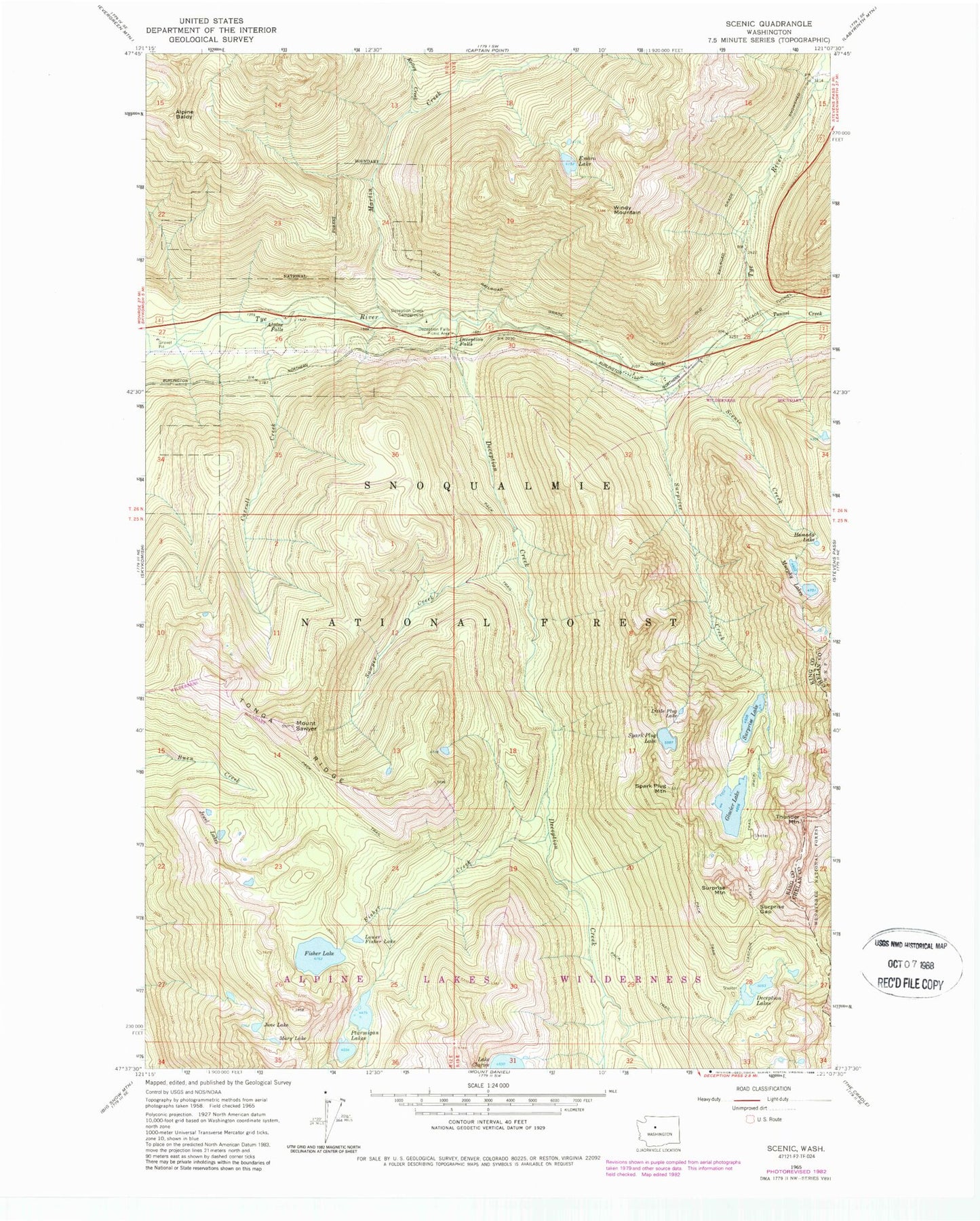
Classic USGS Scenic Washington 7.5'x7.5' Topo Map
Couldn't load pickup availability
Historical USGS topographic quad map of Scenic in the state of Washington. Typical map scale is 1:24,000, but may vary for certain years, if available. Print size: 24" x 27"
This quadrangle is in the following counties: Chelan, King.
The map contains contour lines, roads, rivers, towns, and lakes. Printed on high-quality waterproof paper with UV fade-resistant inks, and shipped rolled.
Contains the following named places: Alpine Baldy, Alpine Falls, Carroll Creek, Deception Creek, Deception Creek Campground, Deception Falls, Deception Falls Picnic Area, Deception Lakes, Embro Lake, Fisher Creek, Fisher Lake, Glacier Lake, Hamada Lake, Jewel Lakes, June Lake, Kelley Creek, Little Plug Lake, Lower Fisher Lake, Martin Creek, Mary Lake, Murphy Lakes, Ptarmigan Lakes, Sawyer Creek, Mount Sawyer, Scenic, Scenic Creek, Spark Plug Lake, Spark Plug Mountain, Surprise Creek, Surprise Gap, Surprise Lake, Surprise Mountain, Thunder Mountain, Tonga Ridge, Tunnel Creek, Windy Mountain, Deception Falls Campground, Tye Canyon Campground, Ptarmigan Lake, Surprise Mountain Lookout, Lake Sawyer, Daisy Lake, Lake Murphy, Pieper Pass