MyTopo
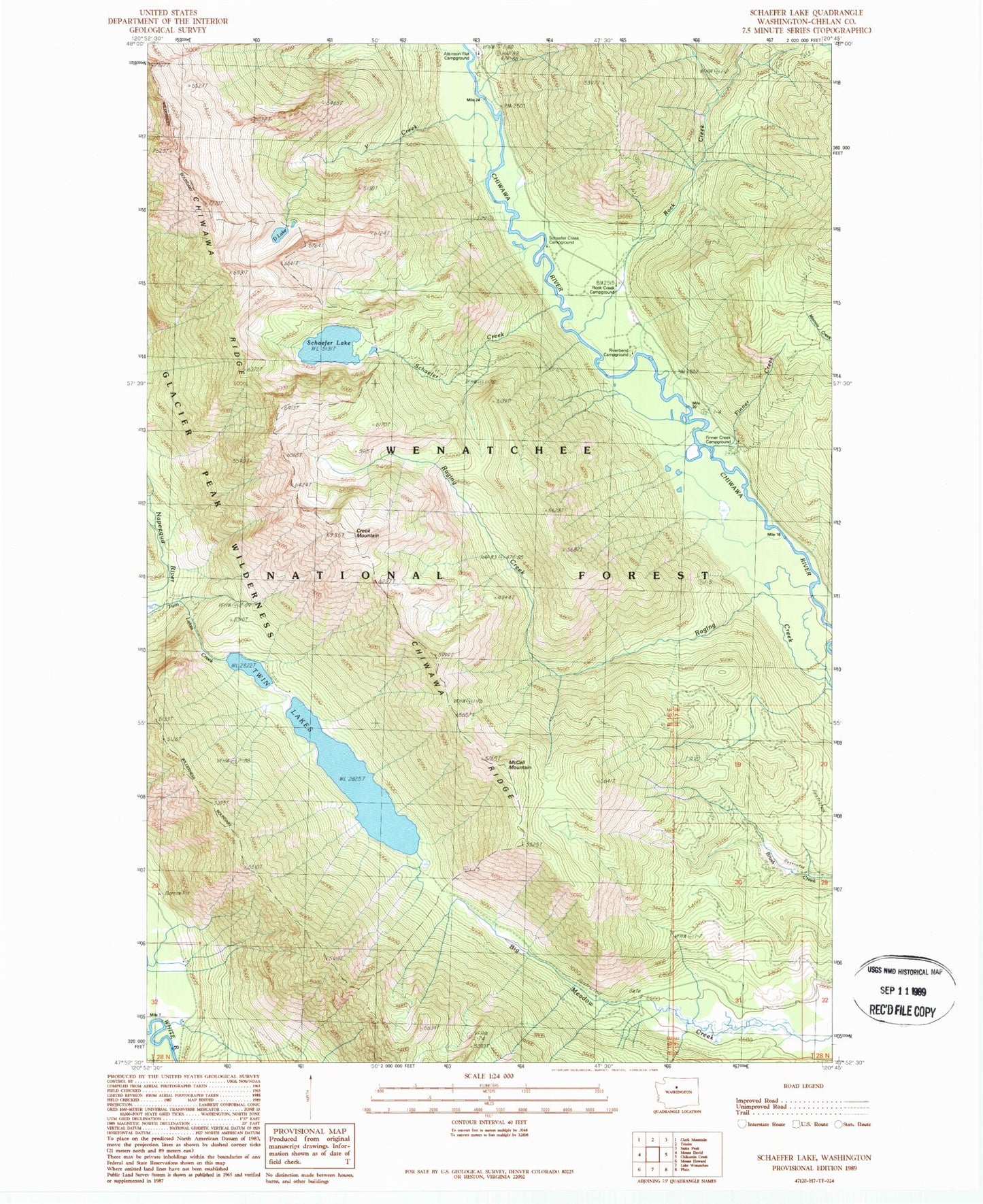
Classic USGS Schaefer Lake Washington 7.5'x7.5' Topo Map
Couldn't load pickup availability
Historical USGS topographic quad map of Schaefer Lake in the state of Washington. Typical map scale is 1:24,000, but may vary for certain years, if available. Print size: 24" x 27"
This quadrangle is in the following counties: Chelan.
The map contains contour lines, roads, rivers, towns, and lakes. Printed on high-quality waterproof paper with UV fade-resistant inks, and shipped rolled.
Contains the following named places: Crook Mountain, D Lake, Estes Butte Lookout, McCall Mountain, Rock Creek Guard Station, Schaefer Creek, Schaefer Creek Campground, Schaefer Lake, Twin Lakes, Y Creek, Atkinson Flat Campground, Finner Creek Campground, Finner Creek, Riverbend Campground, Rock Creek Campground, Chiwawa Horse Camp