MyTopo
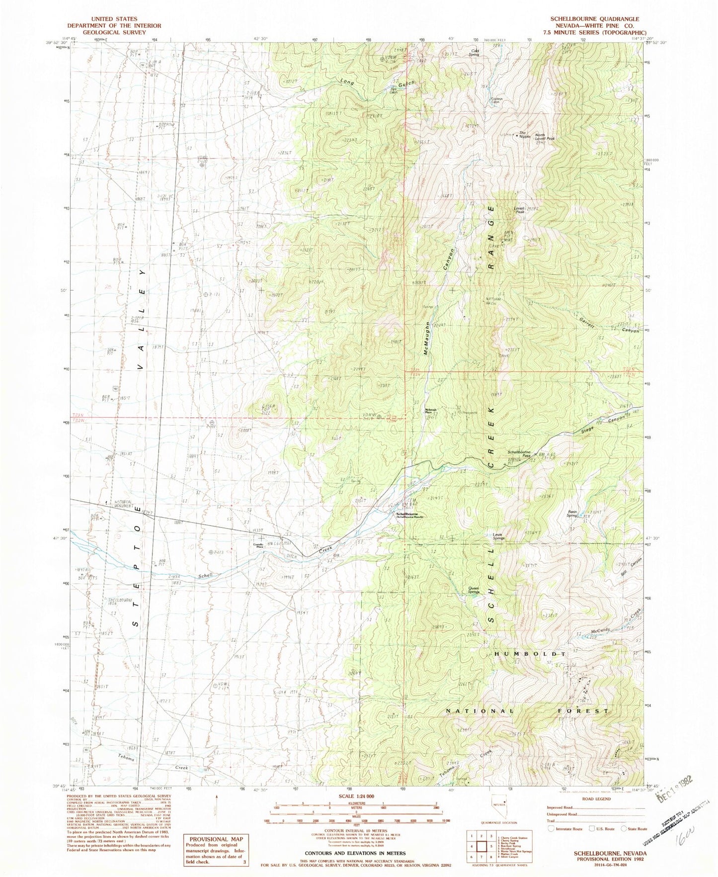
Classic USGS Schellbourne Nevada 7.5'x7.5' Topo Map
Couldn't load pickup availability
Historical USGS topographic quad map of Schellbourne in the state of Nevada. Map scale may vary for some years, but is generally around 1:24,000. Print size is approximately 24" x 27"
This quadrangle is in the following counties: White Pine.
The map contains contour lines, roads, rivers, towns, and lakes. Printed on high-quality waterproof paper with UV fade-resistant inks, and shipped rolled.
Contains the following named places: Aurum Mining District, Basin Spring, Cold Spring, Cooleys Cabin, Costello Place, Fera One Hundred One, Lewis Springs, Long Gulch, Lovell Peak, May Queen Mine, McIntosh Place, McMaughn Canyon, Mud Spring, North Lovell Peak, Queen Spring Mountain, Queen Springs, Schell Creek Station, Schellbourne, Schellbourne Maintenance Station, Schellbourne Pass, Schellbourne Post Office, Schellbourne Springs, Schellbourne Station, The Nipple, Upper Gulch Spring, Upper Long Gulch Spring, White Horse Mine, Zips Cabin