MyTopo
Classic USGS Schenevus New York 7.5'x7.5' Topo Map
Couldn't load pickup availability
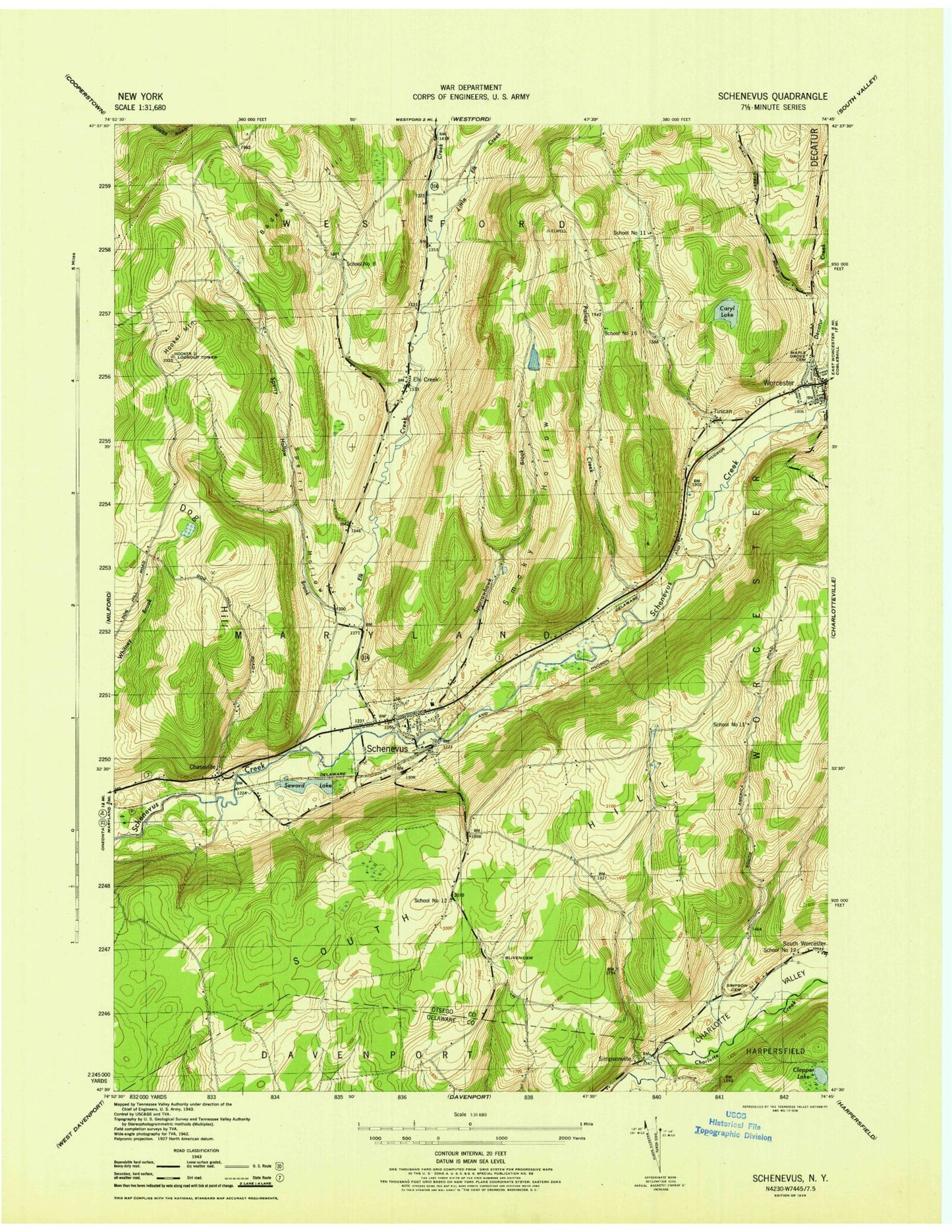
Historical USGS topographic quad map of Schenevus in the state of New York. Map scale may vary for some years, but is generally around 1:24,000. Print size is approximately 24" x 27"
This quadrangle is in the following counties: Delaware, Otsego.
The map contains contour lines, roads, rivers, towns, and lakes. Printed on high-quality waterproof paper with UV fade-resistant inks, and shipped rolled.
Contains the following named places: Badeau Hill, Bliven Cemetery, Caryl Lake, Chaseville, Clapper Lake, Decatur Creek, Dog Hill, Elk Creek, Elk Creek Cemetery, First Presbyterian Church, Hooker Mountain, Knapp Airport, Little Elk Creek, Maple Grove Cemetery, Palmer Creek, Schenevus, Schenevus Cemetery, Schenevus Census Designated Place, Schenevus Central School, Schenevus Fire Department C H Graham Hose Company, Schenevus Post Office, School Number 11, School Number 12, School Number 16, School Number 8, Second Baptist Church, Seward Lake, Simpson Cemetery, Simpsonville, Smoky Hollow, South Hill, Sparrowhawk Brook, Sperry Hollow, Town of Maryland, Tuscan, Willy's Farm, Worcester, Worcester Eastbound Rest Area, Worcester Emergency Squad, Worcester Fire Department, Worcester Post Office, ZIP Code: 12155