MyTopo
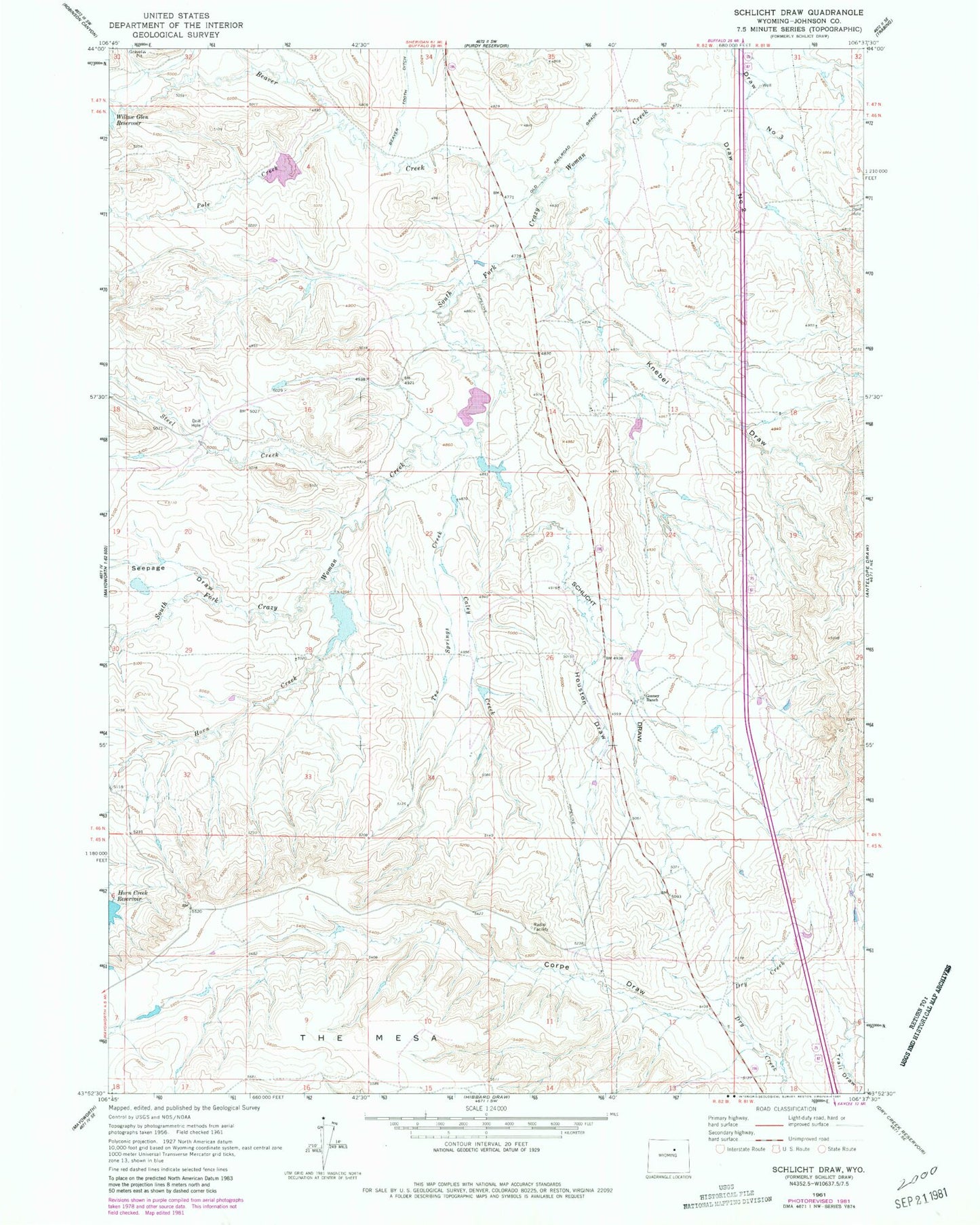
Classic USGS Schlicht Draw Wyoming 7.5'x7.5' Topo Map
Couldn't load pickup availability
Historical USGS topographic quad map of Schlicht Draw in the state of Wyoming. Map scale may vary for some years, but is generally around 1:24,000. Print size is approximately 24" x 27"
This quadrangle is in the following counties: Johnson.
The map contains contour lines, roads, rivers, towns, and lakes. Printed on high-quality waterproof paper with UV fade-resistant inks, and shipped rolled.
Contains the following named places: Beaver Creek, Beaver Tooth Ditch, Caley Creek, Corpe Draw, Draw Number 2, Gosney Ranch, Horn Creek, Horn Creek Dam, Horn Creek Reservoir, Horn Dam, Horn Reservoir, Houston Draw, Knebel Draw, Pole Creek, Pole Creek Irrigation Dam, Pole Creek Irrigation Reservoir, Schlicht Draw, Seepage Draw, South Fork Dam, South Fork Reservoir, Steel Creek, Tex Springs Creek