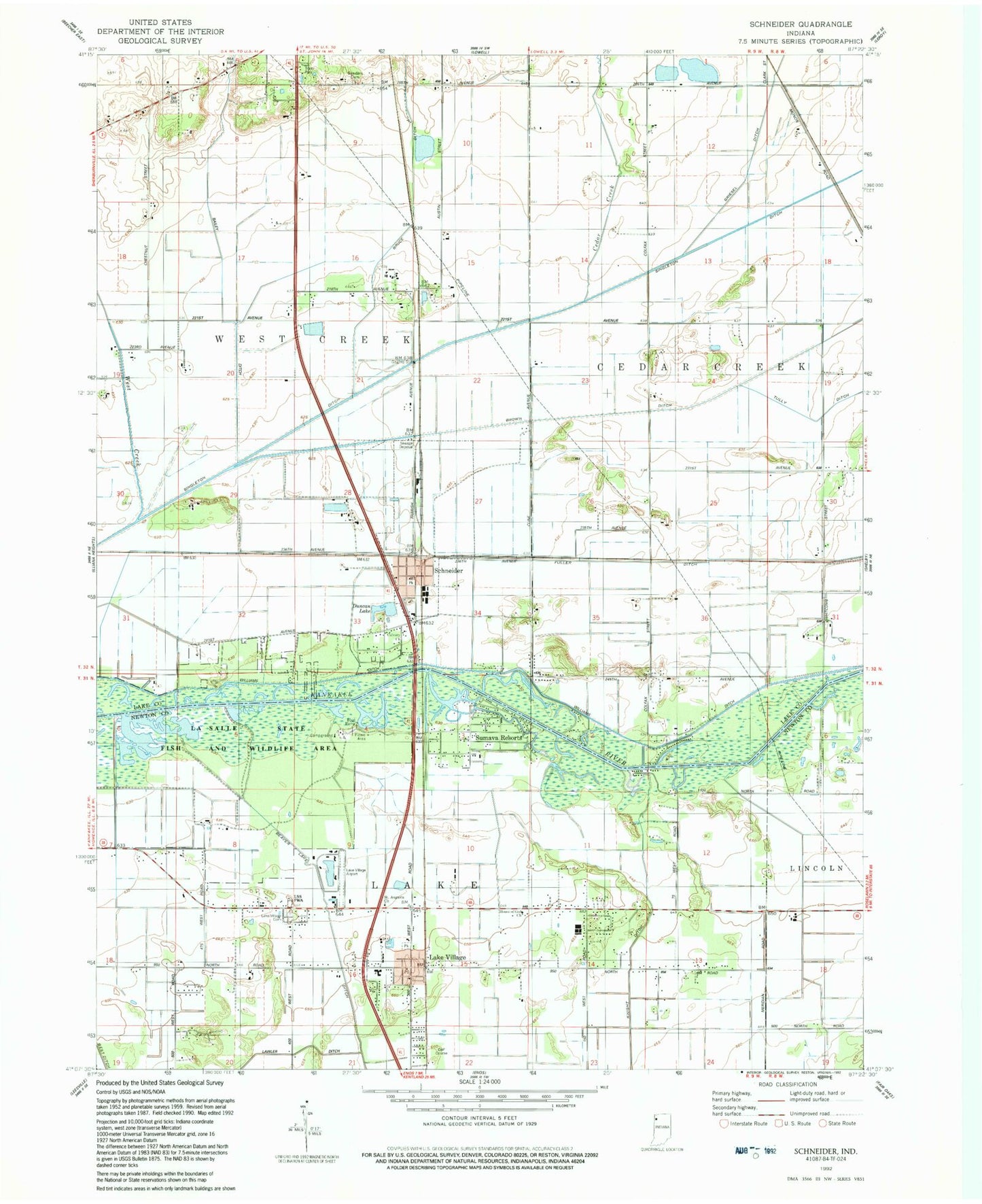
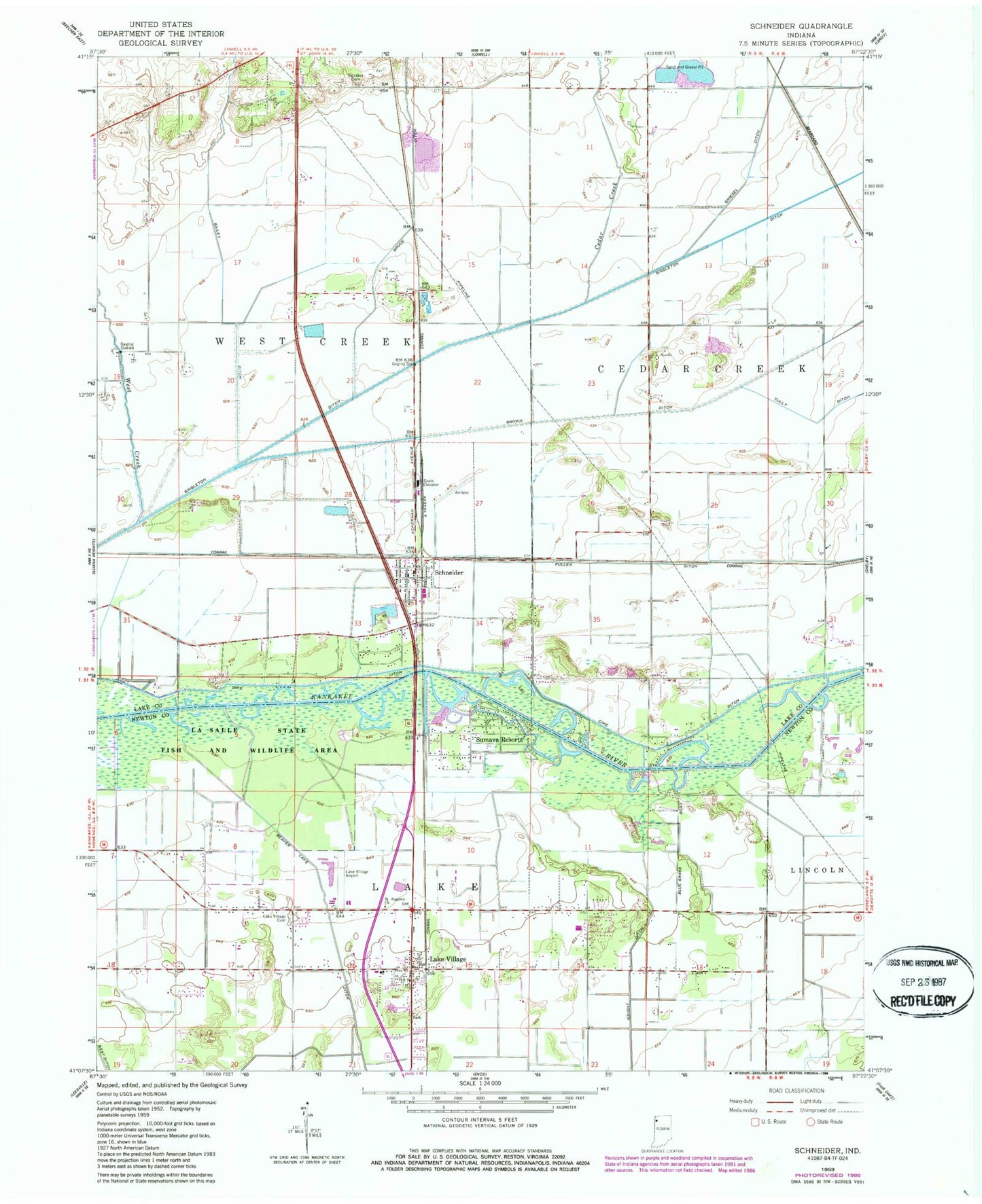
MyTopo
Classic USGS Schneider Indiana 7.5'x7.5' Topo Map
Couldn't load pickup availability
Historical USGS topographic quad map of Schneider in the state of Indiana. Map scale may vary for some years, but is generally around 1:24,000. Print size is approximately 24" x 27"
This quadrangle is in the following counties: Lake, Newton.
The map contains contour lines, roads, rivers, towns, and lakes. Printed on high-quality waterproof paper with UV fade-resistant inks, and shipped rolled.
Contains the following named places: Bailey Ditch, Best Ditch, Blackhawk Airport, Calvary Baptist Church, Cedar Creek, Fuller Ditch, House of God Church, Lake Township Volunteer Fire Department, Lake Village, Lake Village Airport, Lake Village Cemetery, Lake Village Census Designated Place, Lake Village Elementary School, Lake Village Post Office, Lowell Quarry, Oakwood Mobile Home Park, Saint Augusta Church, Sanders Cemetery, Schneider, Schneider Community Hall, Schneider Police Department, Schneider Post Office, Sumava Resorts, Sumava Resorts Post Office, Town of Schneider, Township of Lake, Village Baptist Church, West Creek, West Creek Township Fire Department, Williams Ditch, ZIP Codes: 46376, 46379