MyTopo
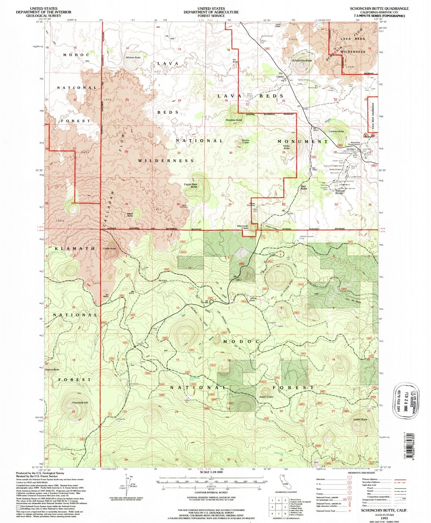
Classic USGS Schonchin Butte California 7.5'x7.5' Topo Map
Couldn't load pickup availability
Historical USGS topographic quad map of Schonchin Butte in the state of California. Map scale may vary for some years, but is generally around 1:24,000. Print size is approximately 24" x 27"
This quadrangle is in the following counties: Siskiyou.
The map contains contour lines, roads, rivers, towns, and lakes. Printed on high-quality waterproof paper with UV fade-resistant inks, and shipped rolled.
Contains the following named places: Aspen Crater, Balcony Bridge, Bat Butte, Bearpaw Bridge, Bearpaw Butte, Big Nasty Trail, Boulevard Bridge, Brushy Bridge, Bunchgrass Trail, Callahan Flow, Chocolate Bridge, Cinder Butte, Crescent Butte, Eagle Nest Butte, Fourmile Hill, Garden Bridges, Heppe Bridge, Heppe Chimney, Hidden Valley, Hippo Butte, Hopkins Bridge, Indian Butte, Indian Well Campground, Irish Bridge, Island Butte, Mammoth Crater, Merrill Natural Bridge, Missing Link Trail, Modoc Crater, Natural Bridge, Ovis Bridge, Peninsula Bridge, Red Butte, Schonchin Butte, Semi Crater, Sentinel Bridge, Symbol Bridge, The Castles, Tickner Chimneys, Venetian Bridge, Whitney Butte, Whitney Butte Trail