MyTopo
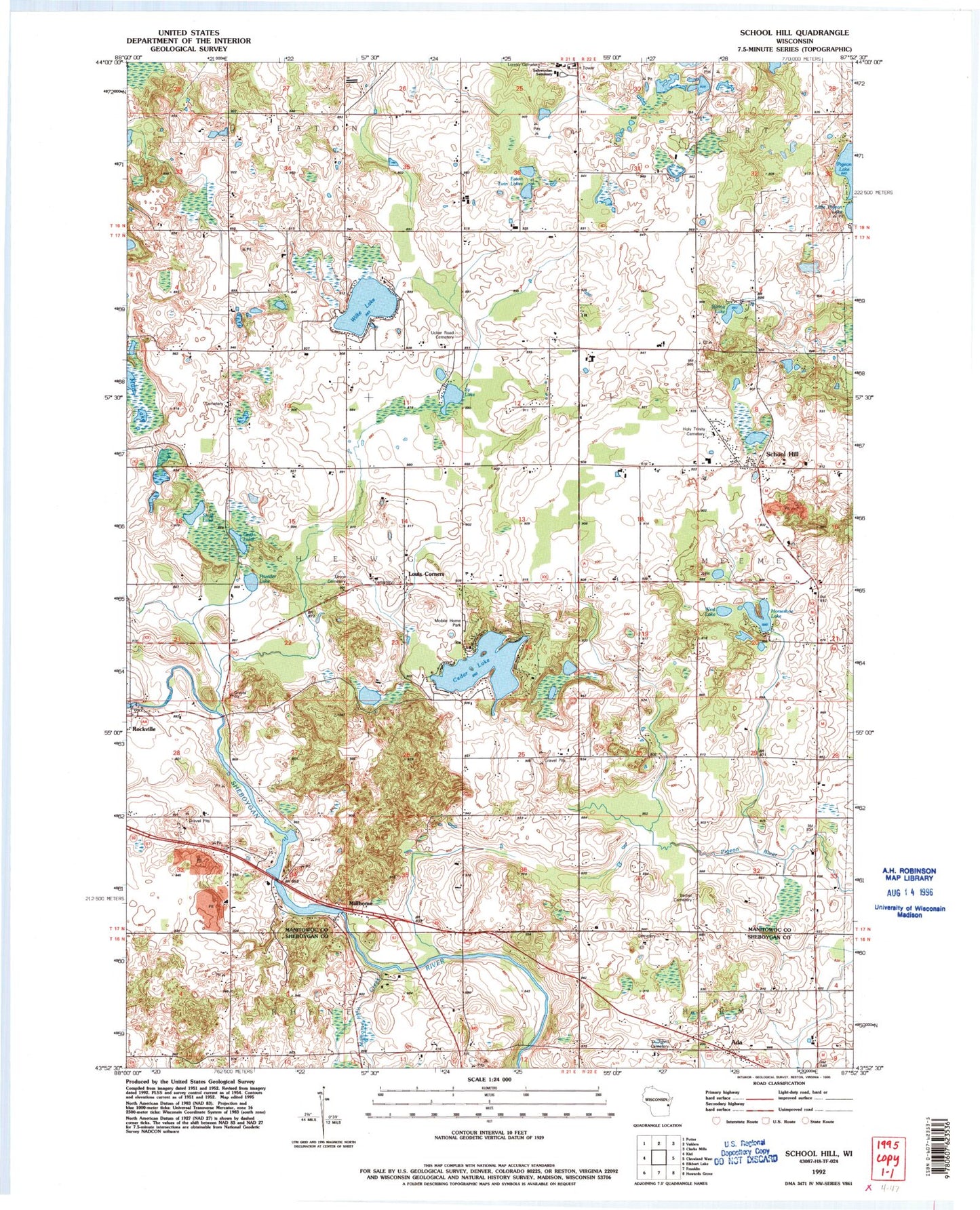
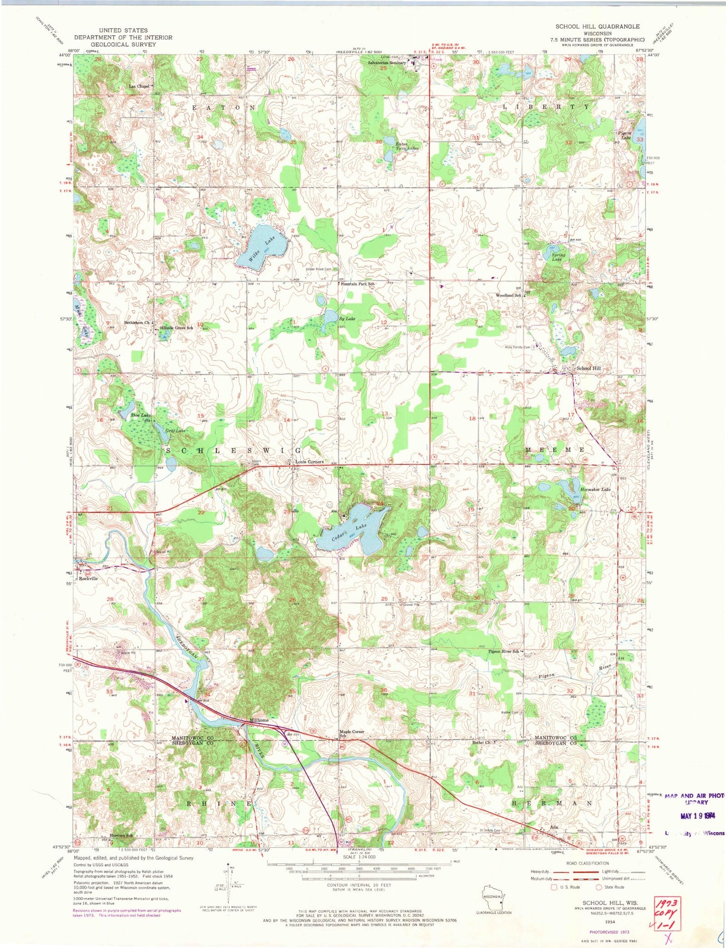
Classic USGS School Hill Wisconsin 7.5'x7.5' Topo Map
Couldn't load pickup availability
Historical USGS topographic quad map of School Hill in the state of Wisconsin. Map scale may vary for some years, but is generally around 1:24,000. Print size is approximately 24" x 27"
This quadrangle is in the following counties: Manitowoc, Sheboygan.
The map contains contour lines, roads, rivers, towns, and lakes. Printed on high-quality waterproof paper with UV fade-resistant inks, and shipped rolled.
Contains the following named places: Ada, Ada Fire Department, Autumn Creek Farm, Bethel Church, Bethel Church Cemetery, Bethlehem Church, Cedar Lake, County Line Orchard, Devin Acres, Eaton Twin Lakes, Fountain Park School, Golden Bear Farm, Graf Lake, Greendale Dairy, Harrison School, Hillside Grove School, Holy Trinity Cemetery, Horseshoe Lake, Karstaedt Lake, Kleinhans Dairy Farm, Koco Ranch, Lax Chapel, Little Pigeon Lake, Little Sy Lake, Louis Corners, Louis Corners Dairy, Maple Corner School, Millhome, Millhome Creek, Millhome Flowage 168, Millhome Nursery and Greenhouse, Millhome WP396 Dam, Misty River Dairy, Mud Lake, Nenning Mobile Home Park, Peterson Lake, Pigeon River School, Prueder Lake, Psalm 23 Farm, Ranger Lake, Robinway Dairy Farms, Rockville, Rockville Dam, Rockville Flowage 153, S and J Farms, Saint John Cemetery, Salvatorian Seminary, Schema Farm, School Hill, Schuler Dairy Farms, Scout Lake, Shoe Lake, Society of the Divine Savior Cemetery, Spindler Farm, Spring Lake, Sy Lake, Town of Schleswig, Townline Dairy, Ucker Cemetery, Union Cemetery, Vanderbloemen Bog State Natural Area, West Lake, Wilke Lake, Woodland School, ZIP Code: 53042