MyTopo
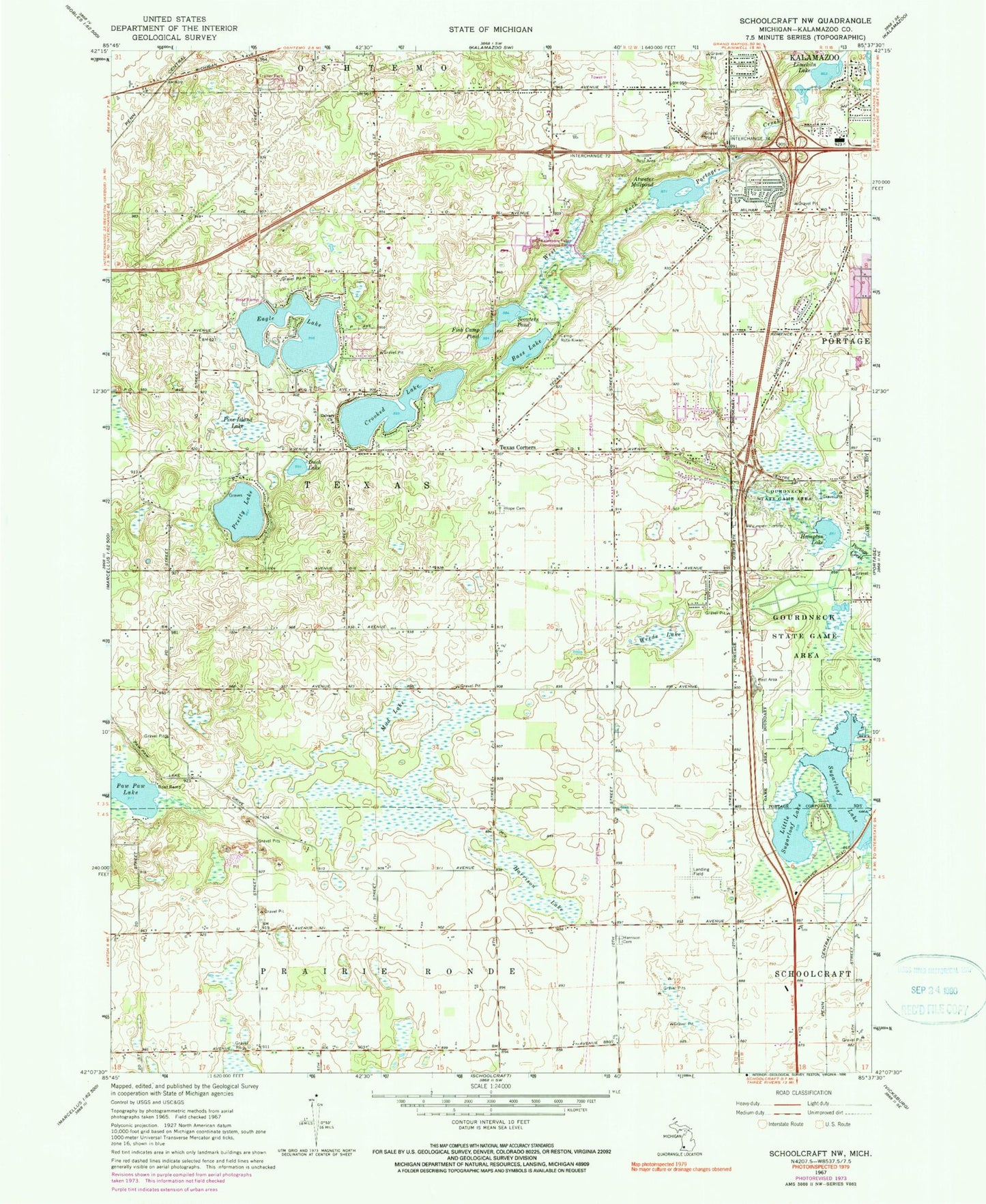
Classic USGS Schoolcraft NW Michigan 7.5'x7.5' Topo Map
Couldn't load pickup availability
Historical USGS topographic quad map of Schoolcraft NW in the state of Michigan. Map scale may vary for some years, but is generally around 1:24,000. Print size is approximately 24" x 27"
This quadrangle is in the following counties: Kalamazoo.
The map contains contour lines, roads, rivers, towns, and lakes. Printed on high-quality waterproof paper with UV fade-resistant inks, and shipped rolled.
Contains the following named places: Angling Road Elementary School, Atwater Millpond, Bass Lake, Borgess at Woodbridge Hills, Calvary Church, Camp Rota-Kiwan, Charter Township of Texas, Crooked Lake, Duck Lake, Eagle Lake, Fish Camp Pond, Gourdneck State Game Area, Hampton Lake, Harrison Cemetery, Harrison Lake, Hope Cemetery, Kalamazoo Region Historical Marker, Kalamazoo Valley Community College, Life Point Church, Lighthouse Community Church, Limekiln Lake, Little Sugarloaf Lake, Moors Golf Club, Moorsbridge Elementary School, Mud Lake, Oak Brook Estates Mobile Home Park, Paw Paw Lake, Perry Airport, Pine Island, Portage Church of Christ, Portage West Middle School, Pretty Lake, Pretty Lake Cemetery, Schoolcraft Assembly of God Church, Scouters Pond, Sugarloaf Lake, Sugarloaf Mobile Home Park, Texas Charter Township Fire and Rescue, Texas Corners, Texas Post Office, Weeds Lake, Westfield Park, Whitcomb Field, Woodland Estates Mobile Home Park