
MyTopo
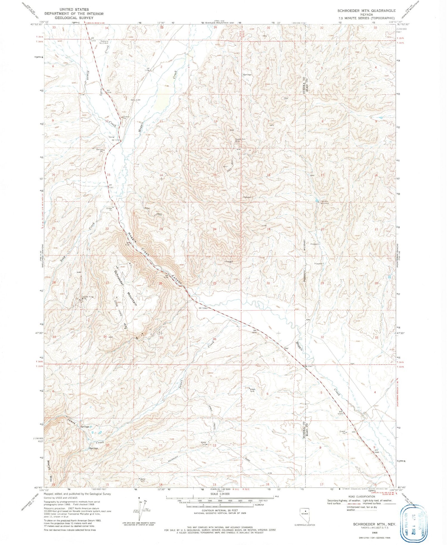
Classic USGS Schroeder Mountain Nevada 7.5'x7.5' Topo Map
Couldn't load pickup availability
Historical USGS topographic quad map of Schroeder Mountain in the state of Nevada. Map scale may vary for some years, but is generally around 1:24,000. Print size is approximately 24" x 27"
This quadrangle is in the following counties: Elko, Eureka.
The map contains contour lines, roads, rivers, towns, and lakes. Printed on high-quality waterproof paper with UV fade-resistant inks, and shipped rolled.
Contains the following named places: Copper King Mine, Good Hope Mine, Hadleys Windmill, James Creek, Lynn Creek, Maggie Creek Canyon, Maggie Creek Mine, Maggie Creek Mining District, Maggie Peak, Nevada Star Mine, Newmont Gold Mine Fire and Emergency Medical Services, Queen Ann Mine, Rebholtz Number Two Well, Schroeder Mountain, Simon Creek, Soap Creek


