MyTopo
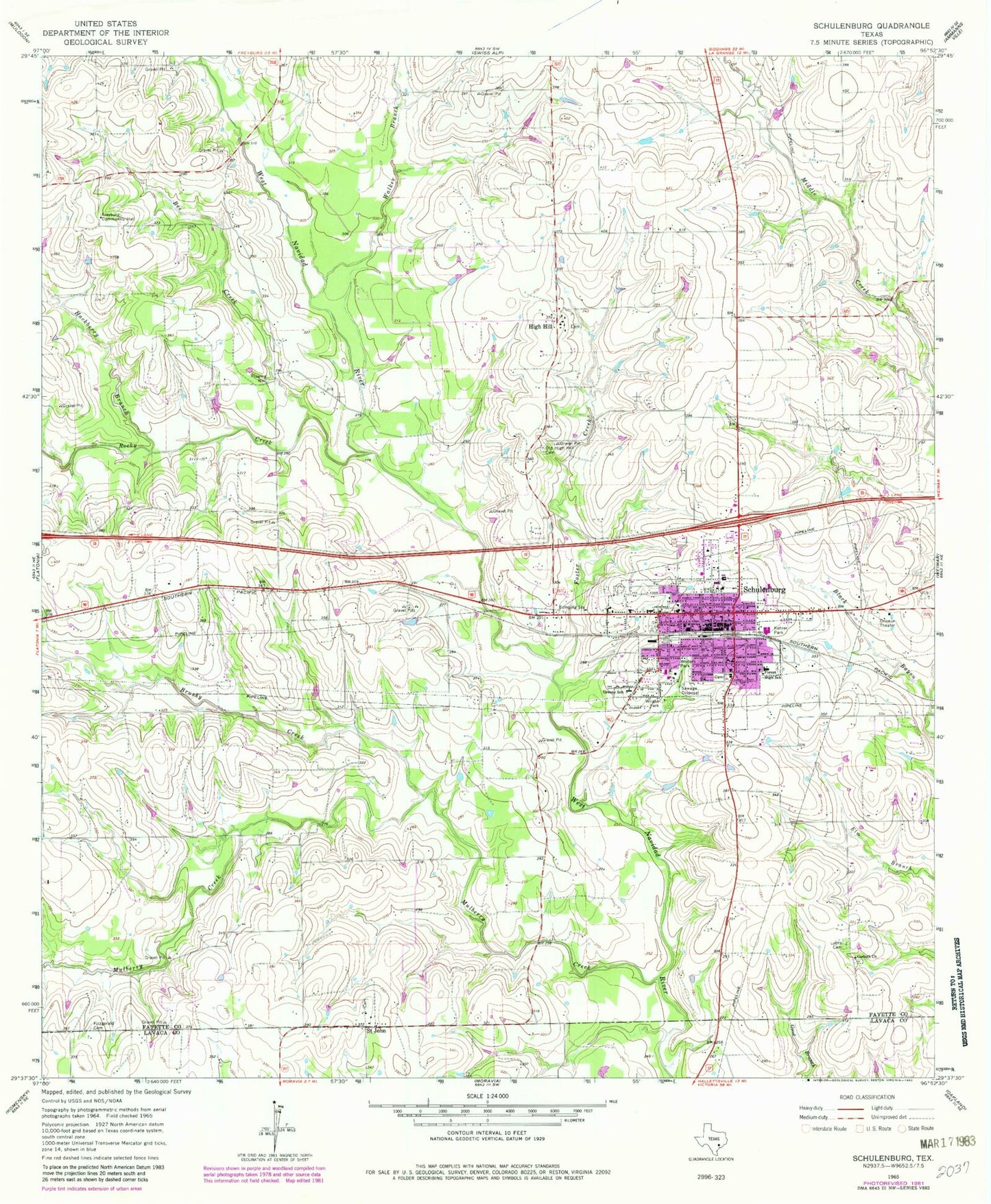
Classic USGS Schulenburg Texas 7.5'x7.5' Topo Map
Couldn't load pickup availability
Historical USGS topographic quad map of Schulenburg in the state of Texas. Map scale may vary for some years, but is generally around 1:24,000. Print size is approximately 24" x 27"
This quadrangle is in the following counties: Fayette, Lavaca.
The map contains contour lines, roads, rivers, towns, and lakes. Printed on high-quality waterproof paper with UV fade-resistant inks, and shipped rolled.
Contains the following named places: Bee Creek, Brushy Creek, City of Schulenburg, Corinth Church, Fayette County Emergency Medical Service Schulenburg, Fitzgerald Cemetery, Forest High School, Foster Creek, Freyburg Community Hall, Greene School, Hackberry Branch, High Hill, Kehrer Park, Lyons Cemetery, Marty Ranch Airport, Mulberry Creek, Mulberry Creek Bridge, Nativity of the Blessed Virgin Mary Catholic Church, Old High Hill Cemetery, Rocky Creek, Saint John, Schonest - Welt Park, Schulenberg City Hall, Schulenburg, Schulenburg Cotton Compress, Schulenburg Elementary School, Schulenburg High School, Schulenburg Historical Museum, Schulenburg Junior High School, Schulenburg Police Department, Schulenburg Post Office, Schulenburg Volunteer Fire Department, Walker Branch, Wolters Park, Wright Park, ZIP Code: 78956