MyTopo
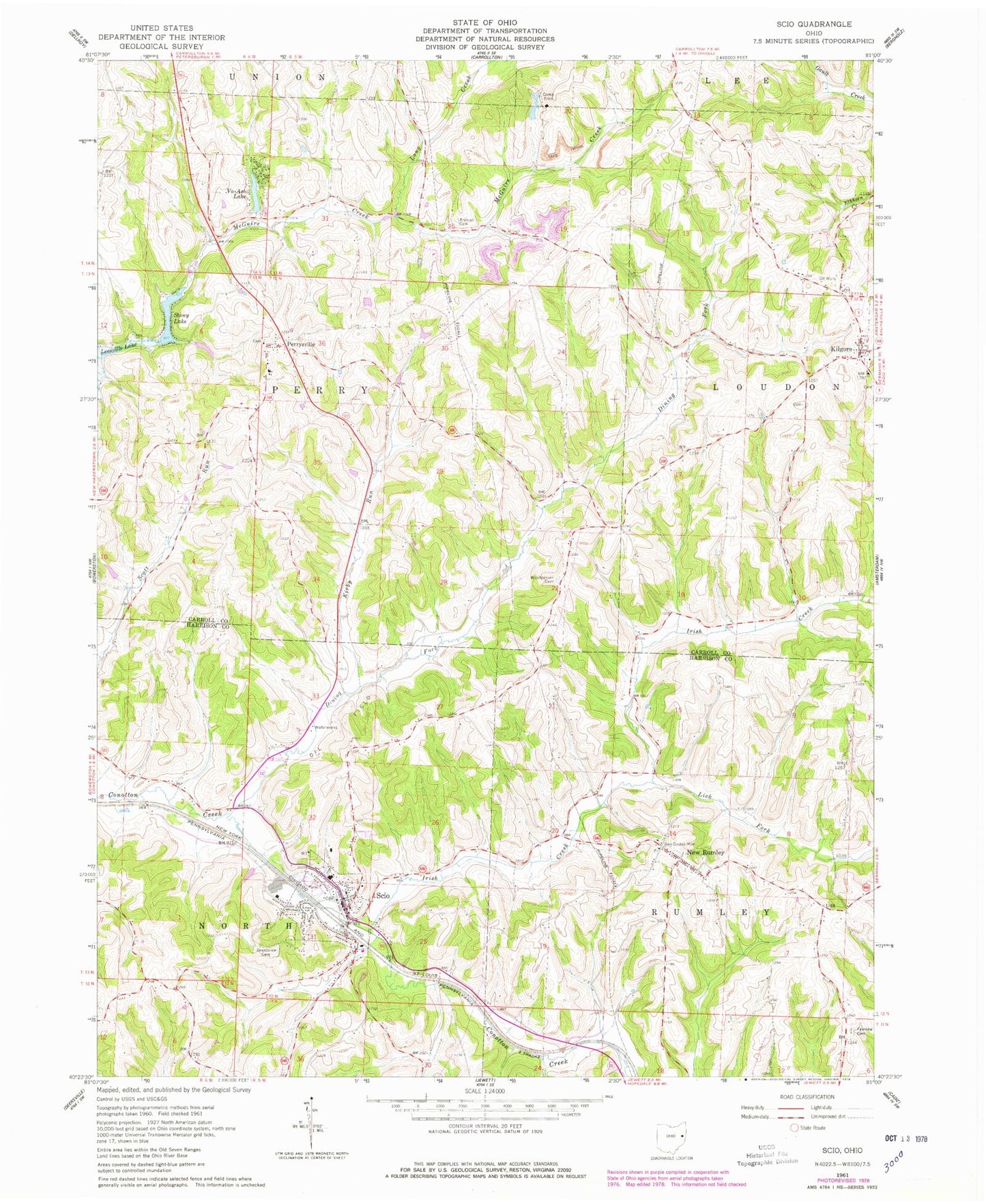
Classic USGS Scio Ohio 7.5'x7.5' Topo Map
Couldn't load pickup availability
Historical USGS topographic quad map of Scio in the state of Ohio. Map scale may vary for some years, but is generally around 1:24,000. Print size is approximately 24" x 27"
This quadrangle is in the following counties: Carroll, Harrison.
The map contains contour lines, roads, rivers, towns, and lakes. Printed on high-quality waterproof paper with UV fade-resistant inks, and shipped rolled.
Contains the following named places: Abel Cemetery, Arabia Cemetery, Camp Ecco, Dining Fork, Evangelical Lutheran Cemetery, Fairview Cemetery, General Custer Monument, Grandview Cemetery, Irish Creek, Jewett-Scio High School, Kilgore, Kilgore Cemetery, Kilgore Elementary School, Kilgore Post Office, Kilgore Presbyterian Cemetery, Kilgore Squad Ambulance Service, Kirby Run, Lick Fork, Long Creek, Loudon Township Volunteer Fire Department, New Perrysville Cemetery, New Rumley, New Rumley Methodist Cemetery, New Rumley Methodist Church, New Rumley Post Office, Perry Township Fire Department, Perry Township Squad, Perrysville, Perrysville Cemetery, Perrysville United Brethren Church, Perrysville United Methodist Church, Scio, Scio Police Department, Scio Post Office, Scio Pottery Pond, Scio Pottery Pond Dam, Scio Volunteer Fire Department, Stony Lake, Stony Lake Dam, Township of North, Township of Perry, Township of Rumley, United Brethren Cemetery, Village of Scio, Vo-Ash Lake, Vo-Ash Lake Dam, Woodpecker Cemetery, ZIP Code: 43988