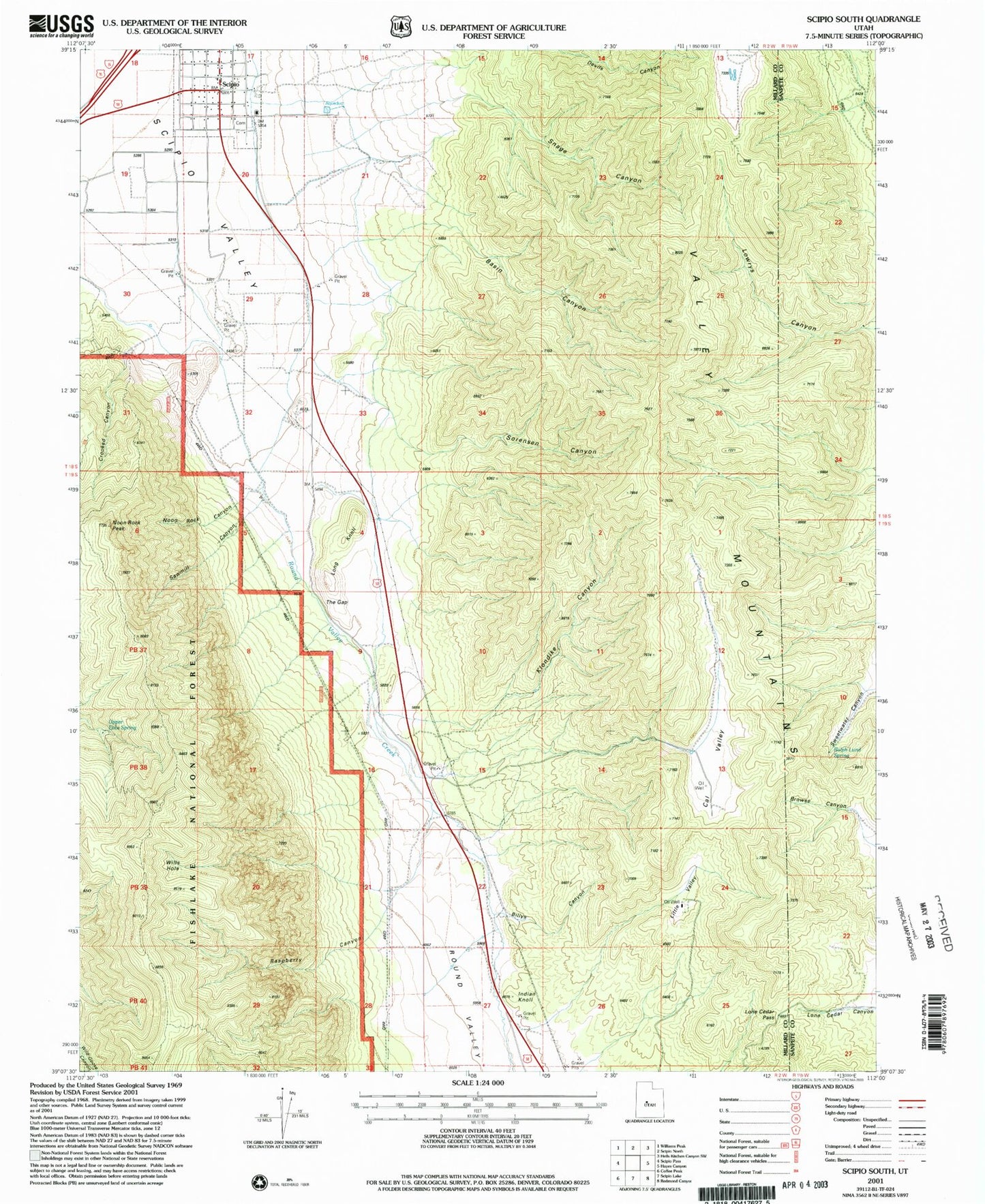
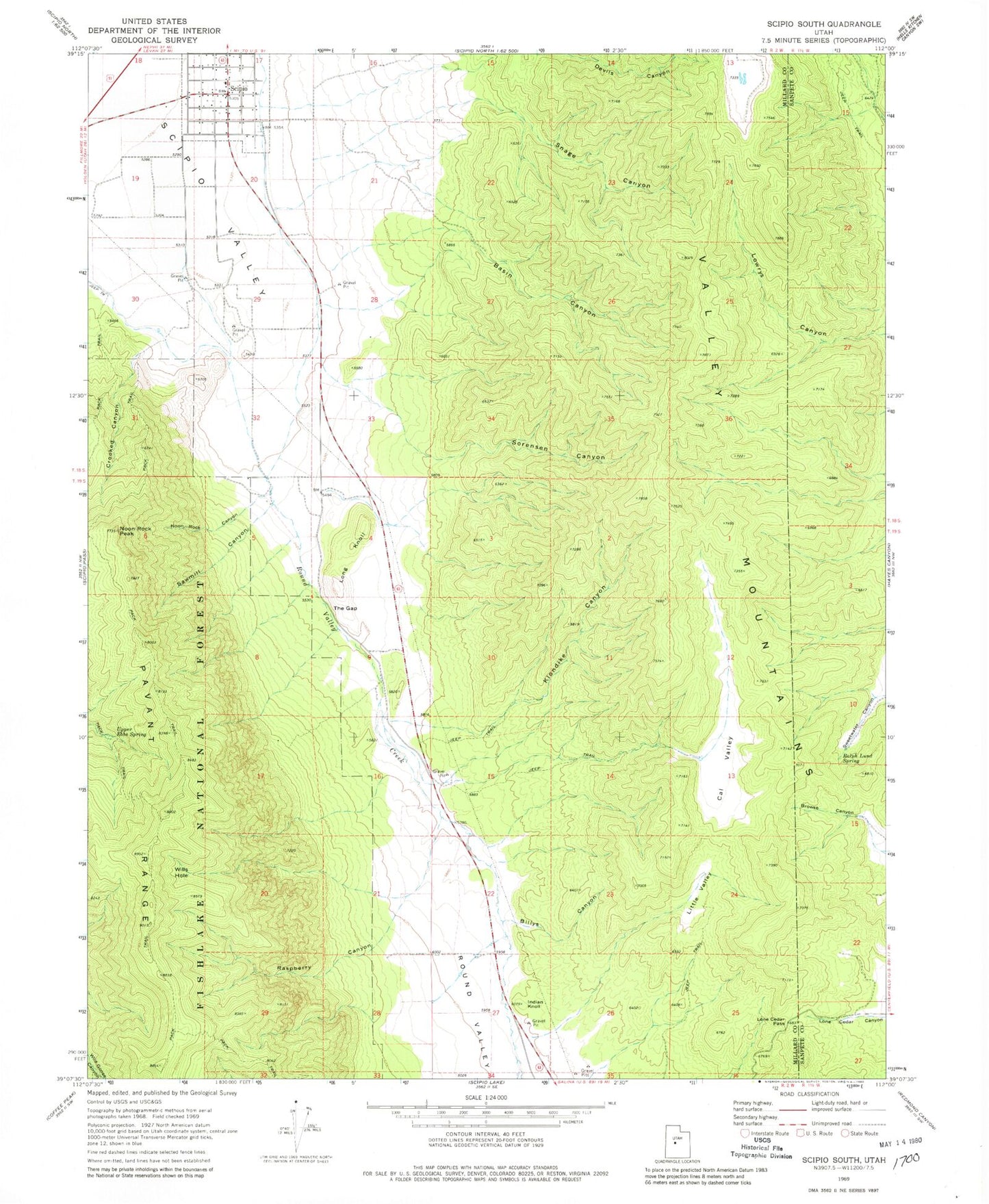
MyTopo
Classic USGS Scipio South Utah 7.5'x7.5' Topo Map
Couldn't load pickup availability
Historical USGS topographic quad map of Scipio South in the state of Utah. Map scale may vary for some years, but is generally around 1:24,000. Print size is approximately 24" x 27"
This quadrangle is in the following counties: Millard, Sanpete.
The map contains contour lines, roads, rivers, towns, and lakes. Printed on high-quality waterproof paper with UV fade-resistant inks, and shipped rolled.
Contains the following named places: Basin Canyon, Billys Canyon, Cal Valley, Crooked Canyon, Indian Knoll, Klondike Canyon, Little Valley, Lone Cedar Pass, Long Knoll, Lowrys Canyon, Noon Rock Canyon, Noon Rock Peak, Ralph Lund Spring, Raspberry Canyon, Round Valley, Round Valley Creek, Sawmill Canyon, Scipio, Scipio Ambulance Service, Scipio Fire Department, Scipio Pioneer Cemetery, Snage Canyon, Sorensen Canyon, Sweetwater Canyon, The Church of Jesus Christ of Latter Day Saints, The Gap, Town of Scipio, Upper Ebbs Spring, Wills Hole, ZIP Code: 84656