MyTopo
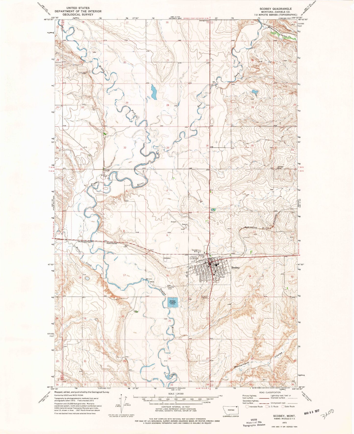
Classic USGS Scobey Montana 7.5'x7.5' Topo Map
Couldn't load pickup availability
Historical USGS topographic quad map of Scobey in the state of Montana. Map scale may vary for some years, but is generally around 1:24,000. Print size is approximately 24" x 27"
This quadrangle is in the following counties: Daniels.
The map contains contour lines, roads, rivers, towns, and lakes. Printed on high-quality waterproof paper with UV fade-resistant inks, and shipped rolled.
Contains the following named places: 35N48E01CCAA01 Well, 35N48E04ABCD01 Well, 35N48E05ACAC01 Well, 35N48E07BCCA01 Well, 35N48E07BCCA02 Well, 35N48E07DABA01 Well, 35N48E09ADAD01 Well, 35N48E09CCDC01 Well, 35N48E10BADD01 Well, 35N48E11CBCB01 Well, 35N48E11CBCC01 Well, 35N48E11CDDD01 Well, 35N48E13CDBC01 Well, 35N48E13CDBC02 Well, 35N48E13CDBC03 Well, 35N48E15ABAB01 Well, 35N48E15ADAB01 Well, 35N48E15CDBB01 Well, 35N48E16CBBD01 Well, 35N48E16CBCD01 Well, 35N48E16CBDC01 Well, 35N48E16CDAA01 Well, 35N48E20ABDC01 Well, 35N48E20ACAC01 Well, 35N48E20ACDB01 Well, 35N48E20CAAA01 Well, 35N48E20CAAA03 Well, 35N48E20CAAD__ Well, 35N48E22ABBB01 Well, 35N48E25CCCC01 Well, 35N48E28DAAA01 Well, 35N48E30BAAA01 Well, 35N48E30BAAC01 Well, 35N48E34ABBB01 Well, 36N44E25DDDD01 Well, 36N47E25DAAA01 Well, 36N47E25DAAA02 Well, 36N48E16CBBC01 Well, 36N48E16CBBC02 Well, 36N48E22ACC_01 Well, 36N48E22BAAD01 Well, 36N48E25CCDB01 Well, 36N48E27ABAB01 Well, 36N48E28ACDC01 Well, 36N48E30DADB01 Well, 36N48E31DBD_01 Well, 36N48E32BBCA01 Well, 36N48E32BBCD01 Well, 36N48E32BCBA01 Well, 36N48E33CCCA01 Well, 36N48E35BCCC01 Well, 36N48E35BCCD01 Well, 36N48E35DCCC01 Well, 36N48E35DCCD01 Well, Aasness Hospital, All Saints Mission, Assembly of God Church, Brenna Trailer Court, Butte Creek, City of Scobey, Dahlquist Hospital, Daniels County Courthouse, Daniels County Fairgrounds, Daniels County Farmers Elevator, Daniels County Library, Daniels County Museum, Daniels County Rural Fire Department, Daniels County Sheriff's Department, Daniels County Vision Clinic, Daniels Memorial Healthcare Center, Daniels Memorial Medical Clinic, Daniels Memorial Nursing Home, Daniels Post Office, East Fork Poplar River, Farmers Elevator, Harris Hospital, Holy Family Church, Humbert Hospital, Idenity Preserve Grain Company Elevator, Leibrands Trailer Court, Lions Campground, Middle Fork Poplar River, Nash Brothers Incorporated Feed and Grain Elevator, Olson Hospital, Plainsmen Field, Riv-R-Vu Drive-In, Roseland Park, Saint Philip Bonitus Catholic Church, Scobey, Scobey Airport, Scobey Alliance Church, Scobey Cemetery, Scobey Golf Course, Scobey Lutheran Church, Scobey Police Department, Scobey Post Office, Scobey School, Scobey Sewage Disposal Ponds Dam, Scobey Volunteer Fire Department, Shannon Coulee, United Methodist Church, Wood Mountain Trail Historical Marker