MyTopo
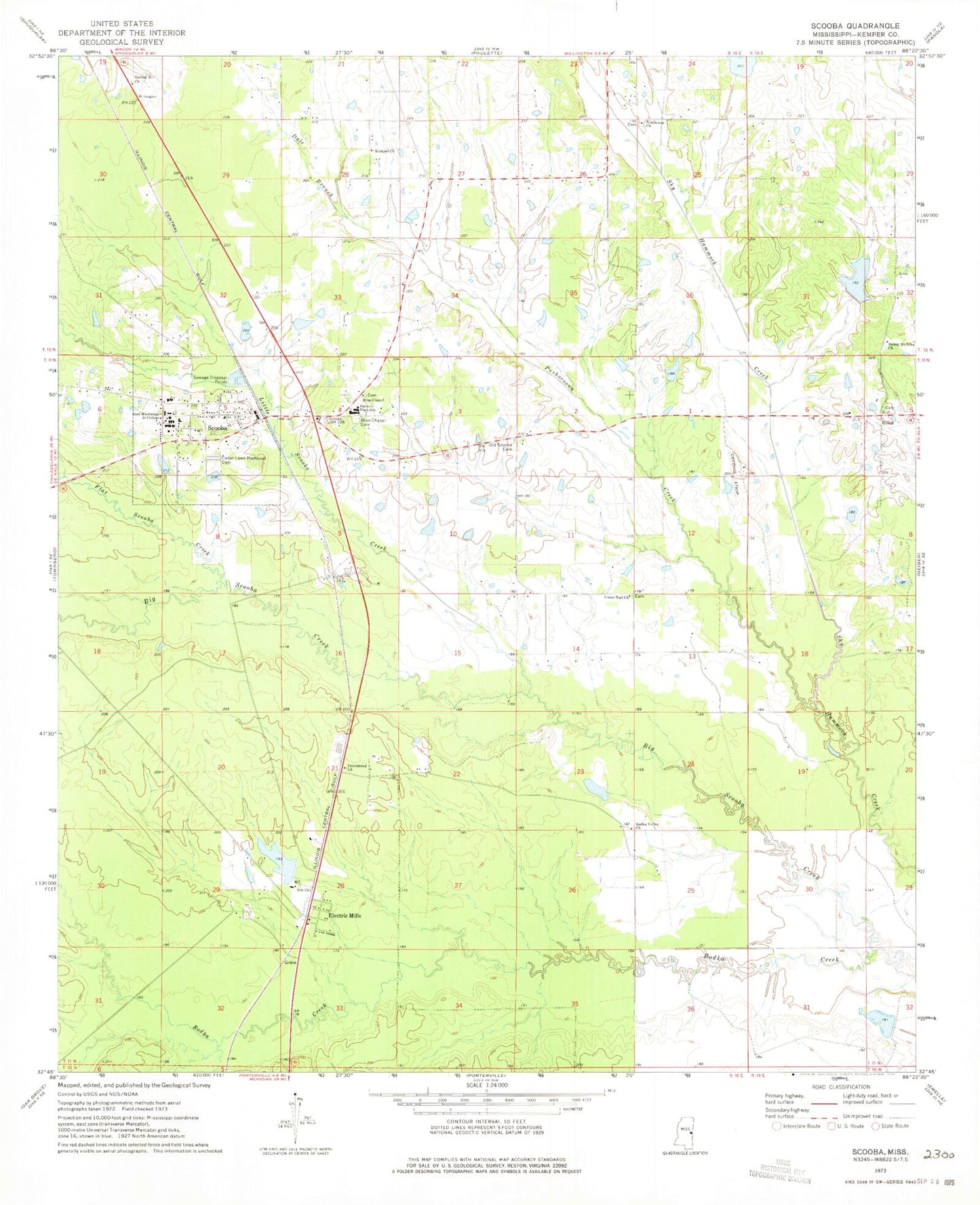
Classic USGS Scooba Mississippi 7.5'x7.5' Topo Map
Couldn't load pickup availability
Historical USGS topographic quad map of Scooba in the state of Mississippi. Map scale may vary for some years, but is generally around 1:24,000. Print size is approximately 24" x 27"
This quadrangle is in the following counties: Kemper.
The map contains contour lines, roads, rivers, towns, and lakes. Printed on high-quality waterproof paper with UV fade-resistant inks, and shipped rolled.
Contains the following named places: 3 Mile Corner Volunteer Fire Department, Big Scooba Creek, Blue Chapel, Blue Chapel Cemetery, Bodka Valley Church, Carlton Fleming Pond Dam, Cedar Lawn Memorial Cemetery, Dale Branch, East Kemper Elementary School, Electric Mills, Flat Scooba Creek, Giles, Giles Airport, Giles Cemetery, Hatchette, Kemper Church, Larry Bell Pond Dam, Little Scooba Creek, Odessa Briggs Pond Dam, Old Scooba, Old Scooba Cemetery, Providence Church, Pushacoona Creek, Scooba, Scooba Post Office, Scooba Volunteer Fire Department, Shammack Creek Structure 2 Dam, Spencer High School, Spring Hill Church, Sunflower Church, Sunny Mount Giles Church, Supervisor District 1, Town of Scooba, Union Hall Church, Weyerhauser Lumber Company Pond Dam