MyTopo
Classic USGS Scooteney Reservoir Washington 7.5'x7.5' Topo Map
Couldn't load pickup availability
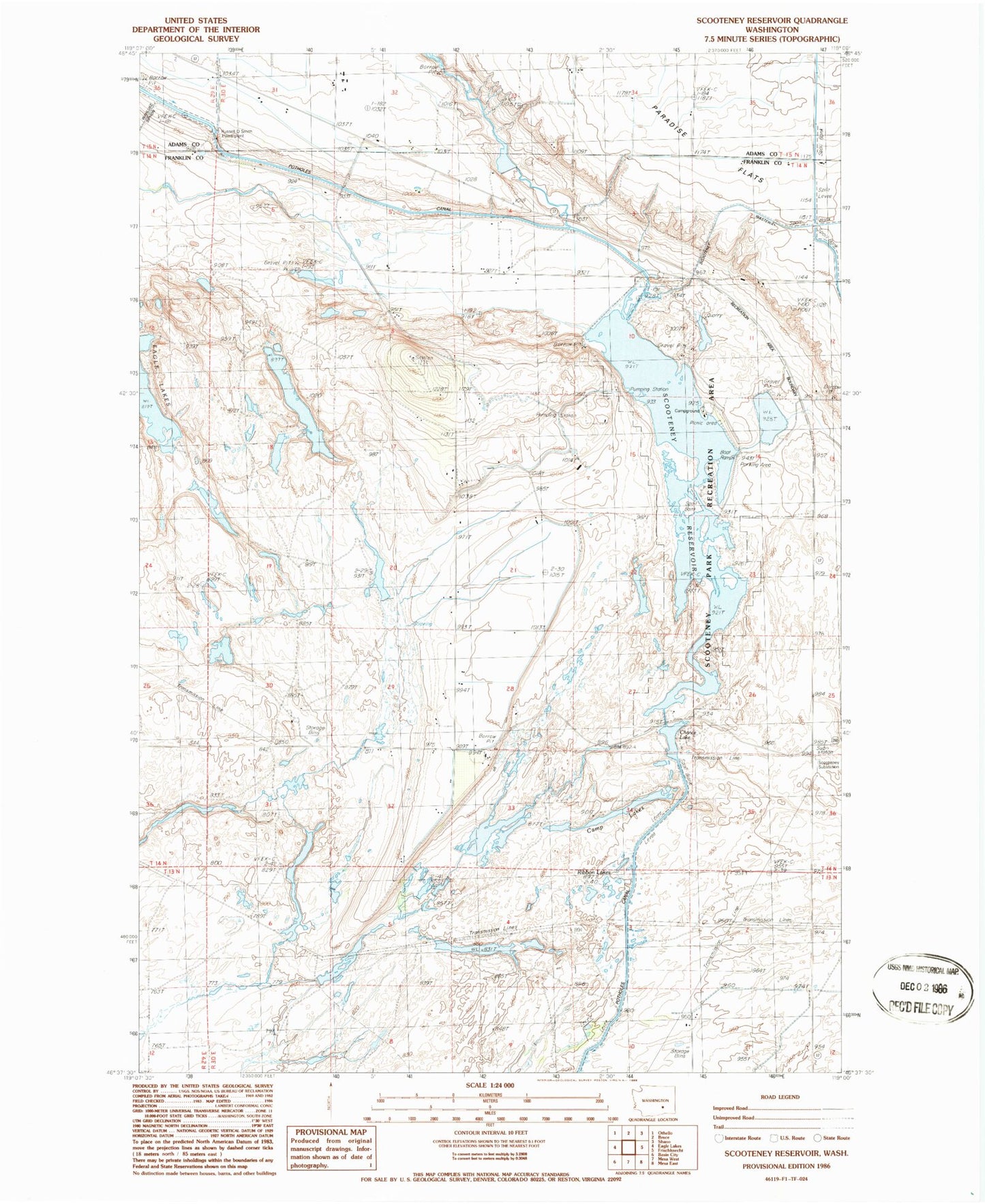
Historical USGS topographic quad map of Scooteney Reservoir in the state of Washington. Map scale may vary for some years, but is generally around 1:24,000. Print size is approximately 24" x 27"
This quadrangle is in the following counties: Adams, Franklin.
The map contains contour lines, roads, rivers, towns, and lakes. Printed on high-quality waterproof paper with UV fade-resistant inks, and shipped rolled.
Contains the following named places: Bernsen Dam, Camp Lakes, Chance Lake, Connell Division, North Scooteney Dike Dam, Potholes Canal, Powerline Reservoir, Ribbon Lakes, Russel D Smith Powerplant, Scooteney Park Recreation Area, Scooteney Reservoir, Scooteney Substation, Snakebite Reservoir, Snakebite Reservoir Dam