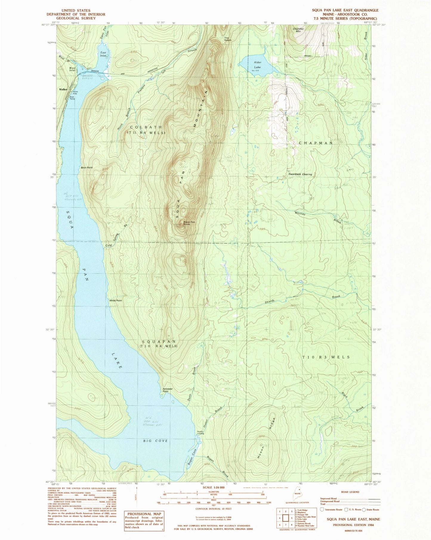
MyTopo
Classic USGS Scopan Lake East Maine 7.5'x7.5' Topo Map
Couldn't load pickup availability
Historical USGS topographic quad map of Scopan Lake East in the state of Maine. Typical map scale is 1:24,000, but may vary for certain years, if available. Print size: 24" x 27"
This quadrangle is in the following counties: Aroostook.
The map contains contour lines, roads, rivers, towns, and lakes. Printed on high-quality waterproof paper with UV fade-resistant inks, and shipped rolled.
Contains the following named places: Alder Lake, Big Cove, Birch Point, Bogan Brook, Cold Spring Brook, Dunn Brook, Huson Brook, Huson Ridge, Scopan Inlet, Scopan Lake, Scopan Mountain, Scopan Knob, Swanback Clearing, Sylvester Point, The Notch, West Branch Scopan Inlet, White Point, Huson Landing, Walker, Squapan Fire Tower (historical), Bogan Cove, East Inlet, West Inlet, T11 R4 WELS, Township of Scopan