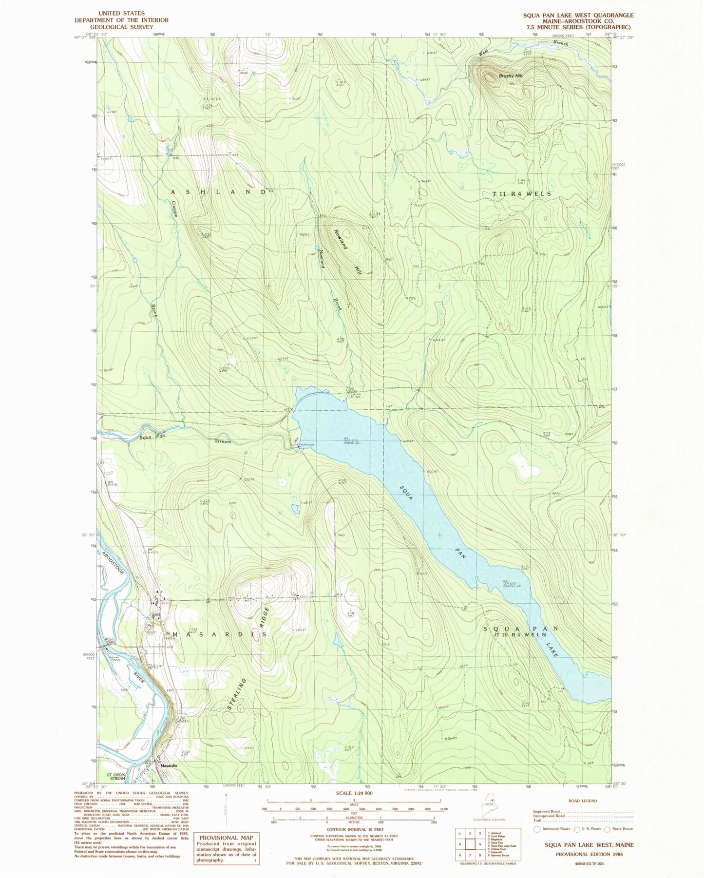
MyTopo
Classic USGS Scopan Lake West Maine 7.5'x7.5' Topo Map
Regular price
$16.95
Regular price
Sale price
$16.95
Unit price
per
Couldn't load pickup availability
Historical USGS topographic quad map of Scopan Lake West in the state of Maine. Map scale may vary for some years, but is generally around 1:24,000. Print size is approximately 24" x 27"
This quadrangle is in the following counties: Aroostook.
The map contains contour lines, roads, rivers, towns, and lakes. Printed on high-quality waterproof paper with UV fade-resistant inks, and shipped rolled.
Contains the following named places: Brushy Hill, Clayton Brook, Masardis, Masardis Post Office, Masardis Volunteer Fire Department, Midway Siding, Nowland Brook, Nowland Hill, Nowland Siding, Old Dam Tote Road, Saint Croix Stream, Smith Cemetery, Squapan Dam, Sterling Ridge, Town of Masardis