MyTopo
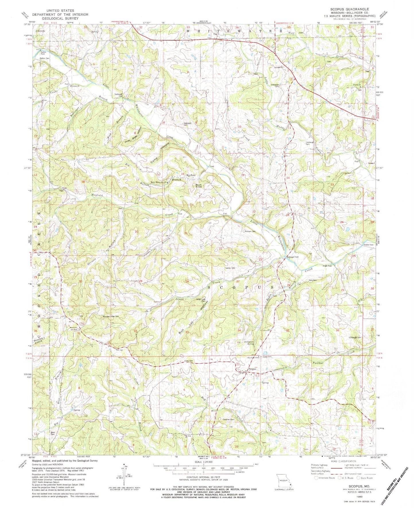
Classic USGS Scopus Missouri 7.5'x7.5' Topo Map
Couldn't load pickup availability
Historical USGS topographic quad map of Scopus in the state of Missouri. Map scale may vary for some years, but is generally around 1:24,000. Print size is approximately 24" x 27"
This quadrangle is in the following counties: Bollinger.
The map contains contour lines, roads, rivers, towns, and lakes. Printed on high-quality waterproof paper with UV fade-resistant inks, and shipped rolled.
Contains the following named places: Angle Ford, Baker Branch, Bess Cemetery, Big Hollow Branch, Bollinger Branch, Bollinger Ford, Bollinger School, Buck Knob, Bull Lot Hollow, Camp Hollow, Cedar Branch School, Cheek Creek, Chostner Cemetery, Church of Christ, Coles Cemetery, Coles School, Cook Cemetery, Cooks Branch, Dalton Cemetery, Dalton Ford, Fish Branch, German Branch, Holt Cemetery, James Cemetery, James Creek, James School, Kinder Ford, Limbaugh Cemetery, Limbaugh School, Little Whitewater Church, Lona Lou Lake, Lona Lou Lake Dam, Mayfield, Mayfield Creek, Mount Zion Church, Mountain View Cemetery, North County Fire Protection District Station 1, Old Pulliam - Judge Long Cemetery, Otter Slide Hollow, Pulliam Cemetery, Scopus, Seabaugh Cemetery, Seabaugh Ford, Seabaugh School, Sedgewickville Fire Protection District Station 2, Smith School, Stillhouse Spring, Township of Scopus, Trinity Church, Yantz Branch