MyTopo
Classic USGS Scotland Indiana 7.5'x7.5' Topo Map
Couldn't load pickup availability
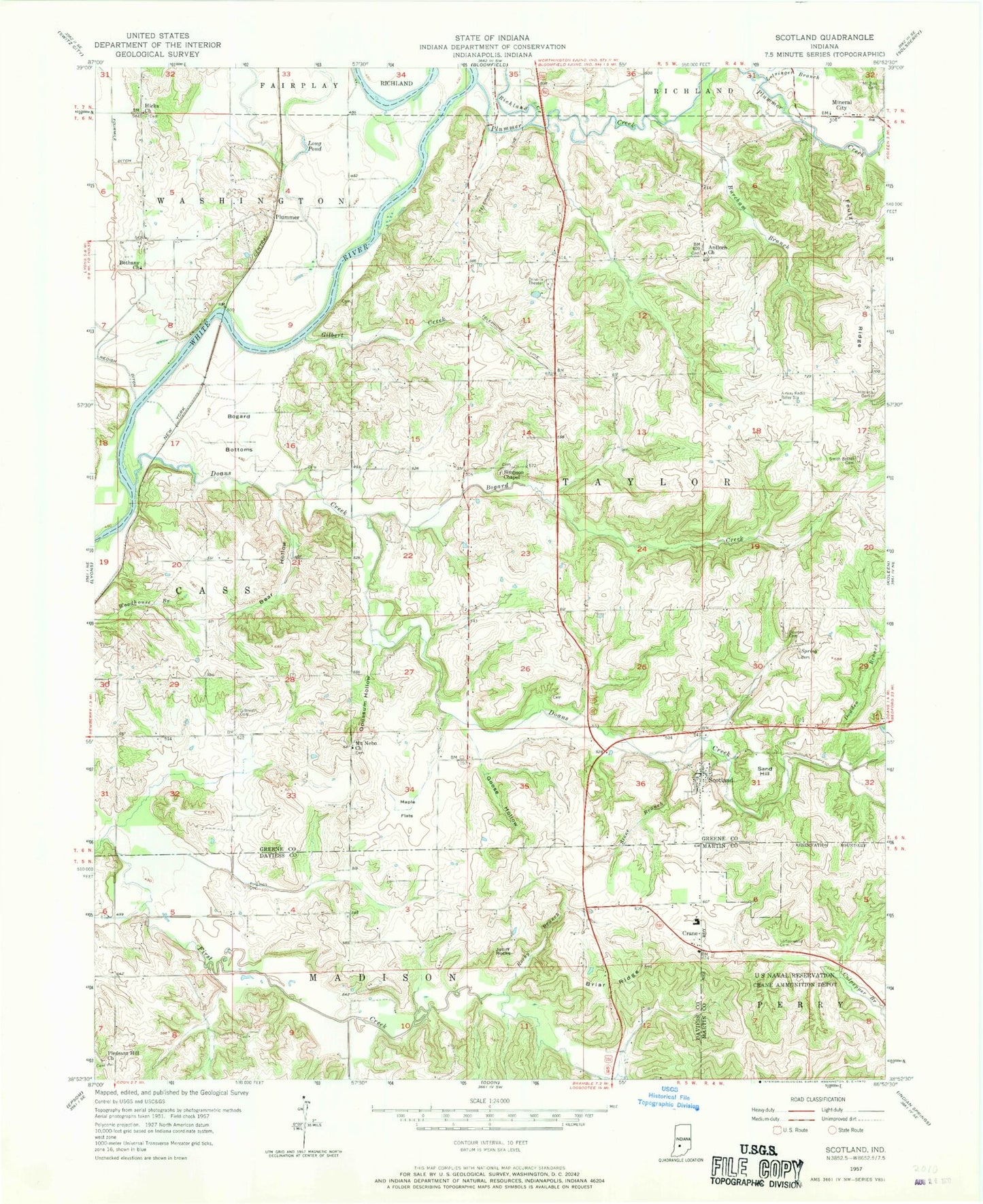
Historical USGS topographic quad map of Scotland in the state of Indiana. Map scale may vary for some years, but is generally around 1:24,000. Print size is approximately 24" x 27"
This quadrangle is in the following counties: Daviess, Greene, Martin.
The map contains contour lines, roads, rivers, towns, and lakes. Printed on high-quality waterproof paper with UV fade-resistant inks, and shipped rolled.
Contains the following named places: Antioch Church, Bear Hollow, Bethany Church, Bogard Bottoms, Bogard Creek, Briar Ridge, Burcham Branch, Crane, Crane Post Office, Culpepper Brook, Doans Creek, Dowden Branch, Dowden Cemetery, Dutch Cemetery, Ferguson Cemetery, Feutz Ridge, Gilbert Creek, Gilbreath Cemetery, Goose Hollow, Hicks Church, Jolliff Rocks, Ledgerwood Cemetery, Letsinger Branch, Long Pond, Maple Flats, Mineral City, Mount Nebo Church, Mount Nebo Church Cemetery, Mount Zion Cemetery, Naval Surface Warfare Center Crane Division Fire Department, Opossum Hollow, Pleasant Hill Church, Plummer, Plummer Creek, Richland Creek, Richland Taylor Fire Department, Rocky Branch, Sand Hill, Scotland, Scotland Census Designated Place, Simpson Chapel, Simpson Chapel Cemetery, Smith - Bethel Cemetery, Stone Branch, Town of Crane, Township of Taylor, ZIP Code: 47457