MyTopo
Classic USGS Scotland South Dakota 7.5'x7.5' Topo Map
Couldn't load pickup availability
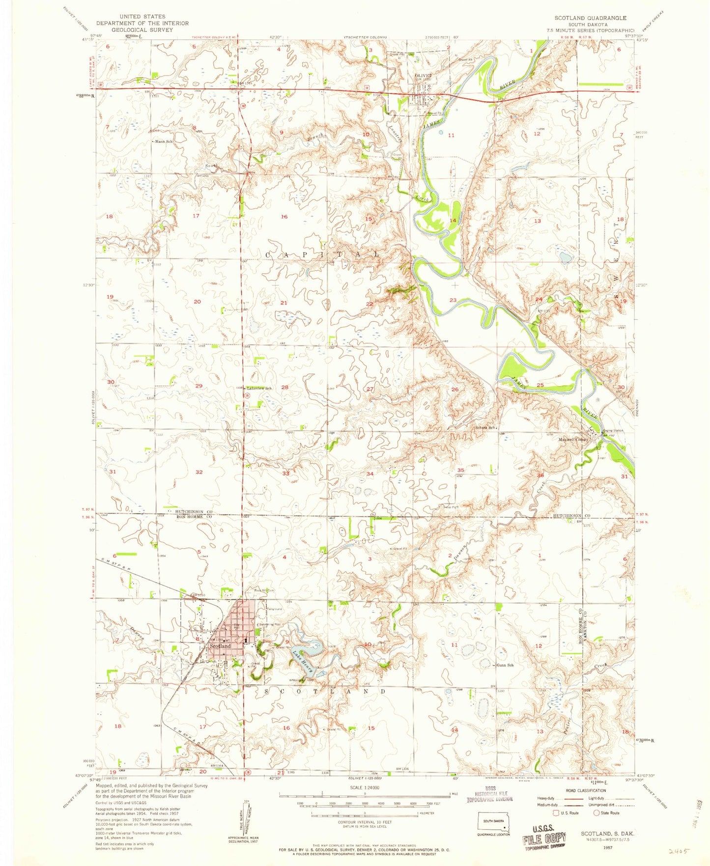
Historical USGS topographic quad map of Scotland in the state of South Dakota. Map scale may vary for some years, but is generally around 1:24,000. Print size is approximately 24" x 27"
This quadrangle is in the following counties: Bon Homme, Hutchinson, Yankton.
The map contains contour lines, roads, rivers, towns, and lakes. Printed on high-quality waterproof paper with UV fade-resistant inks, and shipped rolled.
Contains the following named places: Burke Field, City of Scotland, Dawson Creek, Gunn School, Henry Dam, Hutchinson County Courthouse, Hutchinson County Sheriff's Office, Lake Henry, Lakeview School, Landmann - Jungman Memorial Hospital, Lonetree Creek, Mann School, Maxwell Colony, Maxwell Colony Census Designated Place, Maxwell Colony Elementary School, Olivet, Olivet Post Office, Rose Hill Cemetery, Saint George Catholic Cemetery, Schatz School, Scotland, Scotland City Hall, Scotland Community Ambulance Service, Scotland Community Library, Scotland Elementary School, Scotland Fire Department, Scotland High School, Scotland Middle School, Scotland Police Department, Scotland Post Office, South Branch Lonetree Creek, Town of Olivet, Township of Capital, Township of Olivet, Township of Scotland