MyTopo
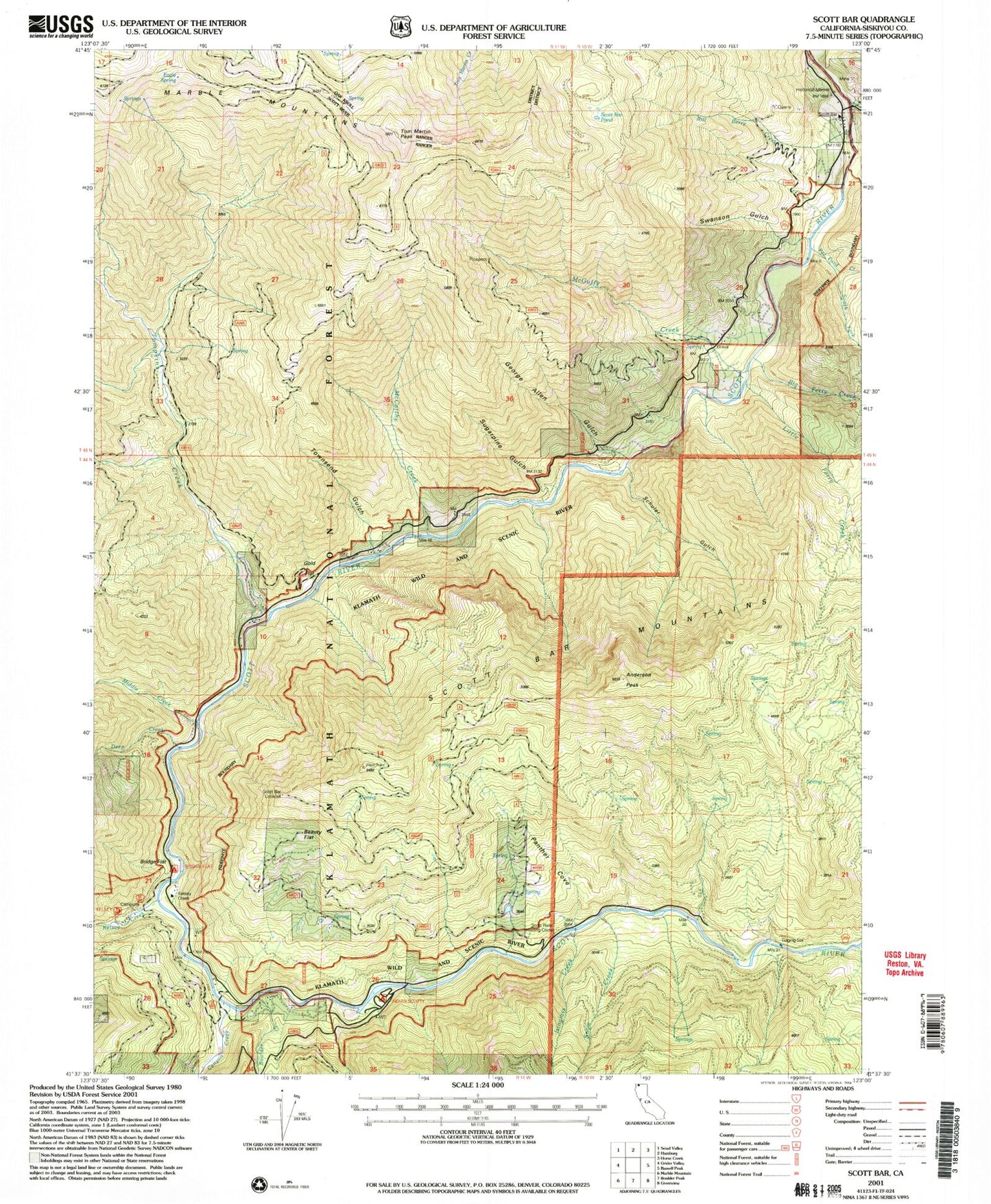
Classic USGS Scott Bar California 7.5'x7.5' Topo Map
Couldn't load pickup availability
Historical USGS topographic quad map of Scott Bar in the state of California. Map scale may vary for some years, but is generally around 1:24,000. Print size is approximately 24" x 27"
This quadrangle is in the following counties: Siskiyou.
The map contains contour lines, roads, rivers, towns, and lakes. Printed on high-quality waterproof paper with UV fade-resistant inks, and shipped rolled.
Contains the following named places: Anderson Peak, Beauty Flat, Big Ferry Creek, Bill Berry Creek, Boulder Creek, Bridge Flat, Bridge Flat Campground, Canyon Creek, Deep Creek, Eagle Spring, Eagle Spring Camp, George Allen Gulch, Gold Flat, Indian Scotty Campground, Isinglass Creek, Jones Beach Picnic Area, Kelsey Camp, Kelsey Creek, Kelsey Creek Guard Station, Little Ferry Creek, McCarthy Creek, McGuffy Creek, Middle Creek, Middle Creek Camp, Mill Creek, Panther Cove, Panther Creek, Panther Gulch, Pat Ford Creek, Peregrine Creek, Peregrine Gulch, Schuler Gulch, Scott Bar, Scott Bar Forest Service Station, Scott Bar Lookout, Scott Bar Pond, Scott Bar Post Office, Scott River Holding Corral, Scotts Bar Cemetery, Snow Creek, South Fork Pat Ford Creek, Spring Flat Campground, Sugarpine Gulch, Swanson Gulch, Tom Martin Peak, Tompkins Creek, Townsend Gulch, Tunnel Mine, Whites Stage Station, Wooliver Creek, ZIP Code: 96085