MyTopo
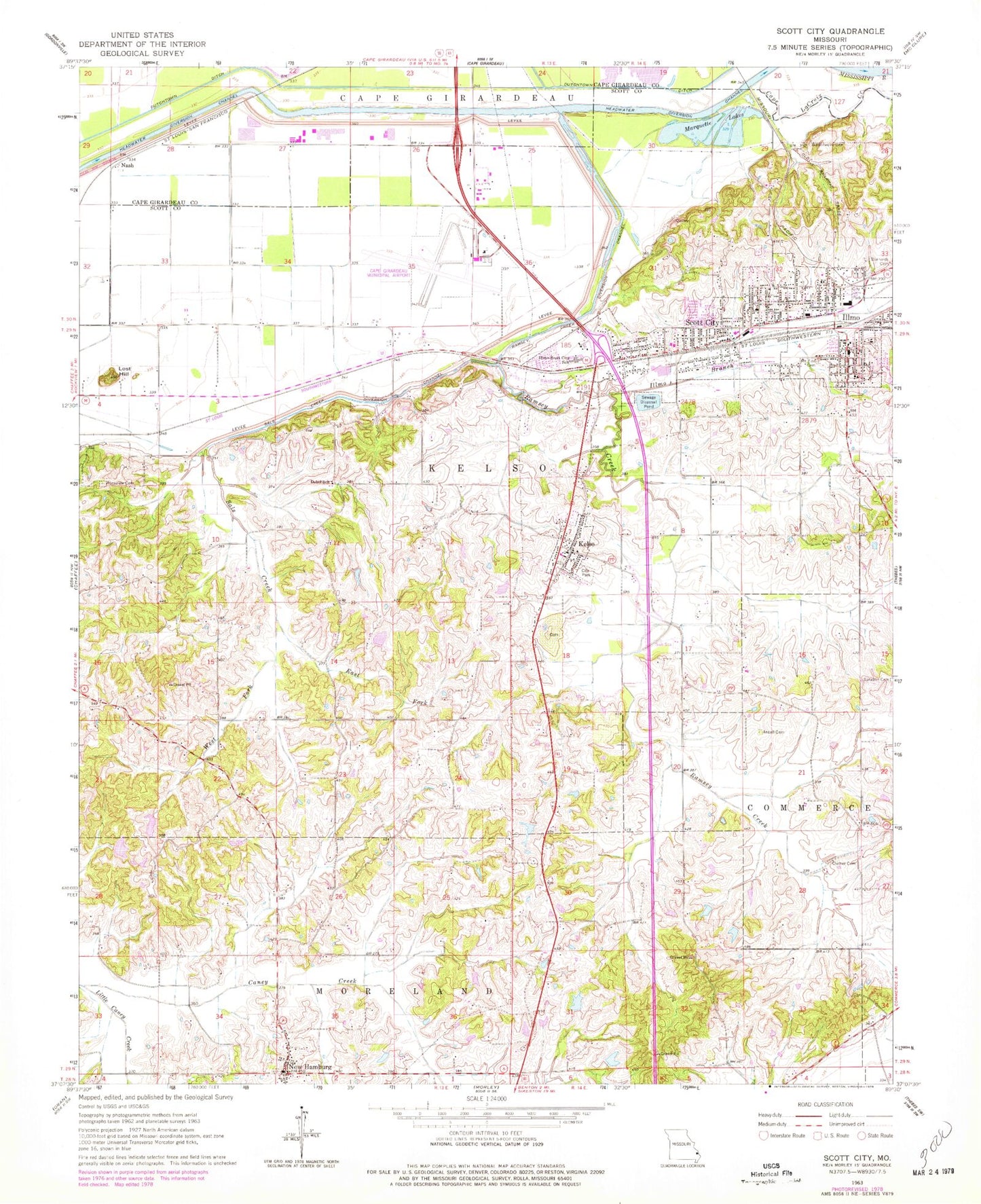
Classic USGS Scott City Missouri 7.5'x7.5' Topo Map
Couldn't load pickup availability
Historical USGS topographic quad map of Scott City in the state of Missouri. Map scale may vary for some years, but is generally around 1:24,000. Print size is approximately 24" x 27"
This quadrangle is in the following counties: Cape Girardeau, Scott.
The map contains contour lines, roads, rivers, towns, and lakes. Printed on high-quality waterproof paper with UV fade-resistant inks, and shipped rolled.
Contains the following named places: Ancell Cemetery, Anton Niederkorn Dam, Bonhardt Cemetery, Cape Girardeau Regional Airport, City of Scott City, Clymer Cemetery, Debol School, Diebold Orchards Lake Section 13, Diebold Orchards Section 13 Dam, Diebold Orchards Section 14 Dam, Diebold Orchards Section 14 Lake, Draper Lake, Draper Lake Dam, Dutchtown Ditch, East Fork Sals Creek, Eisleben Church, Hilltop, Illmo, Illmo Branch, Illmo-Scott City School, Kaechels, Kelso, Kelso Post Office, Little Caney Creek, Lost Hill, Marquette Lakes, Massey, Mothershead Lake, Mothershead Lake Dam, Mount Zion Cemetery, Nash, New Hamburg, New Hamburg Census Designated Place, Niederkorn Lake, Pleasant Hill Church, Pleasant Hill School, Ramsey Branch, Ramsey Creek, Ramsey Creek Diversion Channel, Rockview Cemetery, Saint Lawrence Church, Sals Creek, Sals Creek Diversion Channel, Scott City, Scott City Fire Department, Scott City Police Department, Scott City Post Office, Shearer School, Township of Kelso, Village of Kelso, West Fork Sals Creek, Westerwell Cemetery, ZIP Codes: 63758, 63780