MyTopo
Classic USGS Scott Creek Idaho 7.5'x7.5' Topo Map
Couldn't load pickup availability
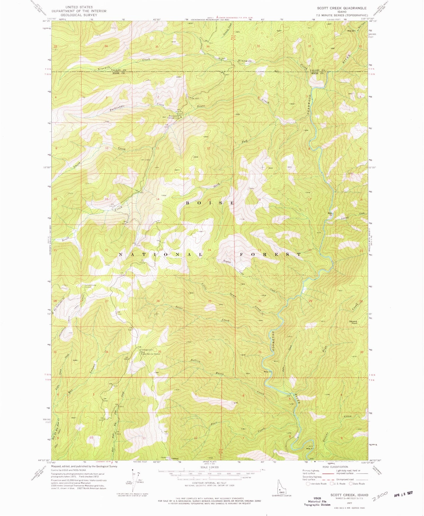
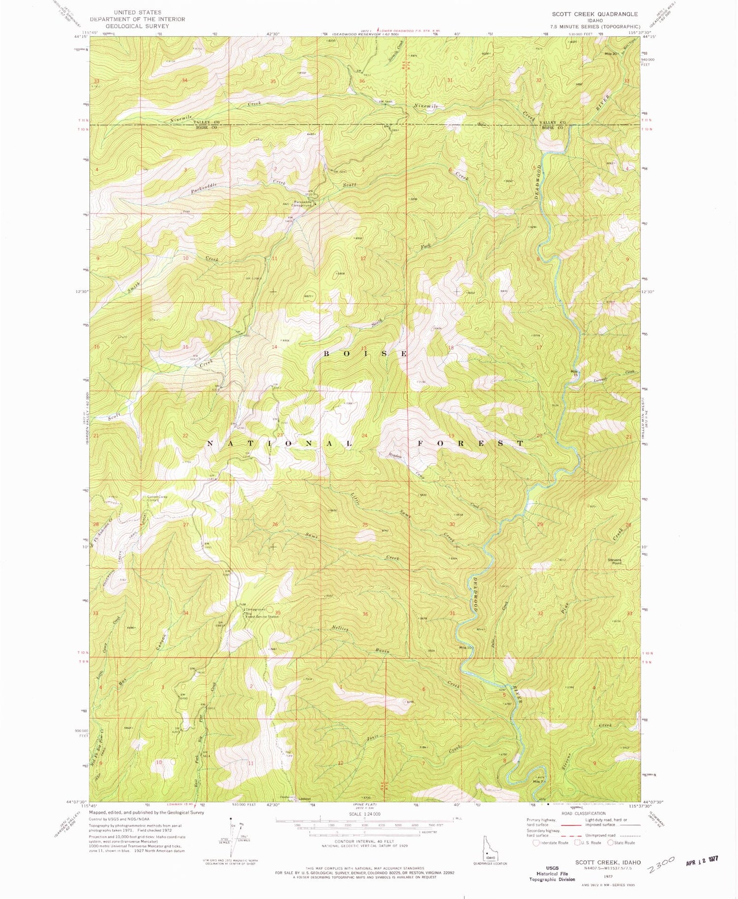
Historical USGS topographic quad map of Scott Creek in the state of Idaho. Map scale may vary for some years, but is generally around 1:24,000. Print size is approximately 24" x 27"
This quadrangle is in the following counties: Boise, Valley.
The map contains contour lines, roads, rivers, towns, and lakes. Printed on high-quality waterproof paper with UV fade-resistant inks, and shipped rolled.
Contains the following named places: Bog Forest Service Station, Box Canyon, Center Camp Corrals, Josie Creek, Julie Creek, Little Sams Creek, Lorenzo Creek, Meadow Camp Creek, Nellies Basin Creek, Ninemile Creek, No Man Creek, Packsaddle Campground, Packsaddle Creek, Pine Creek, Sams Creek, Scott Creek, Smith Creek, South Fork Scott Creek, Stevens Point