MyTopo
Classic USGS Scott Arkansas 7.5'x7.5' Topo Map
Couldn't load pickup availability
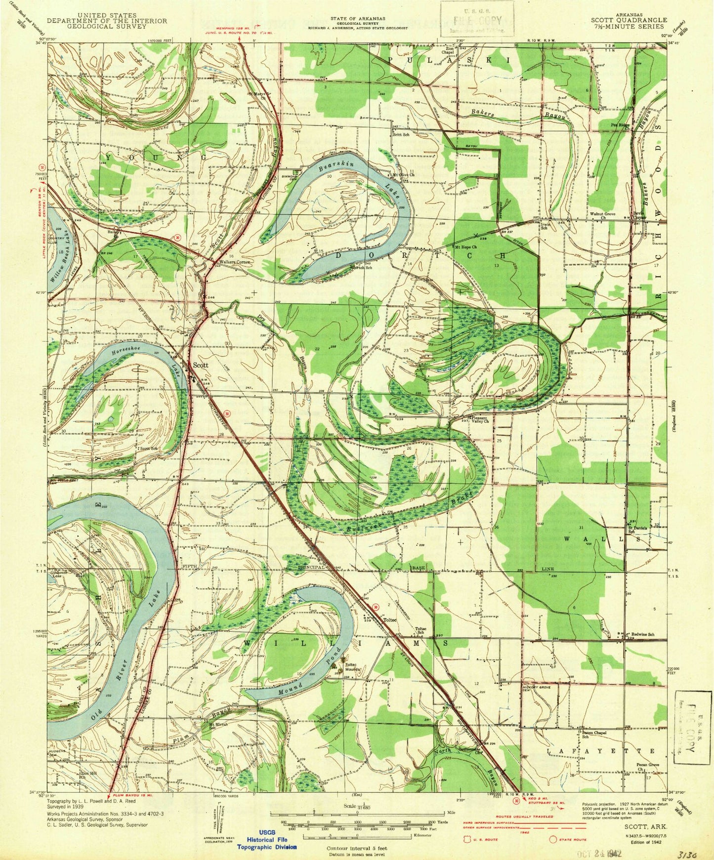
Historical USGS topographic quad map of Scott in the state of Arkansas. Map scale may vary for some years, but is generally around 1:24,000. Print size is approximately 24" x 27"
This quadrangle is in the following counties: Lonoke, Pulaski.
The map contains contour lines, roads, rivers, towns, and lakes. Printed on high-quality waterproof paper with UV fade-resistant inks, and shipped rolled.
Contains the following named places: All Souls Rest Cemetery, Ashley Bayou, Bailey Church, Banes Chapel, Bearskin Lake, Bevis Corner, Britt School, Bullneck Brake, Campbells Store, Cobbs, Country Club, Dooley Bend, Dortch Bend, Dortchs Store, Dry Bayou, Eanes Minnow Farm Lake Number One, Eanes Minnow Farm Lake Number One Dam, Eanes Minnow Farm Lake Number Two, Eanes Minnow Farm Lake Number Two Dam, Gates Store, Hamiter, Hickory Grove Cemetery, Hickory Grove Church, Horseshoe Lake, Hubbs Store, Hudgens Cemetery, Le Grande Cemetery, Luebke Fish Farm, Mound Lake, Mound Lake Dam, Mound Pond, Mount Hope Church, Mount Mirrah School, Mount Moriah Cemetery, Mount Moriah Church, Mount Olive Church, Old River Lake, Pea Ridge Cemetery, Pea Ridge Church, Pecan Grove School, Pleasant Grove Church, Pleasant Valley Church, R V Stewart Field, Scott, Scott Bayou, Scott Census Designated Place, Scott Charter School, Scott Fire Protection District 8 and 18, Scott Post Office, Simmons Cemetery, Snow Brake, Steele Bend, Toltec, Toltec Church, Toltec Mounds, Toltec Mounds State Park, Township of Dortch, Township of Williams, Township of Young, Wabbel, Walkers Corner, Walnut Grove Church, Walts Store, Willow Beach Lake, Willow Belle, Witherspoon School, Zion Chapel, Zion Hill Church, ZIP Code: 72142