MyTopo
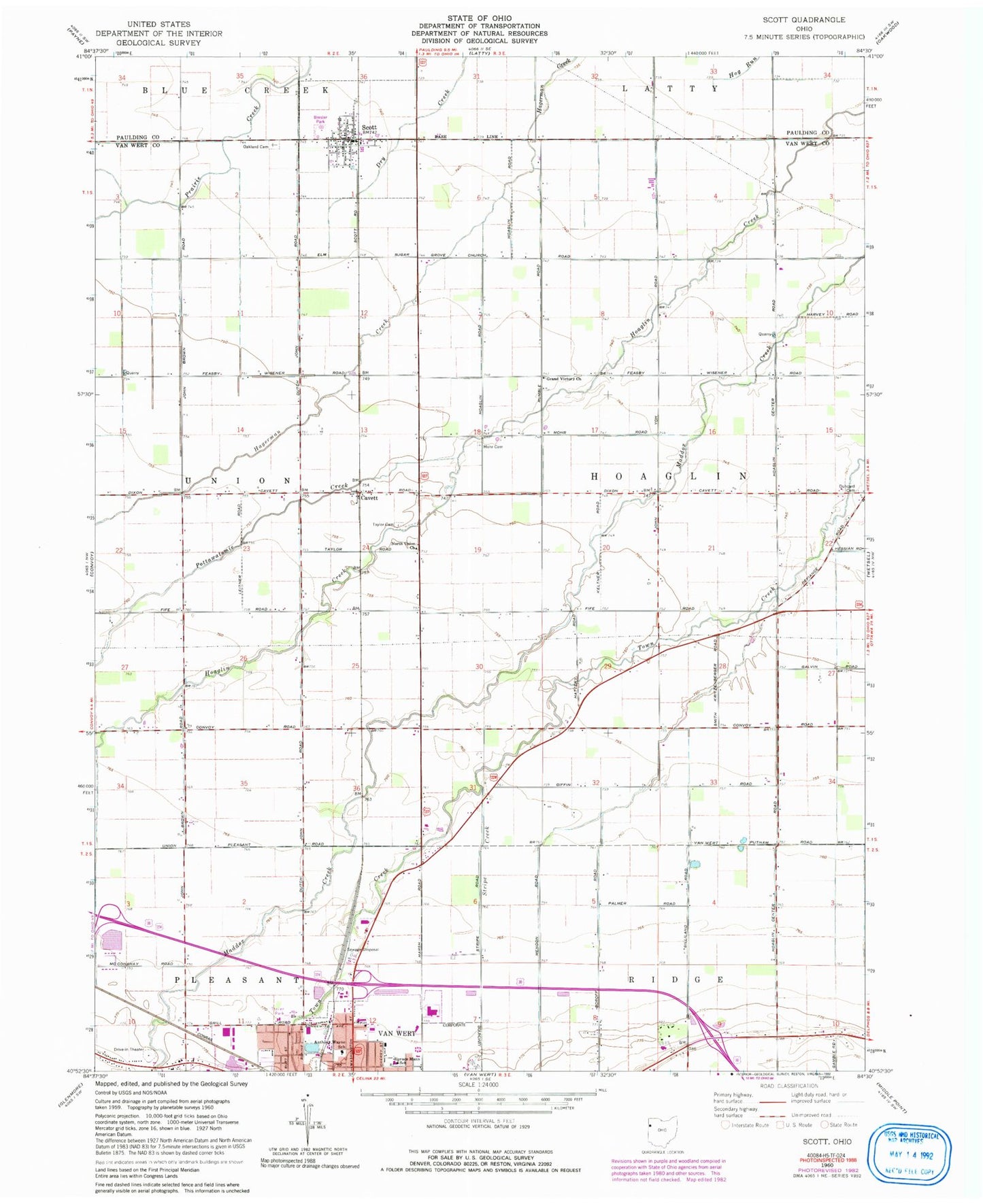
Classic USGS Scott Ohio 7.5'x7.5' Topo Map
Couldn't load pickup availability
Historical USGS topographic quad map of Scott in the state of Ohio. Map scale may vary for some years, but is generally around 1:24,000. Print size is approximately 24" x 27"
This quadrangle is in the following counties: Paulding, Van Wert.
The map contains contour lines, roads, rivers, towns, and lakes. Printed on high-quality waterproof paper with UV fade-resistant inks, and shipped rolled.
Contains the following named places: Anthony Wayne Elementary School, Bresler Park, Briarwood Court, C B J Farms, Cavett, Cavett Post Office, Duncard Cemetery, Foust School, Gordons Trailer Court, Grand Victory Church, Horace Mann Elementary School, Jubilee Park, K C Farms, Kimart Farms, Lehman Farms, Mohr Cemetery, Myers Farms, North Union Church, Northwood Mobile Home Court, Oakland Cemetery, Pottawatomie Creek, Schaffner Farms, School Number 1, School Number 2, School Number 5, School Number 6, School Number 7, School Number 8, Scott, Scott Post Office, Scott Volunteer Fire Department, Stripe Creek, Taylor Cemetery, Thomas Edison Elementary School, Township of Hoaglin, Tri Sis Farm, Tyas Farm, Van Wert Sewage Treatment Plant, Vantage Joint Vocational School, Village of Scott, Vineyard Christian Fellowship Church, Wesley Park, Wilmore Ditch, ZIP Code: 45886