MyTopo
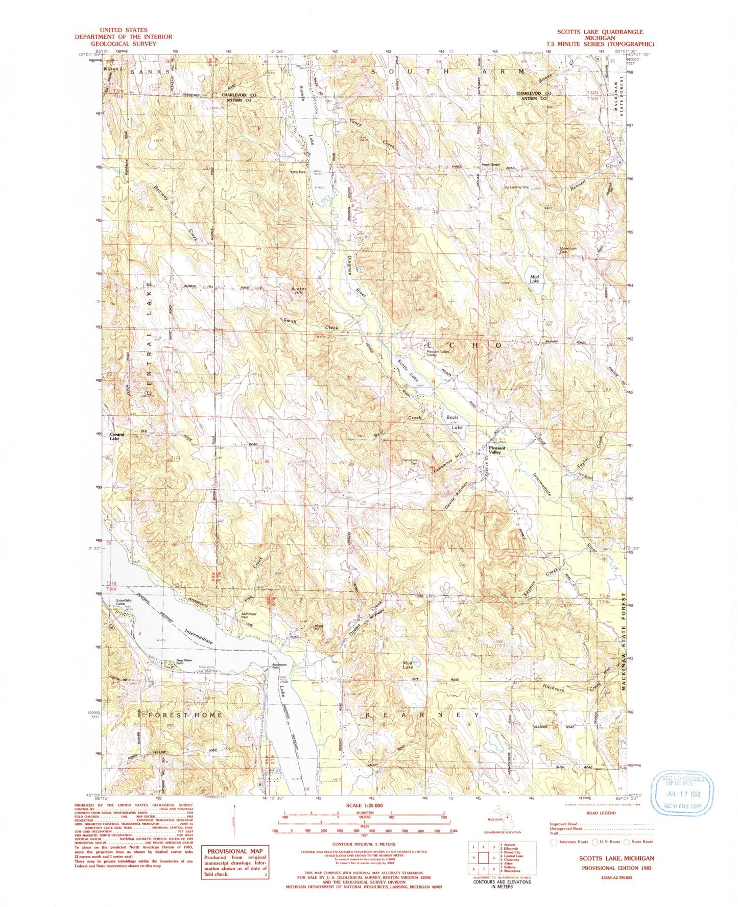
Classic USGS Scotts Lake Michigan 7.5'x7.5' Topo Map
Couldn't load pickup availability
Historical USGS topographic quad map of Scotts Lake in the state of Michigan. Map scale may vary for some years, but is generally around 1:24,000. Print size is approximately 24" x 27"
This quadrangle is in the following counties: Antrim, Charlevoix.
The map contains contour lines, roads, rivers, towns, and lakes. Printed on high-quality waterproof paper with UV fade-resistant inks, and shipped rolled.
Contains the following named places: Antrim County, Beal Creek, Beals Lake, Benway Creek, Bunker Hill, Chain O Lakes Presbyterian Church, Congregational Church, Deep Water Point, Densmore Cemetery, Dingle Hill, Dingman River, Echo Park, Echo Post Office, Fisk Creek, Flewelling Cemetery, Intermediate Lake, Mohrmann Park, Morehouse Cemetery, Mud Lake, Openo Creek, Pleasant Valley, Pleasant Valley Camp, Pleasant Valley Free Methodist Church, Recreation Point, Scotts Lake, Seamon Creek, Sixmile Lake, Smith Creek, Snowflake, Snowflake Camp, Snowflake Post Office, Snowflake Station, Spence Creek, Taylor Creek, Township of Echo, Vance Chapel, Vance Creek, Zig Landing Strip