MyTopo
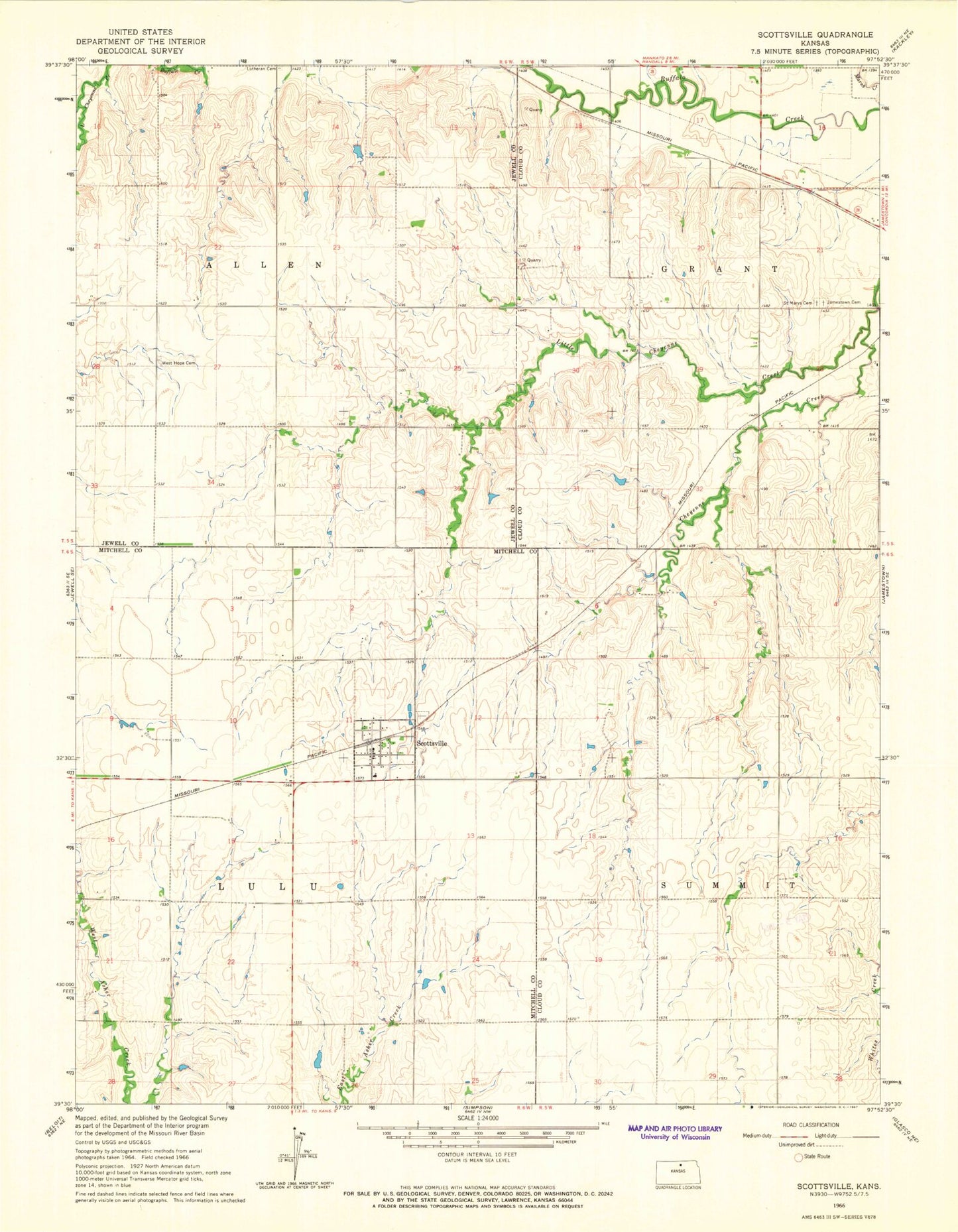
Classic USGS Scottsville Kansas 7.5'x7.5' Topo Map
Couldn't load pickup availability
Historical USGS topographic quad map of Scottsville in the state of Kansas. Map scale may vary for some years, but is generally around 1:24,000. Print size is approximately 24" x 27"
This quadrangle is in the following counties: Cloud, Jewell, Mitchell.
The map contains contour lines, roads, rivers, towns, and lakes. Printed on high-quality waterproof paper with UV fade-resistant inks, and shipped rolled.
Contains the following named places: Agmark Grain Elevator Number 16, City of Scottsville, Jamestown Cemetery, Little Cheyenne Creek, Lovseth Cemetery, Mitchell County Rural Fire District 1 Scottsville Station, Saint Marys Catholic Cemetery, Scottsville, Scottsville Cemetery, Summit 3 Cemetery, Township of Allen, Township of Grant, Township of Lulu, West Hope Cemetery