
MyTopo
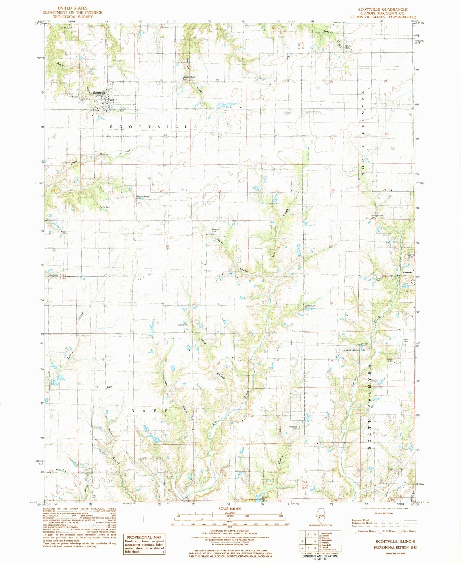
Classic USGS Scottville Illinois 7.5'x7.5' Topo Map
Couldn't load pickup availability
Historical USGS topographic quad map of Scottville in the state of Illinois. Map scale may vary for some years, but is generally around 1:24,000. Print size is approximately 24" x 27"
This quadrangle is in the following counties: Macoupin.
The map contains contour lines, roads, rivers, towns, and lakes. Printed on high-quality waterproof paper with UV fade-resistant inks, and shipped rolled.
Contains the following named places: A M Solomon Cemetery, Andrew Cemetery, Asbury Church, Barr, Bethel School, Cemetery, Crum Cemetery, Goose Creek, Goshen School, Hettick Point Cemetery, Hettick Point School, Hicks Creek, Hollingsworth Cemetery, Howser Cemetery, James W Andrew Airport, Landreth School, Little Negro Lick, Maxfield School, Miller Branch, Miller Cemetery, Mount Moriah School, Mount Olive School, MSDGC Dam Number 5, Nifong Cemetery, Northwestern Area Ambulance and Rescue Service, Oak Hill Cemetery, Panther Creek Cemetery, Range Cemetery, Ross Cemetery, Ruyle Cemetery, Scottville, Scottville - Modesto Rural Fire Protection District, Scottville Post Office, Solomon G O Cemetery, Township of Barr, Township of Scottville, Victory School, Village of Scottville, Wills Cemetery, Workman School, ZIP Code: 62674


