MyTopo
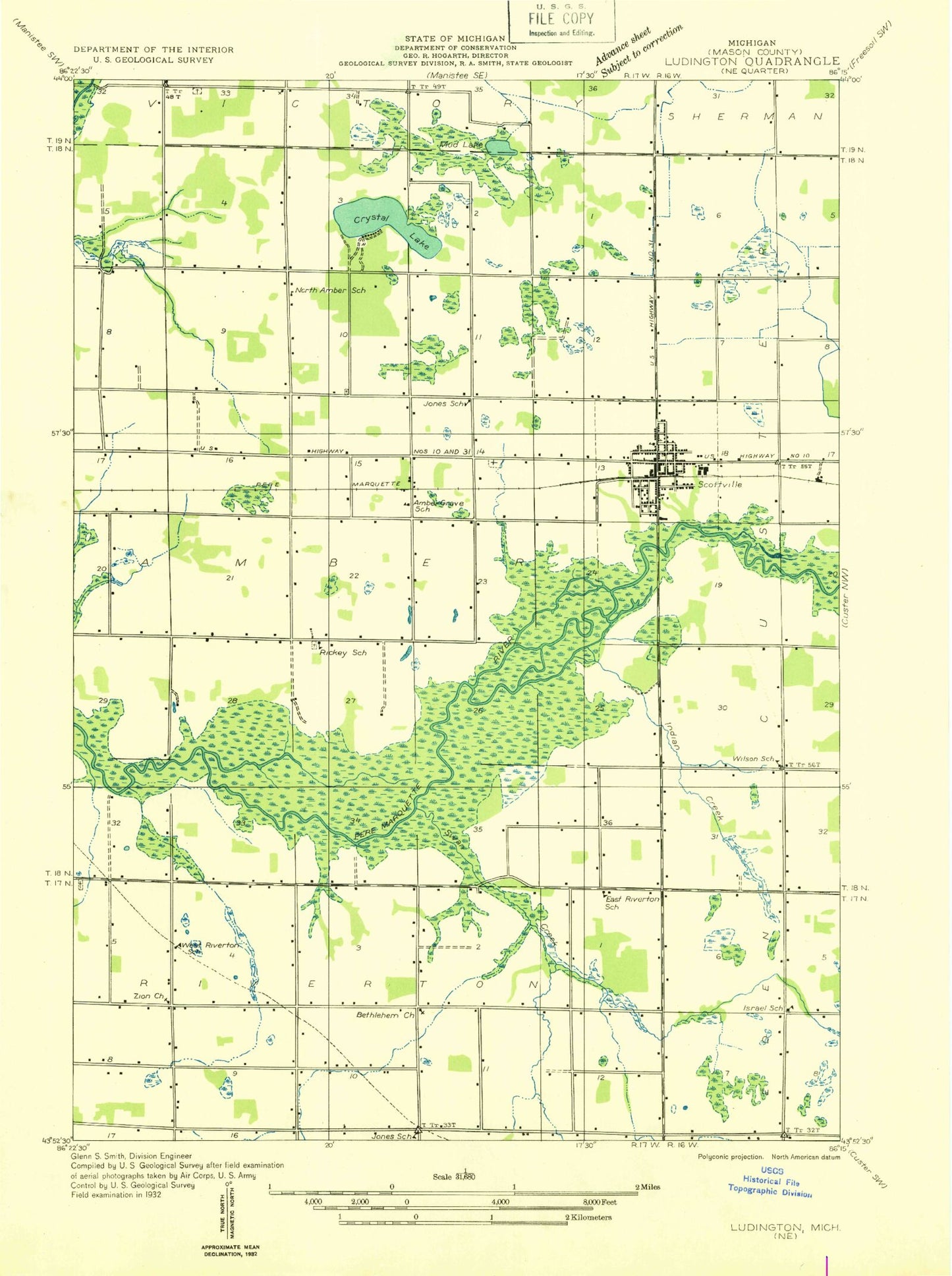
Classic USGS Scottville Michigan 7.5'x7.5' Topo Map
Couldn't load pickup availability
Historical USGS topographic quad map of Scottville in the state of Michigan. Map scale may vary for some years, but is generally around 1:24,000. Print size is approximately 24" x 27"
This quadrangle is in the following counties: Mason.
The map contains contour lines, roads, rivers, towns, and lakes. Printed on high-quality waterproof paper with UV fade-resistant inks, and shipped rolled.
Contains the following named places: Amber, Amber Post Office, Amber Station, Brookside Cemetery, Center Riverton Cemetery, City of Scottville, Covenant Christian School, Crossroads Church, Crystal Lake Campground, East Riverton Post Office, Grace Christian Church, Hackert Lake, Hidden Forest Mobile Home Park, Holiday Village Mobile Home Park, India Creek, Lichte Creek, Mason County Library, Mason County Middle School, Mason County Senior High School, North Amber Cemetery, North Amber School, Our Saviour's Lutheran Church, Redeemer Lutheran Church, Reformed Church, Rickey Cemetery, Riverside Park, Riverton, Riverton Cemetery, Riverton Fire Department and Emergency Medical Services, Riverton Oil Field, Riverton Post Office, Riverton Station, Saint Jerome's Catholic Church, Saint Paul Church, Scottville, Scottville Church of Christ, Scottville Elementary School, Scottville Fire Department, Scottville Historical Marker, Scottville Police Department, Scottville Post Office, Scottville Station, South Victory Cemetery, Stiles Corners, Swan Creek, Third Coast Family Practice Clinic, Township of Amber, United Methodist Church, Victory Baptist Church, Victory Church, Victory Post Office, Vogel Lake, Wesleyan Church, West Riverton Cemetery, WKZC-FM (Scottville), Zion Church, ZIP Code: 49454