MyTopo
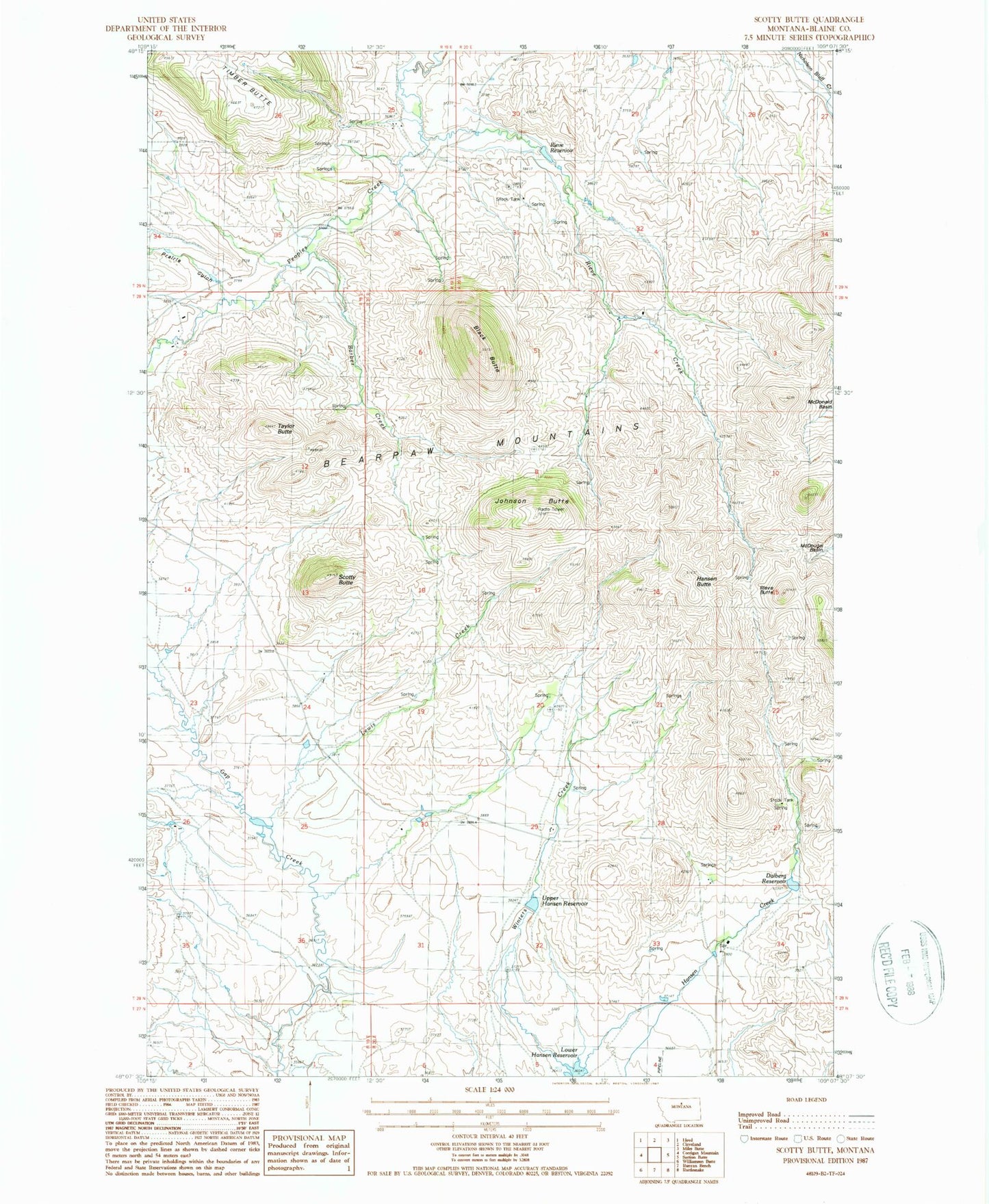
Classic USGS Scotty Butte Montana 7.5'x7.5' Topo Map
Couldn't load pickup availability
Historical USGS topographic quad map of Scotty Butte in the state of Montana. Map scale may vary for some years, but is generally around 1:24,000. Print size is approximately 24" x 27"
This quadrangle is in the following counties: Blaine.
The map contains contour lines, roads, rivers, towns, and lakes. Printed on high-quality waterproof paper with UV fade-resistant inks, and shipped rolled.
Contains the following named places: Barber Creek, Black Butte, Dalberg Reservoir, General AG Corporation Number 1 Dam, Gold Creek, Hansen Butte, Johnson Butte, Lewis Creek, Lower Hansen Reservoir, Number 10 Dam, Prairie Gulch, Rieve Butte, Rieve Creek, Rieve Reservoir, Scotty Butte, Taylor Butte, Upper Hansen Reservoir