MyTopo
Classic USGS Scratch Canyon Arizona 7.5'x7.5' Topo Map
Couldn't load pickup availability
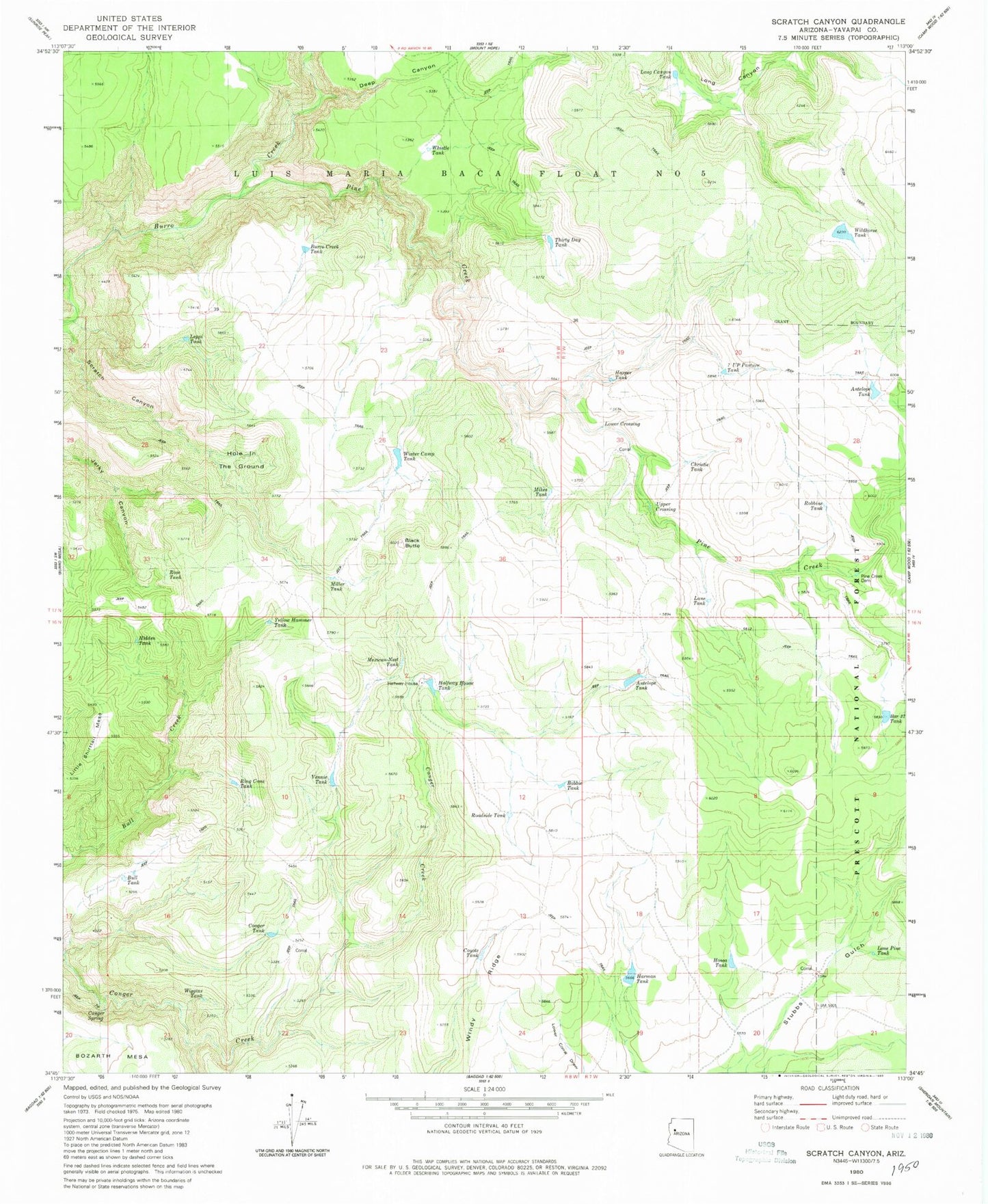
Historical USGS topographic quad map of Scratch Canyon in the state of Arizona. Map scale may vary for some years, but is generally around 1:24,000. Print size is approximately 24" x 27"
This quadrangle is in the following counties: Yavapai.
The map contains contour lines, roads, rivers, towns, and lakes. Printed on high-quality waterproof paper with UV fade-resistant inks, and shipped rolled.
Contains the following named places: Antelope Tank, Bar Thirty Seven Tank, Black Butte, Bobbie Tank, Bull Tank, Burro Creek Tank, Christie Tank, Conger Spring, Conger Tank, Coyote Tank, Deep Canyon, Halfway House, Halfway House Tank, Harman Tank, Harper Tank, Hidden Tank, Hole in the Ground, Hosea Tank, Lane Tank, Leppi Tank, Little Shirttail Mesa, Lone Pine Tank, Long Canyon Tank, Lower Crossing, Mexican-Nest Tank, Mikes Tank, Miller Tank, Pine Creek, Pine Creek Dam, Ring Cone Tank, Roadside Tank, Robbins Tank, Rose Tank, Seven Up Pasture Tank, Thirty Day Tank, Upper Crossing, Vennie Tank, Whistle Tank, White House Dam, Wiggins Tank, Wildhorse Tank, Windy Ridge, Winter Camp Tank, Yellow Hammer Tank