MyTopo
Classic USGS Seager New York 7.5'x7.5' Topo Map
Couldn't load pickup availability
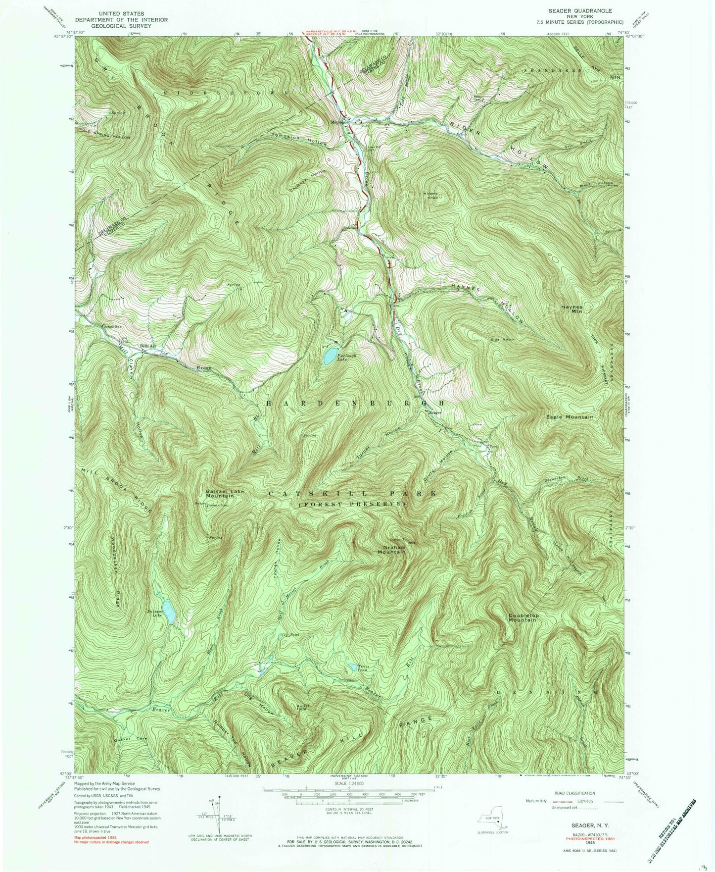
Historical USGS topographic quad map of Seager in the state of New York. Typical map scale is 1:24,000, but may vary for certain years, if available. Print size: 24" x 27"
This quadrangle is in the following counties: Delaware, Ulster.
The map contains contour lines, roads, rivers, towns, and lakes. Printed on high-quality waterproof paper with UV fade-resistant inks, and shipped rolled.
Contains the following named places: Baker Cemetery, Balsam Lake, Balsam Lake Mountain, Beaver Kill Range, Black Brook, Bullet Hole, Chimney Hollow, Clark Hollow, Dog Hollow, Drury Hollow, Dry Brook Ridge, Eagle Mountain, Flatiron Brook, Furlough Lake, Gill Gully, Gulf of Mexico Brook, Haynes Hollow, Haynes Mountain, Hirams Knob, Lake Hill Cemetery, Mine Hollow, Number Ten Hollow, Quaker Cove, Rider Hollow, Shandaken Brook, Sids Notch, Todd Brook, Tompkins Hollow, Tunis Pond, Turner Hollow, Vly Pond, Woodpecker Ridge, Youngs Hollow, Belle Ayr, Mapledale, Seager, Doubletop Mountain, Graham Mountain, School Number 4 (historical), Town of Hardenburgh, Forge Covered Bridge, Tappan Bridge