MyTopo
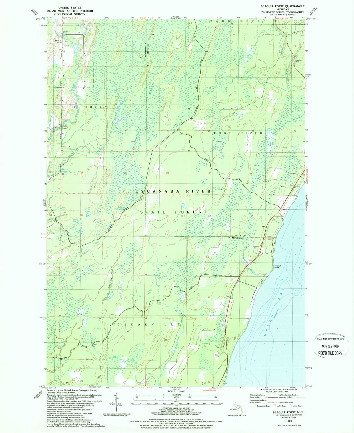
Classic USGS Seagull Point Michigan 7.5'x7.5' Topo Map
Couldn't load pickup availability
Historical USGS topographic quad map of Seagull Point in the state of Michigan. Map scale may vary for some years, but is generally around 1:24,000. Print size is approximately 24" x 27"
This quadrangle is in the following counties: Delta, Menominee.
The map contains contour lines, roads, rivers, towns, and lakes. Printed on high-quality waterproof paper with UV fade-resistant inks, and shipped rolled.
Contains the following named places: Advent Creek, Advent School, Crooked Creek, Depas Creek, Gourley Township Volunteer Fire Department, Jam Dam Bridge, Lake Thirtysix, Mack Spring, McCarty Bridge, Olson Creek, Seagull Point, Sevenmile Marsh, Seventh Day Adventist Church Cemetery, Seventh-Day Adventist Church, West Branch Deer Creek