MyTopo
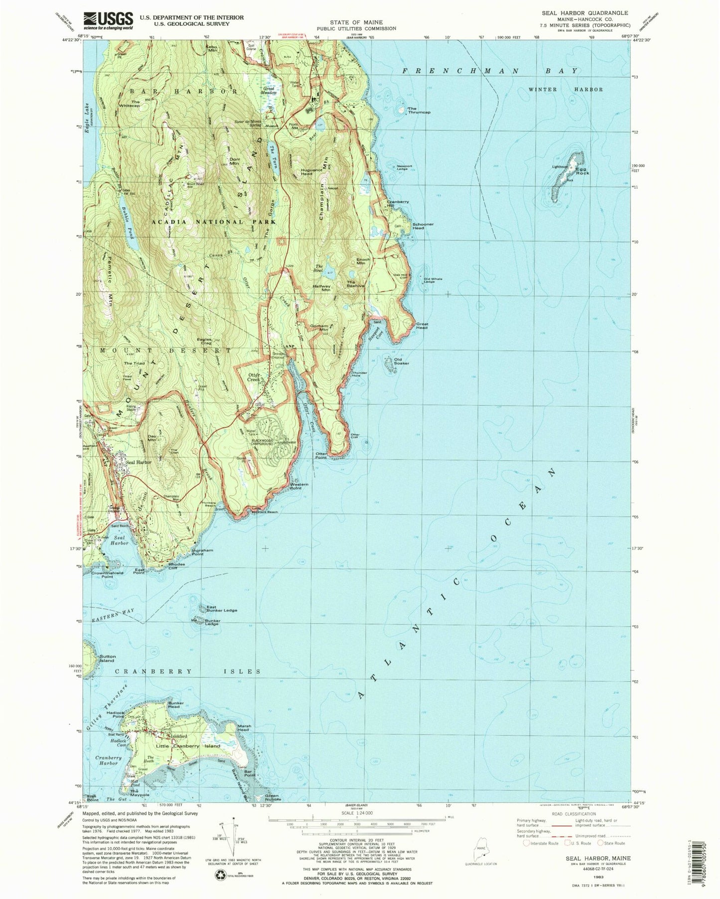
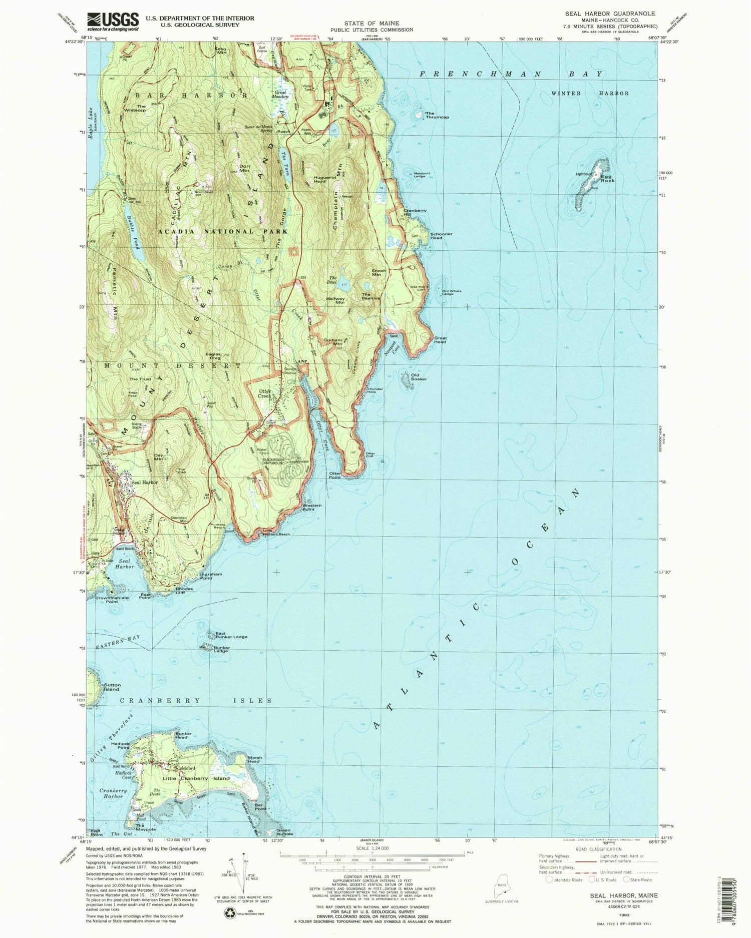
Classic USGS Seal Harbor Maine 7.5'x7.5' Topo Map
Couldn't load pickup availability
Historical USGS topographic quad map of Seal Harbor in the state of Maine. Typical map scale is 1:24,000, but may vary for certain years, if available. Print size: 24" x 27"
This quadrangle is in the following counties: Hancock.
The map contains contour lines, roads, rivers, towns, and lakes. Printed on high-quality waterproof paper with UV fade-resistant inks, and shipped rolled.
Contains the following named places: Abbe Museum, Baker Island Bar, Bar Point, Barr Hill, Bear Brook, Bubble Pond, Bunker Ledge Mon, Bunker Neck, Cadillac Cliffs, Cadillac Mountain, Canon Brook, Champlain Monument, Champlain Mountain, Cranberry Harbor, Cranberry Hill, Crowninshield Point, Day Mountain, Dorr Mountain, Eagles Crag, East Bunker Ledge, East Point, Egg Rock, Gilley Ledge, Gorham Mountain, Great Head, Great Meadow, Green Nubble, Hadlock Point, Halfway Mountain, Huguenot Head, Hunters Beach, Hunters Brook, Ingraham Point, Islesford, Little Cranberry Island, Marsh Head, Newport Cove, Oak Hill Cliff, Old Soaker, Old Whale Ledge, Otter Cove, Otter Creek, Otter Creek, Otter Point, Ox Hill, Pemetic Mountain, Schooner Head, Seal Harbor, Seal Harbor, Sieur de Monts Spring, Sols Cliff, Stanley Brook, The Black Woods, The Bowl, The Cleft, The Gorge, The Maypole, The Tarn, The Thrumcap, The Triad, Thunder Hole, Triad Pass, Western Point, The Beehive, Redfield Hill, North Ridge Trail, Door Mountain North Ridge Trail, Thrumcap, Woodland Ledge, Weaver Rock, Gilley Beach, Old Tom, The Heath, Lewis Rock, Bowden Ledge, Union Church, Rhodes Cliff, Cold Ledge, Blackwoods Campground, Day Mountain Trail, Saint Judes Church, Pemetic Trail, Cadillac Mountain South Ridge Trail, Gorham Mountain Trail, Bubble Brook, Enoch Mountain, The Tarn Trail, Champlain Mountain Trail, Door Mountain South Ridge Trail, Murray Young Path, Gorge Path, Newport Ledge, Handiron Ledge, Harding Ledge, Kebo Mountain, The Whitecap, Hunters Beach Cove, Eastern Way, Hadlock Cove, Otter Cliff, The Tarn Dam, Acadia National Park Nature Center, Beachcroft Trail, Bear Brook Picnic Area, Bear Brook Trail, Beaver Dam Pond, The Black Woods, Bowl Trail, Cadillac Mountain West Face Trail, Cadillac Summit Trail, Canon Brook Trail, Cranberry Island Fishermens Co-operative, Dike Peak, Dorr Mountain Ladder Trail, Dorr Mountain North Ridge Trail, Dorr Mountain Notch Trail, Dorr Mountain South Ridge Trail, Dorr Mountain Trail, Egg Rock Ligh Station, Fabbri Picnic Area, Featherbed Trail, First Light Assembly of God Church, Gardens of Acadia, Gilley Thorofare, Great Head Trail, Great Hill, Hemlock Trail, Hunters Brook Trail, Hunters Head, Islesford Dock, Ashley Bryan Elementary School, Islesford Historical Museum, Islesford Post Office, Jackson Laboratory Public Information Center, Jessup Trail, Jackson Laboratory Joan Staats Library, Kebo Mountain Trail, Kief Pond, Monument Cove, North Gorham Mountain Trail, Ocean Trail, Otter Creek Post Office (historical), Pemetic Mountain North Ridge Trail, Pemetic Mountain Ravine Trail, Pemetic Mountain South Ridge Trail, Precipice Trail, Robert Abbe Museum of Stone Age Antiquities Library, Roscoe B Jackson Memorial Laboratory, Sand Beach, Schooner Head Overlook, Seal Harbor Congregational Church, Seal Harbor Post Office, Seal Harbor Town Wharf, Seal Harbor Yacht Club, Seaside Brook Trail, Sieur de Monts Spring Park (historical), South Gorham Mountain Trail, Strath Eden Trail, The Beehive Trail, The Featherbed, Triad Trail, West Cliff Trail, Wildwood Farm, Wildwood Stables, Cranberry Isles, Cadillac Brook, Desert Fire Department Station 2, Islesford Emergency Medical Services, Sand Beach Cemetery, Schooner Head Cemetery, Seal Harbor Cemetery, Standley Grave, Otter Creek Cemetery, Islesford Library, Seal Harbor Library, Stanley Gilley Cemetery, Stanley - Hadlock Cemetery


