MyTopo
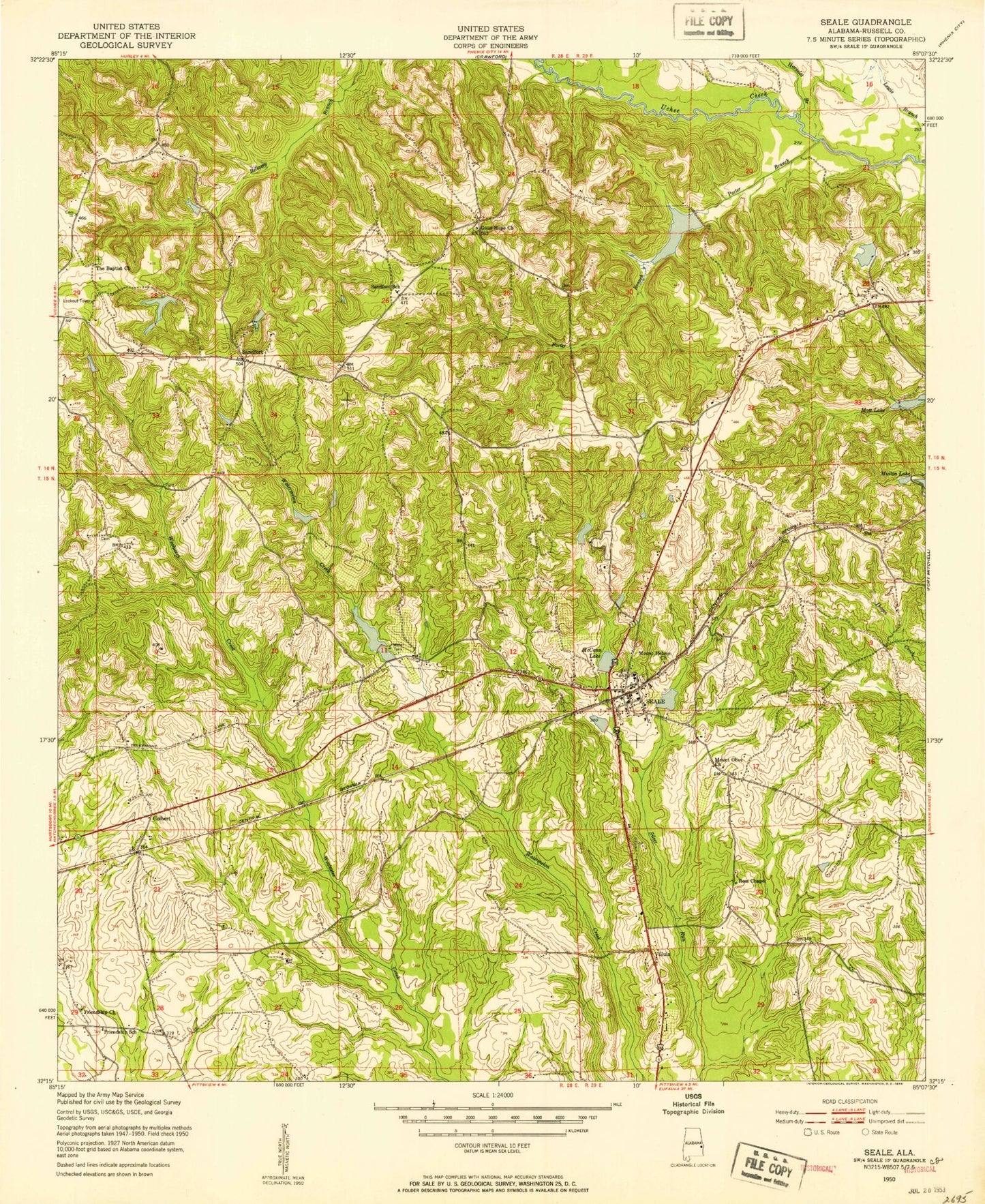
Classic USGS Seale Alabama 7.5'x7.5' Topo Map
Couldn't load pickup availability
Historical USGS topographic quad map of Seale in the state of Alabama. Map scale may vary for some years, but is generally around 1:24,000. Print size is approximately 24" x 27"
This quadrangle is in the following counties: Russell.
The map contains contour lines, roads, rivers, towns, and lakes. Printed on high-quality waterproof paper with UV fade-resistant inks, and shipped rolled.
Contains the following named places: Bass Cemetery, Boykin Cemetery, Carrol Lake, Carroll Lake Dam, Chavale High School, Colbert, Colbert Church, Dudleys, Dudleys Lake, Friendship Church, Friendship School, Goodhope Baptist Church, Greene Number 2 Dam, Horselot Branch, Hyram, Hyram Cemetery, Hyram Post Office, Key Cemetery, Lake Lenora, Lake Lenora Dam, Lewis Branch, Lexington, Lexington Post Office, Matthews Dam, McCann Lake, Ministries of Faith Church, Monte Pond, Mott Lake Dam, Mount Hebron Baptist Church, Mount Olive Church, Natural Bridge Post Office, Perrys Steam Mill, Porter Branch, Porter Branch Lake Dam, Porter Cemetery, Ross Chapel, Russell County, Russell County Farm, Russell County Vocational School, Saint Matthews Church, Saint Peter Cemetery, Saint Peters Church, Sandfort, Sandfort Fire Tower, Sandfort School, Seale, Seale Post Office, Seale School, Seale Volunteer Fire Department, Silver Run Baptist Church, Sumbry Memorial Church, Thomas Bridge, Villula, Wadsworth Lake Dam, Williams Cemetery, Williams Dudley Cemetery, ZIP Code: 36875