MyTopo
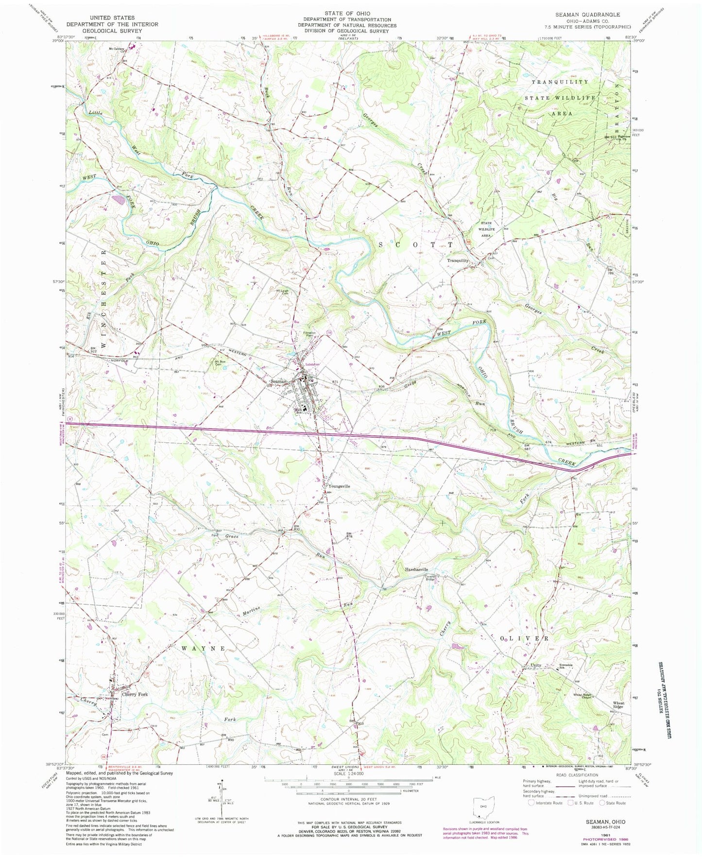
Classic USGS Seaman Ohio 7.5'x7.5' Topo Map
Couldn't load pickup availability
Historical USGS topographic quad map of Seaman in the state of Ohio. Map scale may vary for some years, but is generally around 1:24,000. Print size is approximately 24" x 27"
This quadrangle is in the following counties: Adams.
The map contains contour lines, roads, rivers, towns, and lakes. Printed on high-quality waterproof paper with UV fade-resistant inks, and shipped rolled.
Contains the following named places: Adams County Regional Medical Center, Buck Run, Buck Run Post Office, Buck Run School, Buckeye School, Cherry Fork, Cherry Fork Cemetery, Cherry Fork Census Designated Place, Cherry Fork Post Office, Elk Fork, Eureka School, Fairview Church, Fairview School, Grace Run, Gregg Run, Harmony School, Harshasville, Harshasville Bridge, Harshasville Post Office, Irvington, Irvington Post Office, Irvington School, Little West Fork Ohio Brush Creek, Lower Brush Creek School, Martins Run, Mount Calvary Cemetery, Mount Leigh, Mount Leigh Cemetery, Mount Leigh Post Office, Mount Zion, Mount Zion Cemetery, North Adams High School, Scott Township Fire Department, Seaman, Seaman Elementary School, Seaman Life Squad - Station 200, Seaman Post Office, Sunnyside School, Township of Oliver, Township of Scott, Township of Wayne, Tranquility, Tranquility Cemetery, Tranquillity Post Office, Unity, Unity Cemetery, Upper Georges Creek School, Village of Cherry Fork, Village of Seaman, Wayne Elementary School, Wayne Township Volunteer Fire Department, Wheat Ridge, Wheat Ridge Chapel, Youngsville, ZIP Codes: 45618, 45679